Method for realizing positioning of naval ship by using communication satellite interference measurement

A communication satellite and interferometric technology, applied in the field of communication, can solve the problems of huge station equipment and high technical complexity

Pending Publication Date: 2019-07-16
NAT TIME SERVICE CENT CHINESE ACAD OF SCI
View PDF3 Cites 11 Cited by
  • Summary
  • Abstract
  • Description
  • Claims
  • Application Information

AI Technical Summary

Problems solved by technology

Due to the huge station equipment and high technical complexity of the above-mentioned technologies, the current positioning targets involved are mainly high-precision positioning of static targets (ground stations or VLBI stations that emit satellite interference signals)

Method used


Image

  • Method for realizing positioning of naval ship by using communication satellite interference measurement
  • Method for realizing positioning of naval ship by using communication satellite interference measurement
  • Method for realizing positioning of naval ship by using communication satellite interference measurement

Examples


Embodiment Construction

[0018] The present invention will be further described below in conjunction with the accompanying drawings and embodiments, and the present invention includes but not limited to the following embodiments.

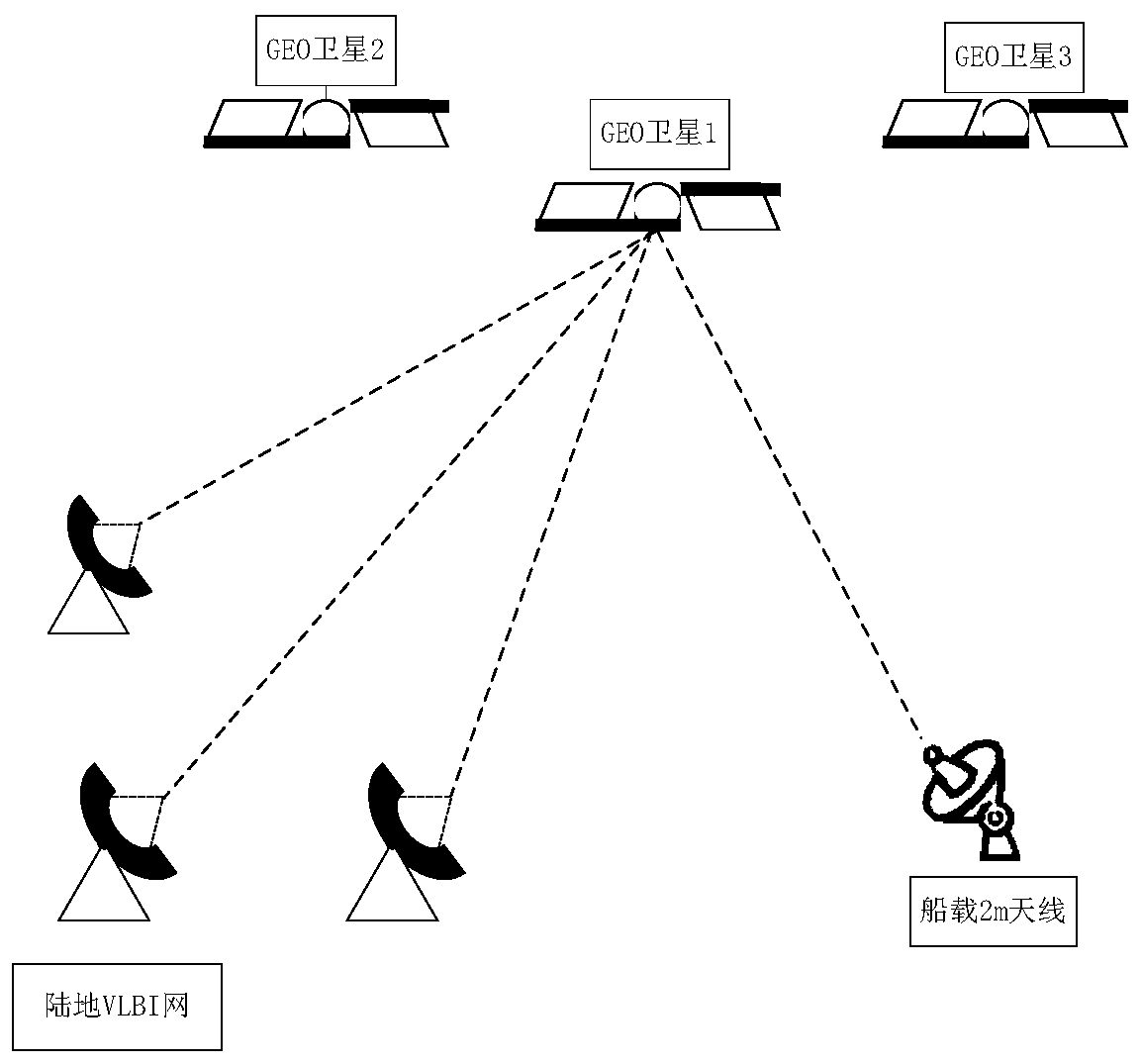
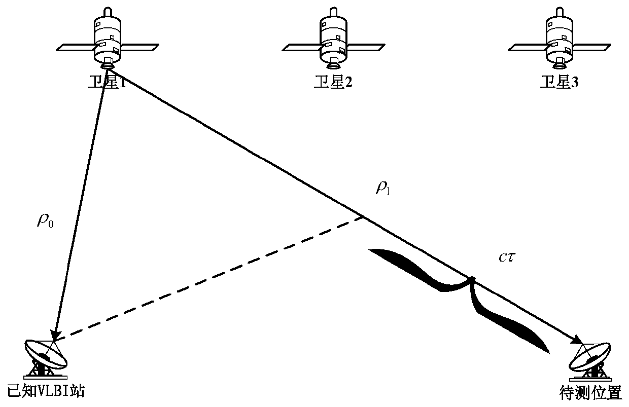
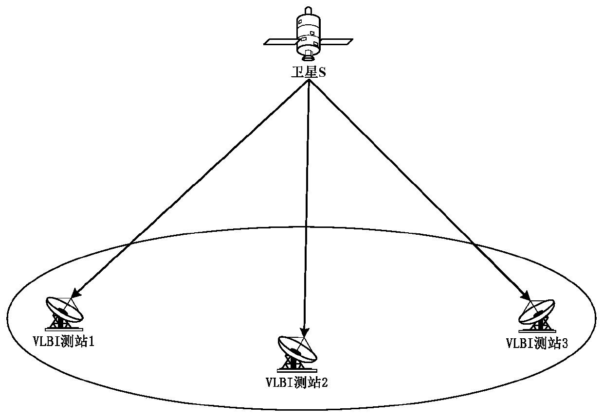
[0019] The present invention provides a method for positioning based on communication satellite interferometry (Positioning System based on Interferometry, referred to as IPS), which refers to VLBI technology, and finally realizes the positioning of ships through interferometry of communication satellites.

[0020] The present invention draws lessons from the idea of ​​VLBI technology, under the premise of ensuring the positioning accuracy, according to the characteristics of the received signal, through technical improvement, the equipment configuration of the positioning target is simplified by using a small array antenna to receive the signal, and the ship (moving target) is realized by interferometric measurement. positioning. The passive observation communication satel...


PUM


Abstract

The invention provides a method for realizing positioning of a naval ship by using communication satellite interference measurement. Radiation source signals of at least three communication satellitesare simultaneously received through a ground VLBI observation network, time delay difference of a satellite signal reaching each antenna is obtained, and precise orbit measurement is conducted on thecommunication satellites to obtain position information of the communication satellites; an array antenna is used on the naval ship to observe the same communication satellites, and time delay difference between the satellite signal reaching the naval ship and any measurement station in the VLBI observation network is obtained; and position information and clock difference of the naval ship are solved by a simultaneous positioning equation. The method does not depend on an existing satellite navigation system, the high precision positioning service of the naval ship can still be realized without affecting the service of the existing satellite navigation system, and the supplement and the backup of an existing positioning technology are formed.

Description

technical field [0001] The invention belongs to the technical field of communication, and relates to a communication satellite positioning method. Background technique [0002] Interferometry technology is a passive satellite tracking technology, which has high accuracy in the observation direction angle, and can be used for precise tracking and measurement of geosynchronous orbit satellites and positioning of ground satellite interference sources. Very long baseline interferometry (VLBI) uses two or more antennas with "independent local oscillators" that are far apart to simultaneously observe and emit power sources. According to different observation purposes, the observed data can be used not only for astronomical high-resolution imaging, but also for precise measurement of the coordinates of celestial bodies and stations. Due to the huge station equipment and high technical complexity of the above-mentioned technologies, the current positioning targets involved are main...

Claims


Application Information

Patent Timeline
Patent Type & Authority Applications(China)
IPC IPC(8): G01S19/42
CPCG01S19/42
Inventor 高媛媛华宇杨旭海赵弦赵坤娟马浪明向渝黄长江王善和姚当
Owner NAT TIME SERVICE CENT CHINESE ACAD OF SCI
Why Eureka
Try Eureka