Method for extraction of arterial traffic through adoption of open street map

An arterial road and map technology, applied in image data processing, instruments, computing, etc., can solve the problem of open source map data quality, increase the difficulty of identifying arterial roads, restrict the extraction of urban arterial roads, etc. Easy to achieve effects

Inactive Publication Date: 2018-12-07
WUHAN UNIV
View PDF7 Cites 8 Cited by
  • Summary
  • Abstract
  • Description
  • Claims
  • Application Information

AI Technical Summary

Problems solved by technology

The data quality problem of open source maps increases the difficulty of identifyi

Method used


Image

  • Method for extraction of arterial traffic through adoption of open street map
  • Method for extraction of arterial traffic through adoption of open street map
  • Method for extraction of arterial traffic through adoption of open street map

Examples


Embodiment Construction

[0035] In order to make the object, technical solution and advantages of the present invention more clear, the present invention will be further described in detail below in conjunction with the accompanying drawings and embodiments. It should be understood that the specific embodiments described here are only used to explain the present invention, not to limit the present invention.

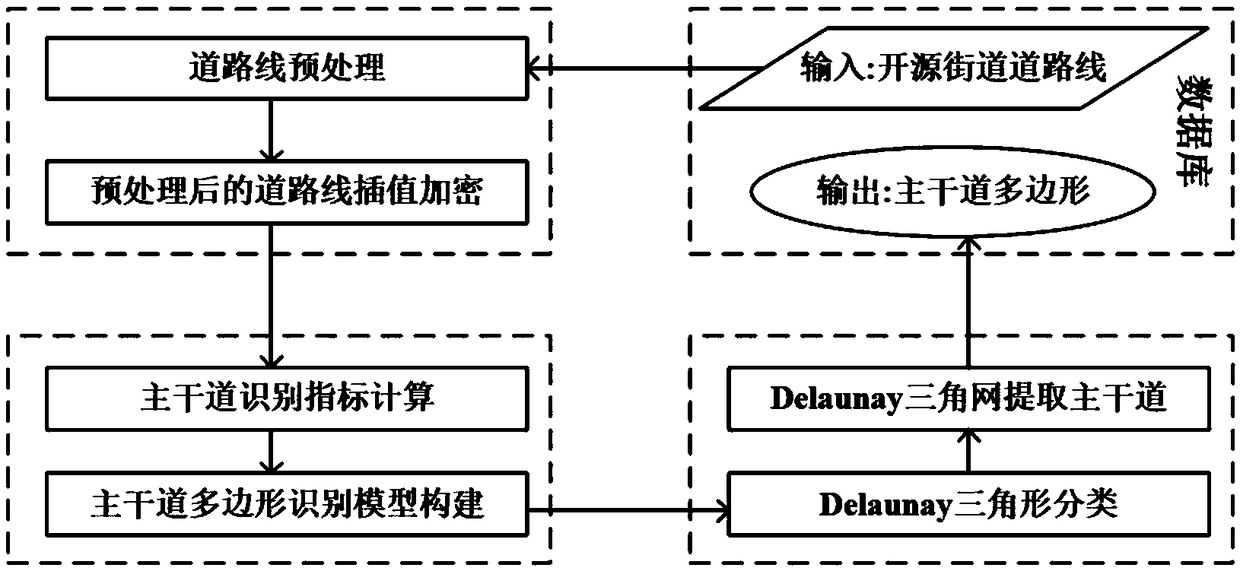
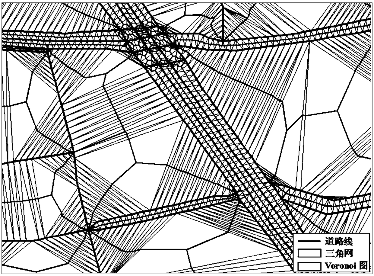
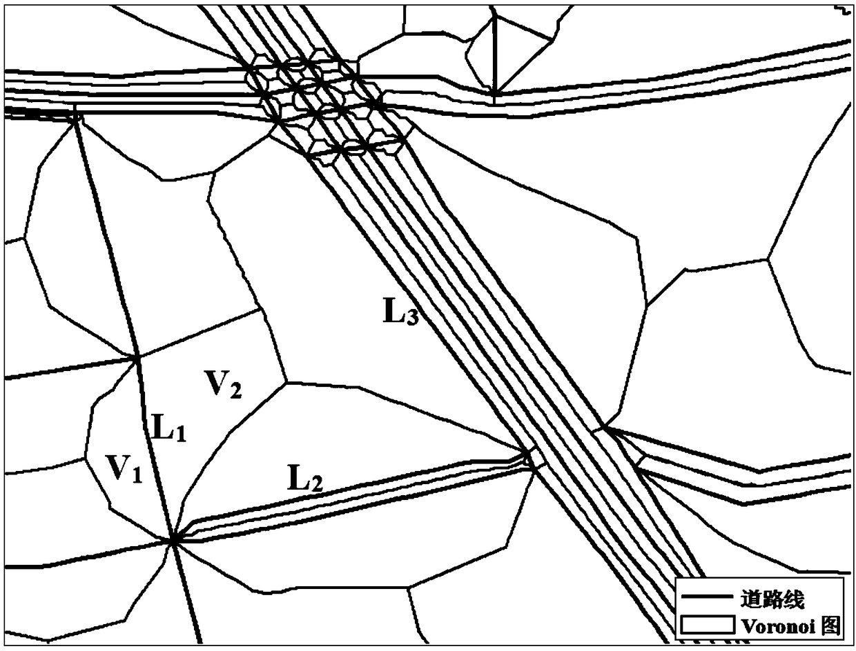
[0036] Such as figure 1 As shown, a method for extracting arterial roads using an open source street map in an embodiment of the present invention includes the following steps:

[0037] Step 1: Preprocess the original road line data, organize it into a data structure of road nodes and road arcs to maintain topological correctness, and interpolate and encrypt the preprocessed road lines;

[0038] Step 1.1: Use the ArcGIS topology inspection tool to preprocess the original road line data, including eliminating errors such as hanging lines and pseudo nodes, and organize the road line into a node-r...


PUM


Abstract

The present invention discloses a method for extraction of arterial traffic through adoption of an open street map. The method comprises the following steps of: the step 1, obtaining original road line data in an open street map, performing pre-processing, organizing the original road line data to a road node and road segmental arc data structure, and performing interpolation encryption of the road line after pre-processing; the step 2, constructing a constraint Delaunay triangulation network for the encrypted road line, employing features of the side length of the Delaunay triangle and a skeleton portion Voronoi map unit area difference to calculate an arterial traffic identification index, and constructing an arterial traffic polygon identification model; and the step 3, utilizing the arterial traffic polygon identification model to perform Delaunay triangle classification, and employing the Delaunay triangulation network and a seed point region growing algorithm to extract the arterial traffic polygon of the open street map. The method can rapidly and reliably extract the arterial traffic from the open road data set so as to reduce the cost of city arterial traffic information extraction, and the extraction method is simple and easy to implement.

Description

technical field [0001] The invention relates to the technical field of geographic information system and spatial data analysis and processing, in particular to a method for extracting main roads by using an open-source street map. Background technique [0002] As an important part of geospatial database, road data is the data basis for expressing, analyzing, planning and serving urban spatial activities. Due to the limitations of network transmission speed, visual rendering, etc., the original road data is difficult to meet the needs of practical applications, and multi-scale modeling is required. Urban arterial roads reflect the skeleton structure of the road network and are an important part of the automatic multi-scale modeling of the database. The extraction of main roads plays an important role in multi-scale expression of road networks, map synthesis, intelligent traffic services, etc. At present, with the development of communication technology and the emergence of ...

Claims


Application Information

Patent Timeline
IPC IPC(8): G06T17/05
CPCG06T17/05
Inventor 艾廷华杨伟卢威李文德
Owner WUHAN UNIV
Why Eureka
Try Eureka