Urban rail transit station area walkability evaluation method
A technology of urban rail transit and rail transit, applied in the field of walkability evaluation of urban rail transit station areas
- Summary
- Abstract
- Description
- Claims
- Application Information
AI Technical Summary
Problems solved by technology
Method used
Image
Examples
Embodiment
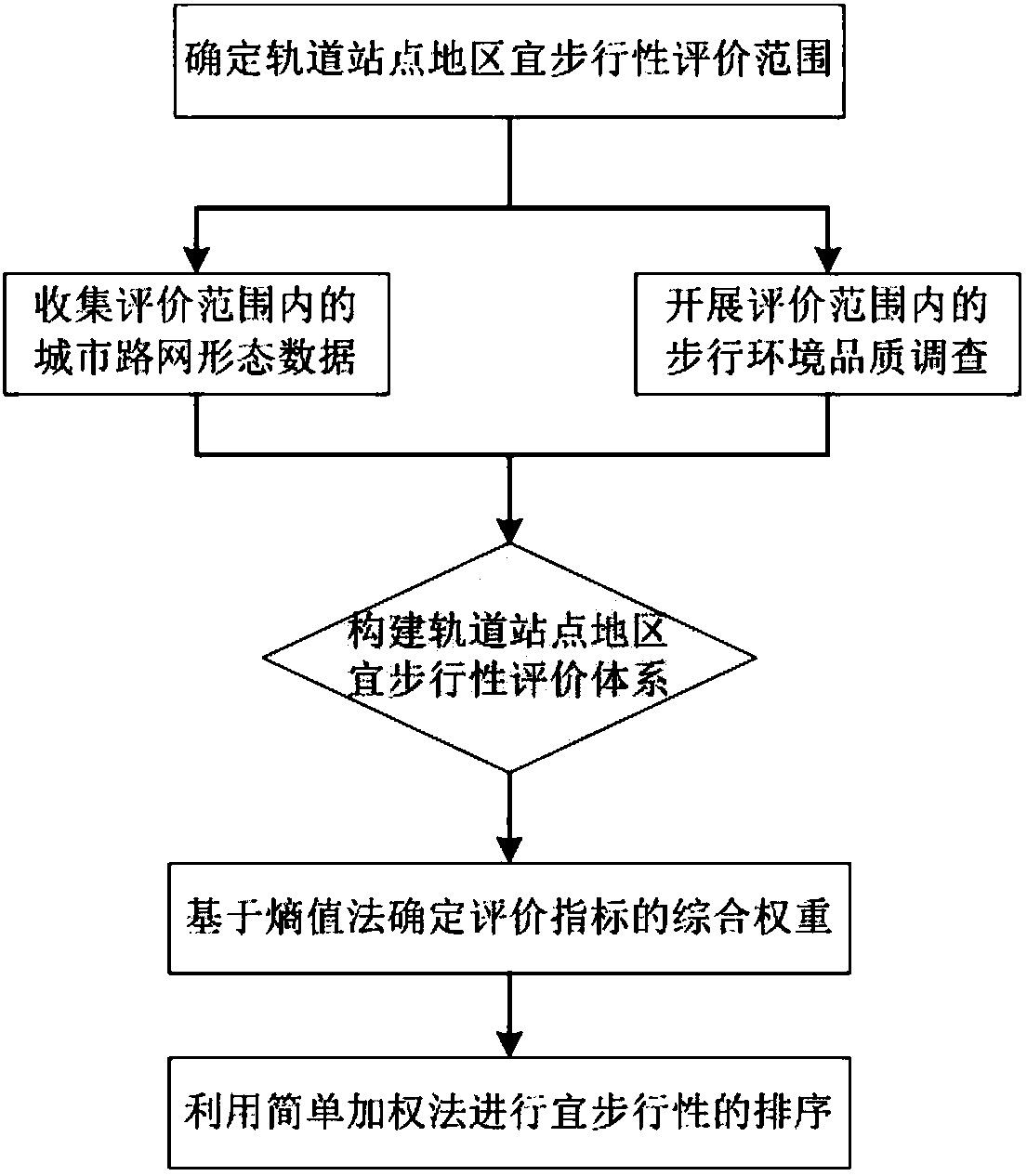
[0055] This embodiment takes Tianjin Metro Line 2 as an example to provide a method for evaluating the walkability of urban rail transit station areas. The following describes a walkability evaluation method for urban rail transit station areas according to an embodiment of the present invention with reference to the accompanying drawings method. The specific implementation process is described as follows:
[0056] 1) Determine the walkability evaluation scope of the rail station area. According to the advantage of walking to rail transit, the travel time is 10 minutes. If the standard walking speed is 3 miles per hour (about 4.8km / hour), the range that can be reached in 10 minutes is 0.5 miles (about 800m). Therefore, the range of 800 meters around the station of Tianjin Metro Line 2 is determined as the evaluation range of walkability.
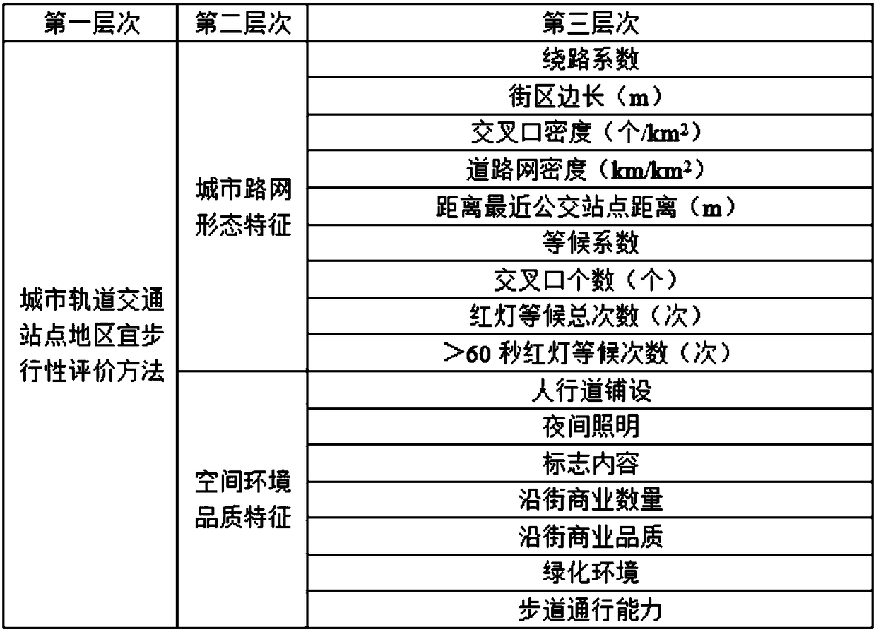
[0057] 2) Collect urban road network form data within the scope of evaluation. Obtain the detour coefficient, block side length, interse...
PUM
| Property | Measurement | Unit |
|---|---|---|
| Radius | aaaaa | aaaaa |
Abstract
Description
Claims
Application Information
 - Generate Ideas
- Intellectual Property
- Life Sciences
- Materials
- Tech Scout
- Unparalleled Data Quality
- Higher Quality Content
- 60% Fewer Hallucinations
Browse by: Latest US Patents, China's latest patents, Technical Efficacy Thesaurus, Application Domain, Technology Topic, Popular Technical Reports.
© 2025 PatSnap. All rights reserved.Legal|Privacy policy|Modern Slavery Act Transparency Statement|Sitemap|About US| Contact US: help@patsnap.com


