
Space-time buffer construction method for road network constrained trajectory

A construction method and buffer technology, applied in instrumentation, computing, electrical digital data processing, etc., can solve problems such as temporal and spatial proximity analysis of massive trajectory data

Active Publication Date: 2018-08-14
WUHAN UNIV
View PDF3 Cites 1 Cited by
  • Summary
  • Abstract
  • Description
  • Claims
  • Application Information

AI Technical Summary

Problems solved by technology

[0008] The present invention proposes the concept of the space-time buffer space of the space-time trajectory and the generation algorithm to solve the problem of space-time proximity analysis of massive trajectory data

Method used


Image

  • Space-time buffer construction method for road network constrained trajectory
  • Space-time buffer construction method for road network constrained trajectory
  • Space-time buffer construction method for road network constrained trajectory

Examples


Embodiment Construction

[0070] The processing object of the present invention is the large-scale spatio-temporal trajectory data in the urban traffic road network; the proximity analysis of the large-scale spatio-temporal trajectory data can be realized.

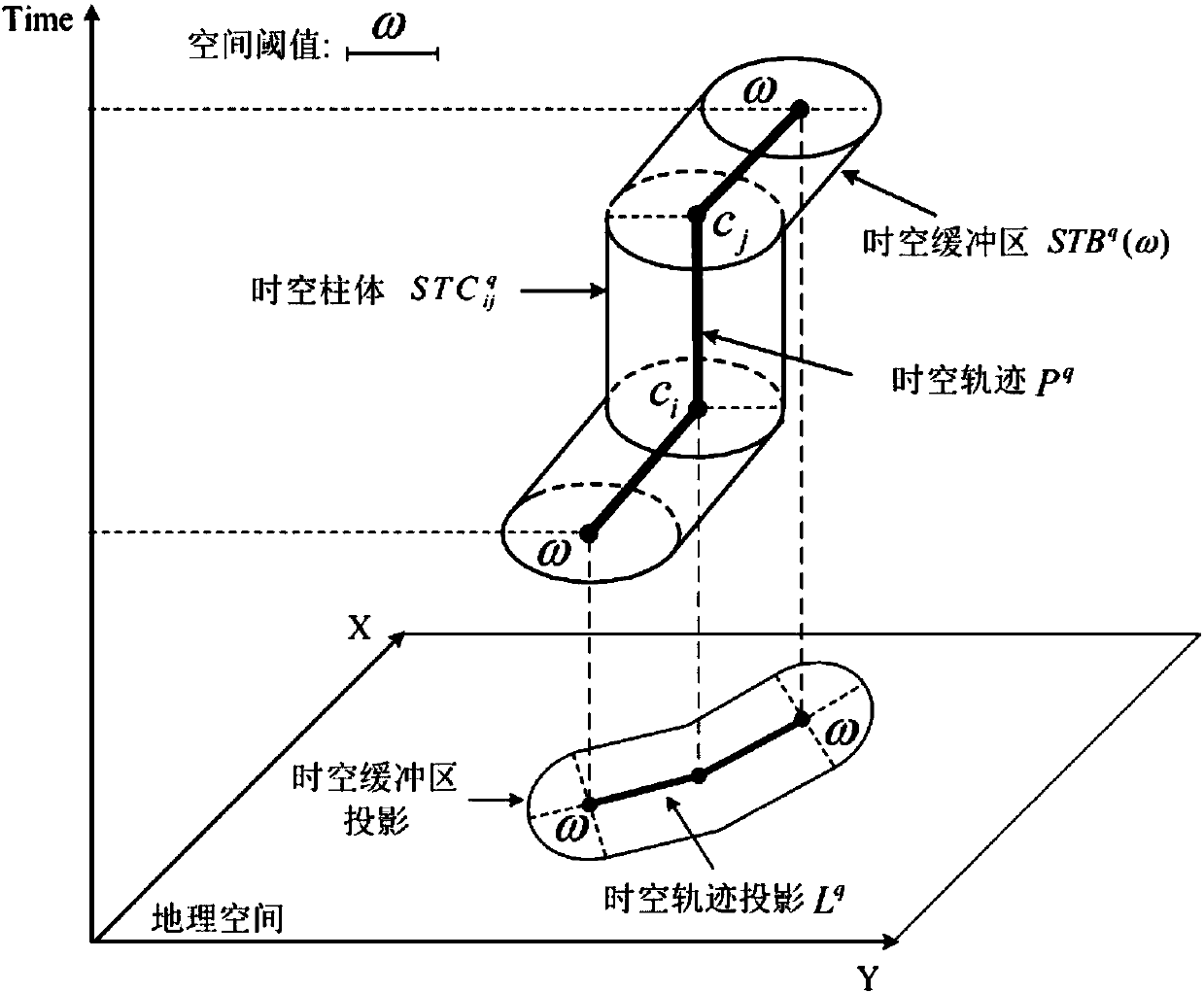
[0071] The embodiment of the present invention first introduces the concept of a space-time buffer of a space-time trajectory.

[0072] When individuals are moving in geographic space, usually only discrete time and space location points can be collected. These discrete trajectory points are called control points. Generally, these control points are collected by GPS and other positioning devices. Each control point c i By space coordinates (x i ,y i ) And time point t i Means:

[0073] c i =(x i ,y i ,t i )

[0074] Two consecutive control points in the personal trajectory are connected to form a trajectory segment (Segment). It is usually assumed that the speed of the individual on the trajectory segment is constant, so connect the control point c i And c...


PUM


Abstract

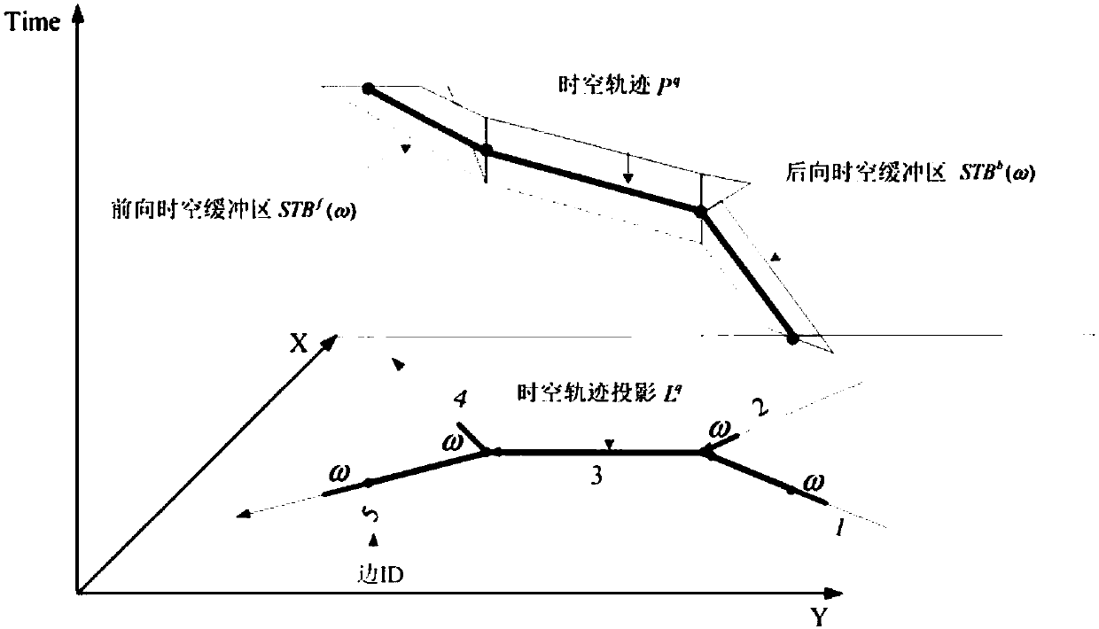
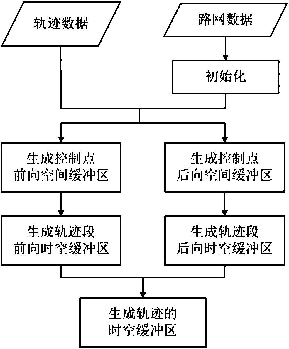
The present invention relates to a space-time buffer construction method for a road network constrained trajectory. The method comprises: Step 1, loading a road network, and constructing a road network topology structure; Step 2, sequentially acquiring a trajectory segment from a space-time trajectory, and constructing forward and backward spatial buffers of a control point on the trajectory segment; Step 3, constructing forward and backward space-time buffers of the trajectory segment by using the forward and backward spatial buffers of the control points respectively; and Step 4, merging theforward and backward space-time buffers of all the trajectory segments to obtain a space-time buffer of the space-time trajectory. The method provided by the present invention can provide an efficient trajectory space-time proximity calculation method for analysis on trajectory clustering, trajectory pattern recognition, abnormal trajectory recognition, and the like, is significantly superior tothe existing space-time proximity calculation method in calculation performance, and has the prospect of business and popularization application.

Description

Technical field [0001] The invention relates to the technical field of traffic data processing, in particular to a method for constructing a space-time buffer zone of a road network constrained trajectory. Background technique [0002] With the development of mobile positioning technology and wireless communication technology, various types of positioning devices have collected massive amounts of personal activity trajectory data. Typical trajectory data includes taxi GPS (Global Positioning System) positioning data (also called floating car data) , Bus swiping data, mobile phone location data, social sign-in data, and various user original geographic information data. Spatio-temporal trajectory big data contains a lot of in-depth knowledge, and the analysis, mining and utilization of spatio-temporal big data will bring great value. [0003] Related literature: Chen,BY,Yuan,H.,Li,Q.,Shaw,S.-L.,Lam,WHand Chen,X.,2016,Spatiotemporal data model for network time geographic analysis in...

Claims


Application Information

Patent Timeline
Patent Type & Authority Applications(China)
IPC IPC(8): G06F17/30
CPCG06F16/2282G06F16/2465G06F16/9537
Inventor 陈碧宇袁辉李清泉
Owner WUHAN UNIV
Learn More