


Quick Research
Generate reliable direction feasibility study reports for your R&D in just a few steps.

Technical Q&A
Discover and master advanced knowledge NOW. Basics, ideas, possibilities, all at once.

Find Solutions
As an expert in R&D theories, this can generate solutions to your technical problems instantly.

Evaluate Feasibility
Analyze your overall solution with one click, know your potential R&D risks in advance.

Monitor Landscape
Get weekly tech updates, stay abreast of the latest tech innovations and key insights.
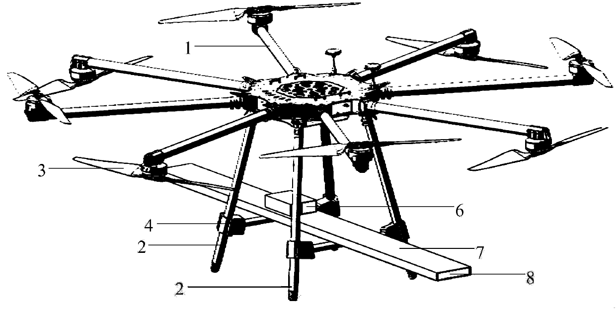
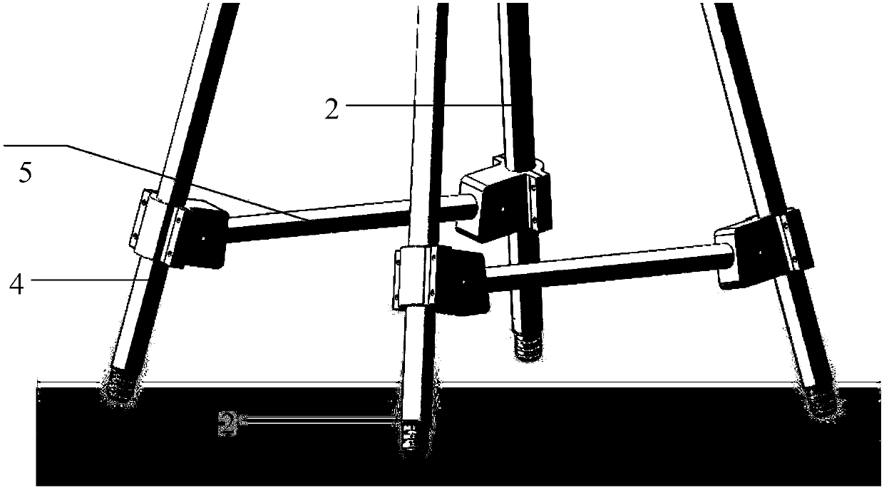
Soil and road surface conductivity measuring system mounted on UAV
An unmanned aerial vehicle and measurement system technology, which is applied in the field of soil and road conductivity measurement systems, can solve the problems of long cycle, many labor, high consumption, etc., and achieve the effects of easy implementation, improved work efficiency, and clear structure
- Summary
- Abstract
- Description
- Claims
- Application Information
AI Technical Summary
Problems solved by technology
Method used
Image

Examples
Embodiment
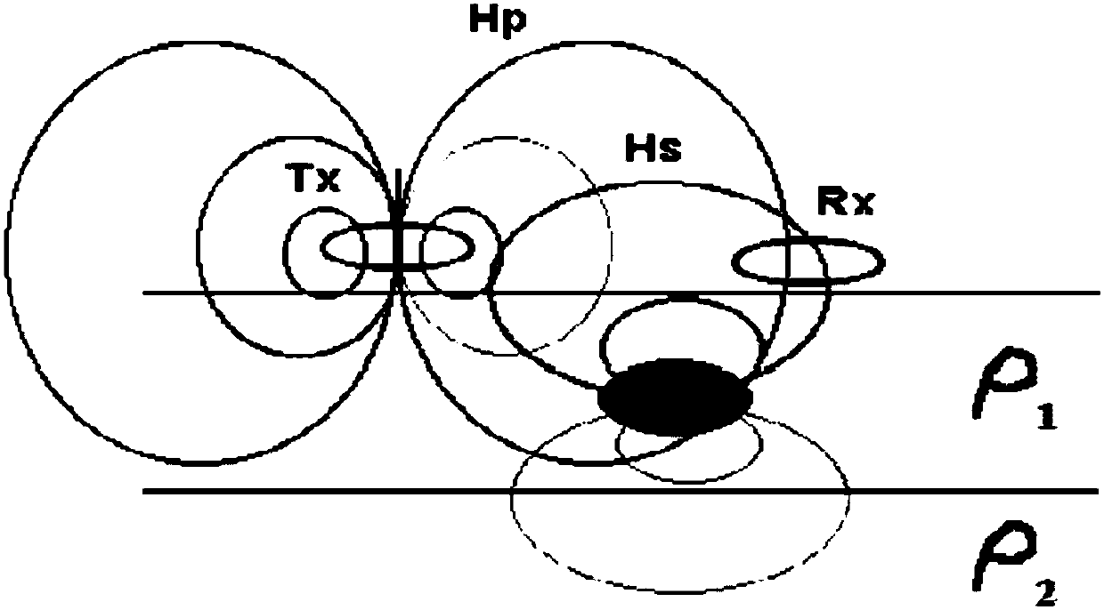
[0027] Such as image 3 As shown, ρ1 and ρ2 refer to different objects to be detected (soil or other good conductors in the soil). The embodiment of the present invention provides a soil and road surface conductivity measurement system mounted on an unmanned aerial vehicle, and its working principle is : There is a small transmitting coil at the signal transmitting end TX, which can generate a primary magnetic field H that changes with time and whose strength gradually weakens as the depth of the earth increases P , this magnetic field can generate a very weak AC induced current in the earth, and this current induces a secondary magnetic field H S The signal receiving end RX of the conductivity meter is responsible for receiving the secondary electromagnetic field signal generated by the soil conduction current. The electrical signal received by the instrument and proportional to the soil conductivity is displayed as the apparent conductivity of the soil after calculation and ...
PUM
 Abstract
Description
Claims
Application Information
 - R&D Engineer
- R&D Manager
- IP Professional
- Industry Leading Data Capabilities
- Powerful AI technology
- Patent DNA Extraction
Browse by: Latest US Patents, China's latest patents, Technical Efficacy Thesaurus, Application Domain, Technology Topic, Popular Technical Reports.
© 2024 PatSnap. All rights reserved.Legal|Privacy policy|Modern Slavery Act Transparency Statement|Sitemap|About US| Contact US: help@patsnap.com