
dlg data acquisition method and device

A data collection and data technology, applied in the field of aerial photogrammetry, can solve the problems of poor practicability, low efficiency, and low equipment cost investment, and achieve the effects of convenient operation, high processing efficiency, and low equipment cost

Active Publication Date: 2019-12-06
AERIAL PHOTOGRAMMETRY & REMOTE SENSING CO LTD
View PDF11 Cites 0 Cited by
  • Summary
  • Abstract
  • Description
  • Claims
  • Application Information

AI Technical Summary

Problems solved by technology

[0004] In order to overcome the above-mentioned deficiencies in the prior art, the present invention provides a DLG data acquisition method and device, which can effectively solve the problems of low efficiency and poor practicability existing in the existing DLG acquisition method, and can be operated by ordinary computers, and the equipment cost Low investment and easy operation

Method used


Image

  • dlg data acquisition method and device
  • dlg data acquisition method and device
  • dlg data acquisition method and device

Examples


no. 1 example

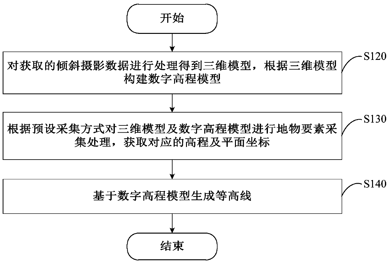
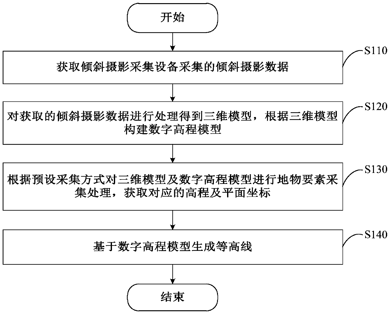
[0036] Please refer to figure 2 , figure 2 It is one of the flow charts of the steps of the DLG data collection method provided in the first embodiment of the present invention. The method is applied to computing device 100 . The specific process of the DLG data acquisition method will be described in detail below.

[0037] Step S120, processing the acquired oblique photographic data to obtain a three-dimensional model, and constructing a digital elevation model according to the three-dimensional model.

[0038] In this embodiment, the Digital Elevation Model (Digital Elevation Model, DEM) realizes the digital simulation of ground terrain (that is, the digital expression of terrain surface form) through limited terrain elevation data. It is a solid ground model, using a The ground elevation is expressed in the form of an ordered numerical array, which is a branch of the Digital Terrain Model (DTM).

[0039] In step S130, according to the preset collection mode, the three-d...

no. 2 example

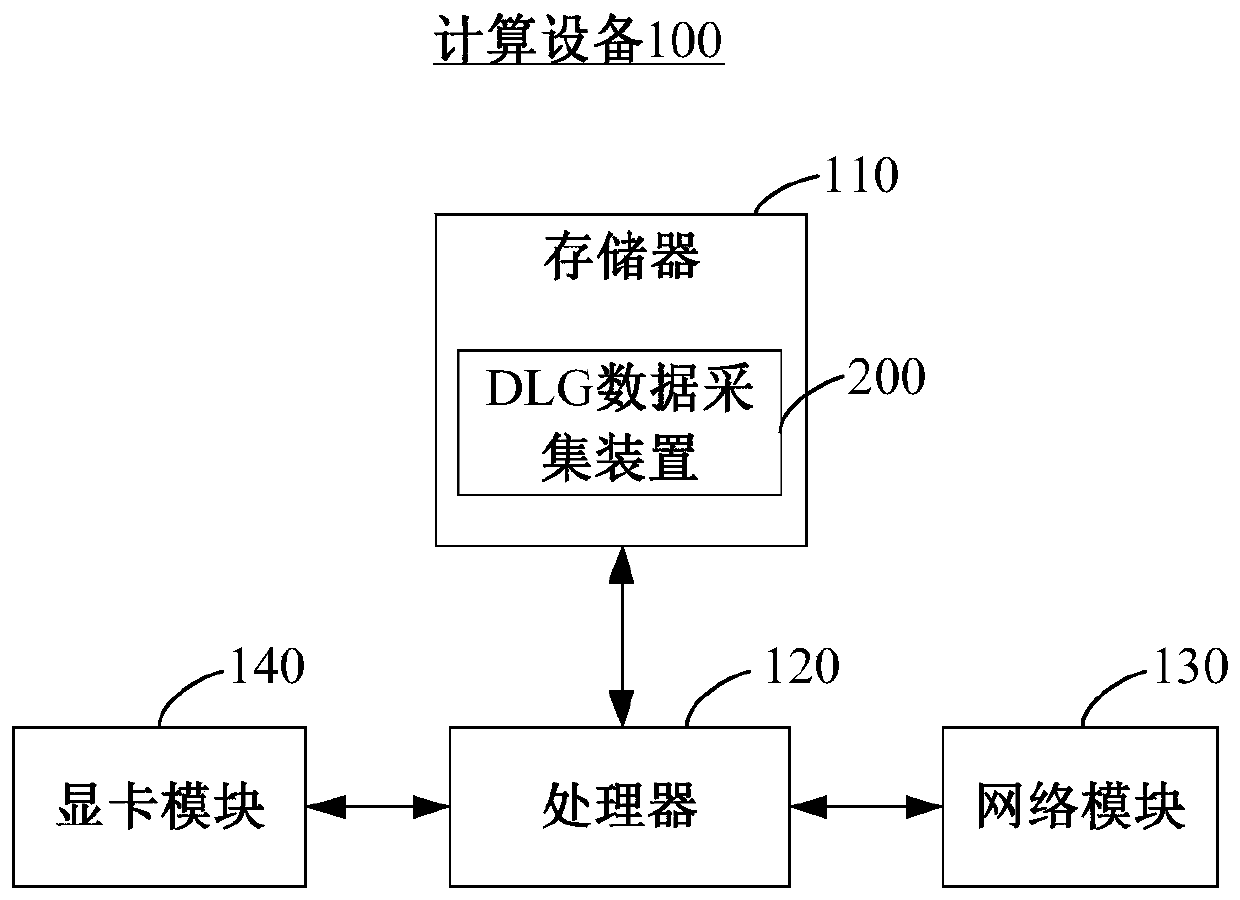
[0085] Please refer to Figure 9 , Figure 9 A functional block diagram of the DLG data collection device 200 provided for the second embodiment of the present invention. The apparatus is applied to the above-mentioned computing device 100 . The device includes: a model processing module 220 , an element processing module 230 and a contour generating module 240 .

[0086] The model processing module 220 is configured to process the acquired oblique photographic data to obtain a three-dimensional model, and construct a digital elevation model according to the three-dimensional model.

[0087] In this embodiment, the model processing module 220 is used to execute figure 2 In step S120, for the specific description of the model processing module 220, please refer to figure 2 The description of step S120 in.

[0088] The element processing module 230 is used to collect and process the three-dimensional model and the digital elevation model to obtain the corresponding elevat...


PUM


Abstract

The invention provides a DLG (Digital Line Graphic) data acquisition method and a DLG data acquisition device, which are applied to computing equipment. The method comprises the following steps: processing acquired oblique photographic data to obtain a three-dimensional model; constructing a digital elevation model according to the three-dimensional model; acquiring ground object elements of the three-dimensional model and the digital elevation mode according to preset acquiring modes, and acquiring corresponding elevation and plane coordinates, wherein the preset acquiring modes comprise a mode for acquiring the ground object elements and a mode for acquiring the ground object elements of building elevation through an inner buffering area; and generating a contour line based on the digital elevation model. Therefore, the DLG data acquisition method and the DLG data acquisition device can be operated on the basis of common computing equipment; the input equipment is low in cost and convenient to operate; moreover, the processing efficiency of the model is high; the model data accuracy is high; and the DLG mapping effect is good.

Description

technical field [0001] The invention relates to the technical field of aerial photogrammetry, in particular to a DLG data acquisition method and device. Background technique [0002] Aerial photogrammetry technology has been developed for one and a half centuries. Aerial photogrammetry technology is mainly used for DLG (Digital Line Graphic, digital line map) data collection, including the collection of vector outline data of ground features on aerial images, and position calculation. , to obtain the actual geographic coordinates of the feature elements and other processing procedures. With the continuous development of electronic technology and computer technology, the main technical means of DLG data collection is still three-dimensional collection. [0003] At present, the DLG acquisition system adopted in my country is mainly based on the all-digital aerial photogrammetry system. The system is mainly used to acquire stereo image pairs, and the acquisition efficiency is ...

Claims


Application Information

Patent Timeline
Patent Type & Authority Patents(China)
IPC IPC(8): G01C11/04
CPCG01C11/04
Inventor 郭永春武捷高鹏韩华龙
Owner AERIAL PHOTOGRAMMETRY & REMOTE SENSING CO LTD
Learn More