Tropical cyclone intensity objective determination method based on satellite cloud chart and RVM
A technology of satellite cloud images and tropical cyclones, which is applied in the field of image processing technology and meteorological forecasting, and can solve problems affecting the accuracy and scope of application, error, and TC intensity of intensity determination, etc.
- Summary
- Abstract
- Description
- Claims
- Application Information
AI Technical Summary
Problems solved by technology
Method used
Image
Examples
Embodiment Construction
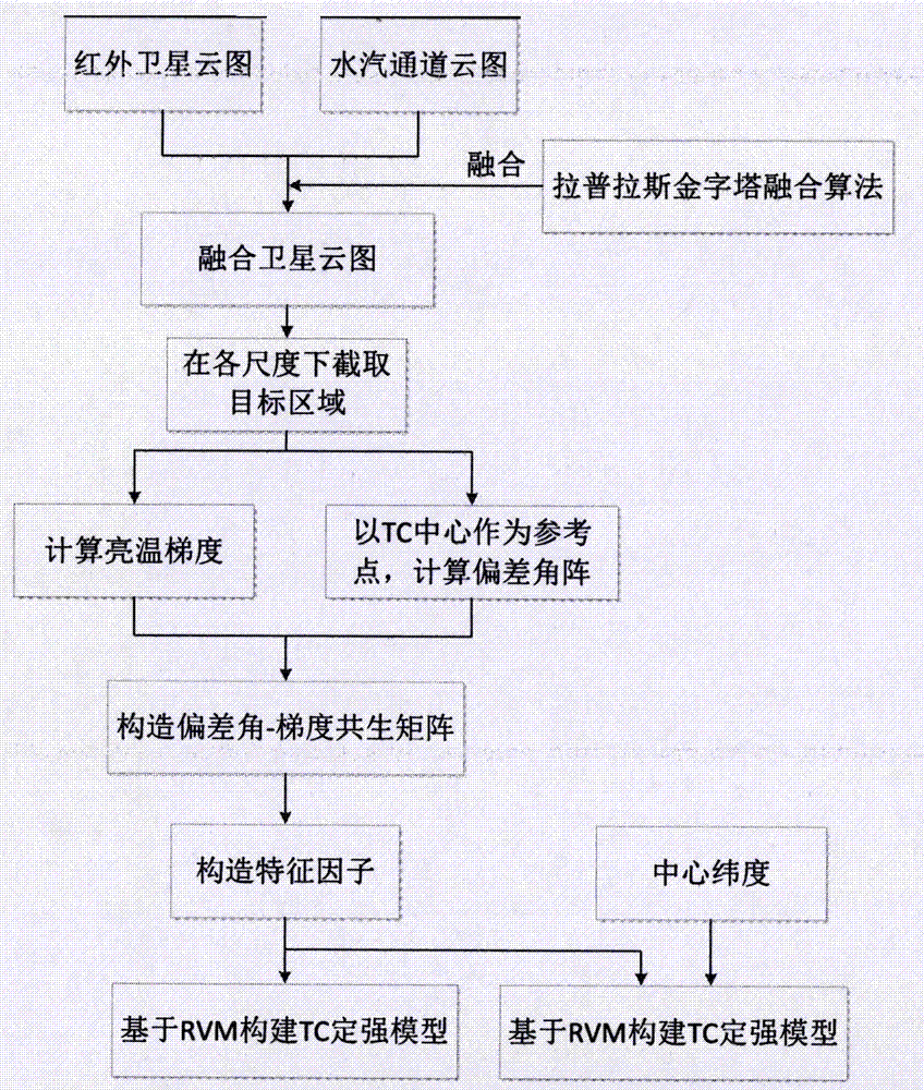
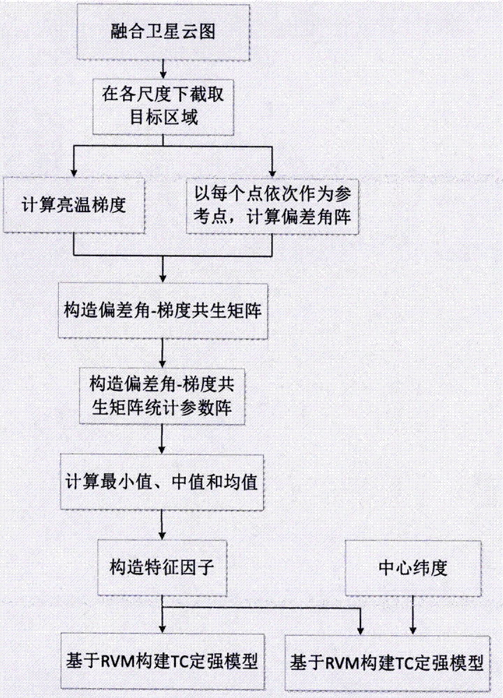
[0069] The present invention uses 132 TCs scanned by the FY-2 satellite from 2005 to 2014, including tropical storms, severe tropical storms, typhoons, strong typhoons and super typhoons. Since the yearbook data is at intervals of 3 hours or 6 hours, 2744 infrared 1-channel cloud images and 2744 water vapor channel cloud images at the same time were obtained after selection. The present invention provides a method for objectively determining the strength of TC based on satellite cloud images and RVM, including two aspects: taking the TC center as a reference point and each point as a reference point in turn, such as figure 1 with figure 2 Perform the following steps in sequence as shown. figure 1 Steps performed:
[0070] Step 1. Based on the Laplacian pyramid image fusion algorithm, the infrared 1 channel cloud image and the water vapor channel cloud image in the satellite cloud image are fused to obtain a fused cloud image;
[0071] Step 2 Use the yearbook data provide...
PUM
 Abstract
Description
Claims
Application Information
 - R&D
- Intellectual Property
- Life Sciences
- Materials
- Tech Scout
- Unparalleled Data Quality
- Higher Quality Content
- 60% Fewer Hallucinations
Browse by: Latest US Patents, China's latest patents, Technical Efficacy Thesaurus, Application Domain, Technology Topic, Popular Technical Reports.
© 2025 PatSnap. All rights reserved.Legal|Privacy policy|Modern Slavery Act Transparency Statement|Sitemap|About US| Contact US: help@patsnap.com


