Tomography SAR 3D imaging method based on stagewise weak orthogonal matching pursuit
A technology of orthogonal matching tracking and three-dimensional imaging, which is applied in the directions of radio wave reflection/re-radiation, utilization of re-radiation, measurement devices, etc., can solve the difficulty of increasing production and application, and it is difficult to accurately determine the vertical signal sparsity of slant distance, etc. problems, to achieve the effect of expanding the imaging range
- Summary
- Abstract
- Description
- Claims
- Application Information
AI Technical Summary
Problems solved by technology
Method used
Image
Examples
Embodiment 1
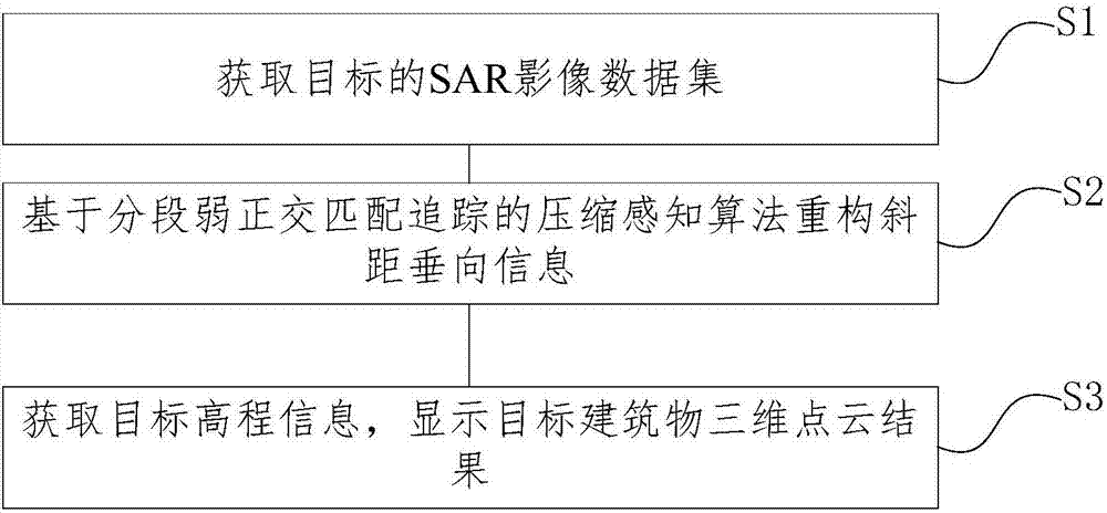
[0041] figure 1 A flow chart of a tomographic SAR three-dimensional imaging method based on segmented weak orthogonal matching pursuit is shown, including the following steps:
[0042] S1. Obtain the two-dimensional SAR image of the target building and perform preprocessing to form an observation data set;
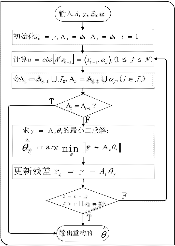
[0043] S2. The compressed sensing algorithm based on segmented weak orthogonal matching pursuit reconstructs the vertical information of slant range;
[0044] S3. Obtain the target elevation information, and display the 3D point cloud result of the target building.
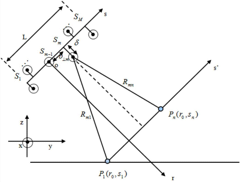
[0045] In step S1 of this embodiment, if figure 2 As shown, [S 1 ,S 2 ,…S m-1 ,S m ,…S M ] are the two-dimensional SAR images acquired by the sensor for the same target area at different times and different track positions. S m-1 S m The baseline distance between is b ⊥m , S m The vertical distance to the s-axis is δ (δ is caused by the instability of the route, which can be eliminated by correcti...
Embodiment 2
[0066] The solution in this embodiment provides 14 scenes of two-dimensional SAR image data in a certain area. Use ENVI to read the data of the target area of 14 scenes, and save the data in a format that MATLAB can read as the preparation data. It is also possible to select only 14 scenes of image data of a single building in the area as the preparation data. The selected area needs to record its coordinate position in the SAR image. The scheme selects 14 scenes of the 2D SAR image of a certain hotel in Beijing as the preparation data.
[0067] 3D point cloud generation of the target area (TomoSAR 3D point cloud imaging algorithm based on compressed sensing SWOMP)
[0068] (1) Read and load data
[0069] Read and load the prepared data into MATLB.
[0070] (2) Determine the location of the target area
[0071] The starting and ending positions of the azimuth and distance directions of the intercepted target image are respectively determined. Read the image data of 14 sc...
PUM
 Abstract
Description
Claims
Application Information
 - R&D
- Intellectual Property
- Life Sciences
- Materials
- Tech Scout
- Unparalleled Data Quality
- Higher Quality Content
- 60% Fewer Hallucinations
Browse by: Latest US Patents, China's latest patents, Technical Efficacy Thesaurus, Application Domain, Technology Topic, Popular Technical Reports.
© 2025 PatSnap. All rights reserved.Legal|Privacy policy|Modern Slavery Act Transparency Statement|Sitemap|About US| Contact US: help@patsnap.com


