
Broadcast type VRS positioning method and system

A positioning method and broadcast technology, applied in the field of satellite navigation, can solve the problems of wasting bandwidth, increasing system cost, restricting application, etc., to achieve the effect of ensuring accuracy and reliability, enhancing position security, and reducing the amount of calculation.

Active Publication Date: 2017-06-16
GUANGZHOU HI TARGET SURVEYING INSTRUMENT CO LTD
View PDF8 Cites 26 Cited by
  • Summary
  • Abstract
  • Description
  • Claims
  • Application Information

AI Technical Summary

Problems solved by technology

Therefore, the application of this technology in the field of large concurrent users is limited
[0009] (2) The two-way communication mode increases the cost of the system and causes a waste of bandwidth
And the user needs to send the location information to the server, so the user's location security is poor, not suitable for military-grade applications
[0010] (3) Does not support high dynamic users
[0016] (2) Does not support hierarchical services
It is impossible to provide differential services with different precision levels for different areas of the CORS network

Method used


Image

  • Broadcast type VRS positioning method and system
  • Broadcast type VRS positioning method and system
  • Broadcast type VRS positioning method and system

Examples


Embodiment Construction

[0064] Below, in conjunction with accompanying drawing and specific embodiment, the present invention is described further:

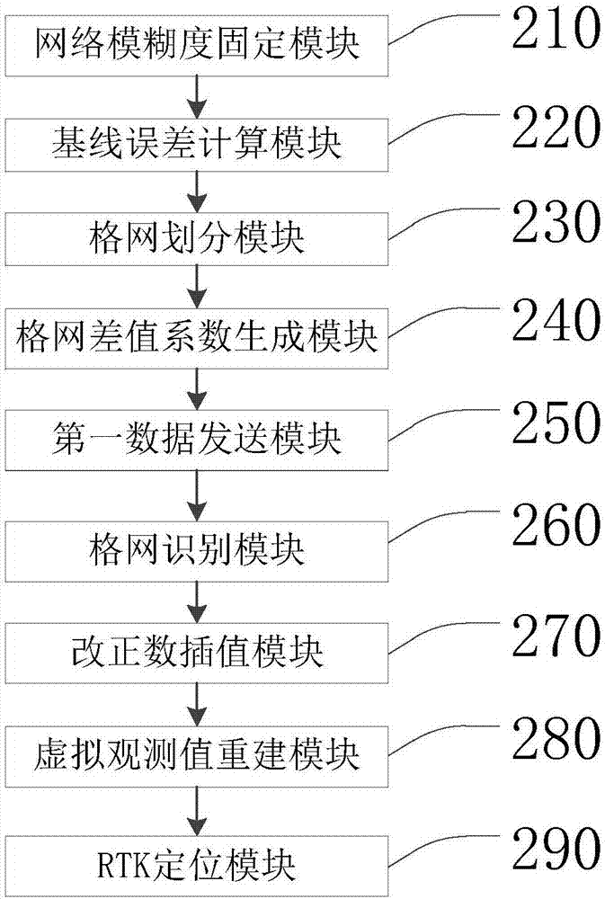
[0065] Such as figure 1 As shown, it is a schematic diagram of a broadcast VRS positioning method according to an embodiment of the present invention. The shown method includes the following steps:

[0066] Step 110, fixing the network ambiguity of the reference station;

[0067] Step 110 shown includes:

[0068] Step 111, constructing MW combined observations to estimate wide-lane ambiguity;

[0069] Step 112, constructing the ionosphere-independent combination observation value, substituting the wide-lane ambiguity into the ionosphere-independent combination observation value to estimate the narrow-lane ambiguity, and fixing the reference according to the wide-lane ambiguity and narrow-lane ambiguity station network ambiguity.

[0070] The main formula is as follows:

[0071] MW combined observation ambiguity:

[0072]

[0073] in: is the ...


PUM


Abstract

The invention relates to the field of satellite navigation, and discloses a broadcast type VRS positioning method and system. Correction number interpolation is performed on the handbook end of a user so that the computing burden of a server can be greatly reduced and the problem that the concurrent user volume is limited by the computing burden can be solved; the user end and a computing center adopt a one-way communication mechanism so that the position security of the user end can be enhanced; the whole CORS is subdivided through the mode of grid division, and the correction number interpolation coefficient of each sub-grid is generated according to a grid solving unit so that the regional difference of the atmospheric condition of wide range of the CORS grid can be reflected, the accuracy and the reliability can be guaranteed and the broadcast volume of the data can also be reduced; and use of high dynamic users is supported.

Description

technical field [0001] The invention relates to the field of satellite navigation, in particular to a broadcast VRS positioning method and system. Background technique [0002] Network RTK technology refers to the uniform deployment of multiple (three or more) permanent continuous operation reference stations within a certain range, using the Internet as a communication link, and sending the real-time observation values ​​of the reference stations to the main control station (computing center), according to The coordinate information of each reference station is accurately known, and the double-difference ambiguity of each baseline of the network reference station is solved in real time, and then the atmospheric delay information on each baseline is extracted. The error is calculated, and the correction item information of the position of the rover is generated in real time. The correction information is encoded by RTCM (Radio Technical Commission for Maritime Services, Int...

Claims


Application Information

Patent Timeline
Patent Type & Authority Applications(China)
IPC IPC(8): G01S19/44
Inventor 李成钢袁志敏
Owner GUANGZHOU HI TARGET SURVEYING INSTRUMENT CO LTD
Learn More