
Method for evaluating spatial representativeness of station LAI (Leaf Area Index) observation in remote sensing product pixel scale

An evaluation method and technology of remote sensing products, applied in the field of satellite remote sensing, can solve the problems of different representativeness, uncertainty of product verification results, etc.

Inactive Publication Date: 2017-01-04
INST OF REMOTE SENSING & DIGITAL EARTH CHINESE ACADEMY OF SCI
View PDF3 Cites 8 Cited by
  • Summary
  • Abstract
  • Description
  • Claims
  • Application Information

AI Technical Summary

Problems solved by technology

Different sites are affected by the heterogeneity of the surface space, and the LAI measurement results are not representative of the LAI value at the pixel scale of the product. If the site observations are used without screening at the same time, it will bring uncertainty to the product verification results.

Method used


Image

  • Method for evaluating spatial representativeness of station LAI (Leaf Area Index) observation in remote sensing product pixel scale
  • Method for evaluating spatial representativeness of station LAI (Leaf Area Index) observation in remote sensing product pixel scale
  • Method for evaluating spatial representativeness of station LAI (Leaf Area Index) observation in remote sensing product pixel scale

Examples


Embodiment Construction

[0055] In order to make the object, technical solution and advantages of the present invention clearer, the present invention will be further described in detail below in conjunction with the accompanying drawings. It should be understood that these descriptions are exemplary only, and are not intended to limit the scope of the present invention. Also, in the following description, descriptions of well-known structures and techniques are omitted to avoid unnecessarily obscuring the concept of the present invention.

[0056] Such as figure 1 As shown in , a spatial representativeness evaluation method of site LAI observations at the pixel scale of remote sensing products includes the following steps:

[0057] Step S1. Obtain the corresponding high spatial resolution images (HJ-1 / CCD, Landsat / TM, etc.) during site observation, and obtain reflectance data after data preprocessing such as area clipping, geometric correction and radiation correction;

[0058] Step S2, use the veg...


PUM


Abstract

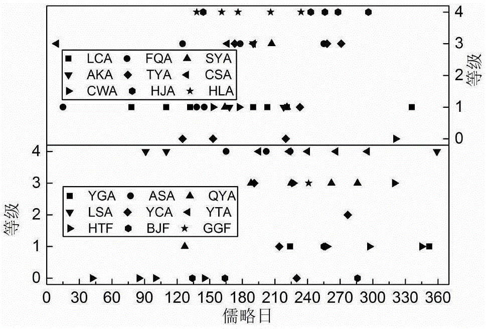
The invention discloses a method for evaluating the spatial representativeness of station LAI (Leaf Area Index) observation in a remote sensing product pixel scale. The method includes the following step that: (1) corresponding high-spatial resolution images in station observation are obtained, and reflectivity data are obtained; (2) an LAI and reflectivity lookup table is generated by using a plant canopy physical model, a corresponding LAI high-resolution image corresponding to the station observation is generated based on the reflectivity data, and the LAI high-resolution image is evaluated, so that an LAI high-resolution image with a certain precision can be obtained; (3) a station observation vegetation type representative evaluation index DVTP (Dominant Vegetation Type Percent) and the representative evaluation indexes RSSE (Relative Spatial Sampling Error) and CS (Coefficient of Sill) of the station observation LAI (Leaf Area Index) for vegetation growth in the product pixel scale are calculated; and (4) the levels of the spatial representativeness of the station LAI observation in the product pixel scale are divided into L0 to L4 according to the maximum dividability principle of representative errors of different levels. The method of the invention has the advantages of high verification precision, high reliability, simple evaluation index calculation mode, and easiness in realization, and can provide references for LAI products in climate change research, agricultural production estimation, environmental monitoring and the like.

Description

technical field [0001] The invention relates to the technical field of satellite remote sensing, in particular to a method for evaluating spatial representativeness of site LAI observations in the pixel scale of remote sensing products. Background technique [0002] Leaf Area Index (LAI) is defined as the sum of the single surface area of ​​all leaves per unit ground area. It is an important biophysical parameter to describe vegetation photosynthesis, evapotranspiration and land surface energy balance, and is also the key to the carbon-water cycle model of terrestrial ecosystems. Input parameters. At present, a variety of global-scale LAI products have been produced by means of remote sensing technology, such as GLASS, CYCLOPES, and MODIS LAI. In order for the global LAI products to meet the above research needs, their absolute accuracy and relative accuracy generally need to be within ±0.5 and 20%, respectively. Therefore, it is very necessary to obtain a reliable global ...

Claims


Application Information

Patent Timeline
IPC IPC(8): G06T7/00
CPCG06T7/0002G06T2207/10032G06T2207/30188
Inventor 李静徐保东柳钦火
Owner INST OF REMOTE SENSING & DIGITAL EARTH CHINESE ACADEMY OF SCI
Learn More