Inversion method for offshore secchi disk depth based on HICO simulation
A technology of water transparency and transparency, which is applied in the field of remote sensing, can solve problems other than the remote sensing inversion method of water transparency, and achieve the effect of accurate monitoring
- Summary
- Abstract
- Description
- Claims
- Application Information
AI Technical Summary
Problems solved by technology
Method used
Image
Examples
Embodiment Construction
[0019] The method for inverting the transparency of coastal water bodies based on HICO simulation of the present invention will be further described below in conjunction with the accompanying drawings and specific embodiments.
[0020] 1. Overview of the research area
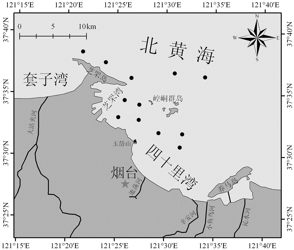
[0021] In a preferred embodiment of the present invention, the research area is Sishili Bay and its adjacent sea areas, which are located in the northeast sea area of Yantai City on the Jiaodong Peninsula, adjacent to the North Yellow Sea. Sishili Bay is connected to Yangma Island in the southeast, Zhifu Bay in the northwest, and the mouth of the bay in the northwest, with Kongtong Islands scattered among them. The coastline of Shishili Bay is about 25km long, with an area of about 182km 2 , the water depth is 8-15m, and the average water depth is about 10m. It is an important mariculture area along the coast of northern China. Forty Mile Bay is a typical temperate bay, with an average annual temperature ...
PUM
 Abstract
Description
Claims
Application Information
 - R&D Engineer
- R&D Manager
- IP Professional
- Industry Leading Data Capabilities
- Powerful AI technology
- Patent DNA Extraction
Browse by: Latest US Patents, China's latest patents, Technical Efficacy Thesaurus, Application Domain, Technology Topic, Popular Technical Reports.
© 2024 PatSnap. All rights reserved.Legal|Privacy policy|Modern Slavery Act Transparency Statement|Sitemap|About US| Contact US: help@patsnap.com


