Two-dimensional mesoscopic numerical value simulation method of water age of surface water
A numerical simulation and surface water technology, applied in general water supply conservation, electrical digital data processing, special data processing applications, etc., can solve the problems of Lagrangian method, such as large amount of calculation, complex program form, and inability to calculate water age , to achieve the effect of promoting development, reducing the amount of calculation, and increasing feasibility
- Summary
- Abstract
- Description
- Claims
- Application Information
AI Technical Summary
Problems solved by technology
Method used
Image
Examples
Embodiment 1
[0018] Such as figure 1 As shown, the present invention discloses a two-dimensional mesoscopic numerical simulation method of surface water age, and the simulation method includes the following specific steps:
[0019] Collect the background information of the research area and establish the prototype of the model: collect the topographic data, hydrological data, water quality data, meteorological data and pollutant parameters of the research area, and use the above data to establish a preliminary model;
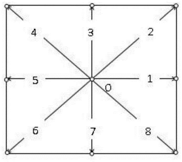
[0020] Construct the lattice Boltzmann model for solving the two-dimensional shallow water equation: further, by setting the outflow and inflow boundaries and initial conditions, use the lattice Boltzmann equation of the two-dimensional shallow water equation with the BGK collision operator to establish the lattice Boltzmann hydrodynamic model: where f α is the particle distribution function, f eq is the local equilibrium distribution function, F i is the external force ...
Embodiment 2
[0025] Experiment purpose and method: In order to verify the feasibility and effectiveness of this application, this embodiment further illustrates the present invention with the largest freshwater lake Baiyangdian Lake in the North China Plain as an implementation case, using the method described in Example 1, wherein the relevant hydrological data, water quality Data, meteorological data, and pollutant parameters are all from official data, while terrain data is supplemented by multi-beam sonar measurement. The Baiyangdian Lake was simulated using the water age model to obtain the water age distribution map at the 33rd day ( figure 2 ).
[0026] Experimental results: if figure 2 The entrance of Baiyangdian Lake shown is at the bottom of the figure, and the exit is at the top. It can be seen from the figure that the value of water age shows a gradual upward trend from the inlet to the outlet. The maximum value of water age appears in the lower right corner of the study a...
PUM
 Abstract
Description
Claims
Application Information
 - R&D
- Intellectual Property
- Life Sciences
- Materials
- Tech Scout
- Unparalleled Data Quality
- Higher Quality Content
- 60% Fewer Hallucinations
Browse by: Latest US Patents, China's latest patents, Technical Efficacy Thesaurus, Application Domain, Technology Topic, Popular Technical Reports.
© 2025 PatSnap. All rights reserved.Legal|Privacy policy|Modern Slavery Act Transparency Statement|Sitemap|About US| Contact US: help@patsnap.com


