SPSA meteorological parameter solution method based on assimilation of navigation satellite occultation data

A technology of navigation satellites and meteorological parameters, applied in the field of GPS meteorology, can solve the problems of difficult design of tangent linear operators and adjoint operators, increase algorithm complexity, etc., avoid tangent linear operators and adjoint operators, and improve efficiency and feasibility, the effect of simplifying the solution algorithm

Inactive Publication Date: 2016-03-02
HEFEI UNIV OF TECH
View PDF2 Cites 13 Cited by
  • Summary
  • Abstract
  • Description
  • Claims
  • Application Information

AI Technical Summary

Problems solved by technology

This process greatly increases the complexity of the algorithm, and the design of the tangent linear operator and the adjoint operator is a difficult point

Method used


Image

  • SPSA meteorological parameter solution method based on assimilation of navigation satellite occultation data
  • SPSA meteorological parameter solution method based on assimilation of navigation satellite occultation data
  • SPSA meteorological parameter solution method based on assimilation of navigation satellite occultation data

Examples


Embodiment Construction

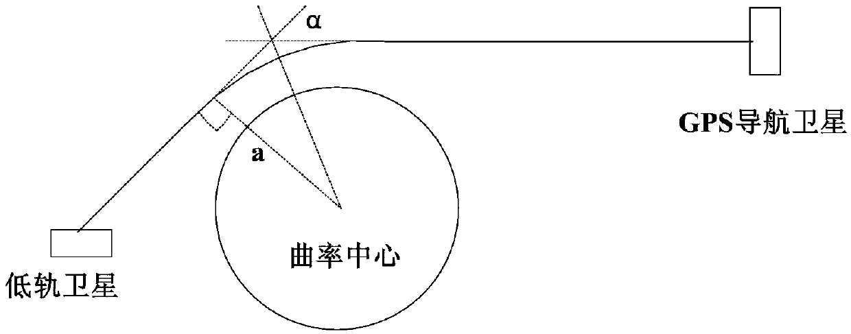
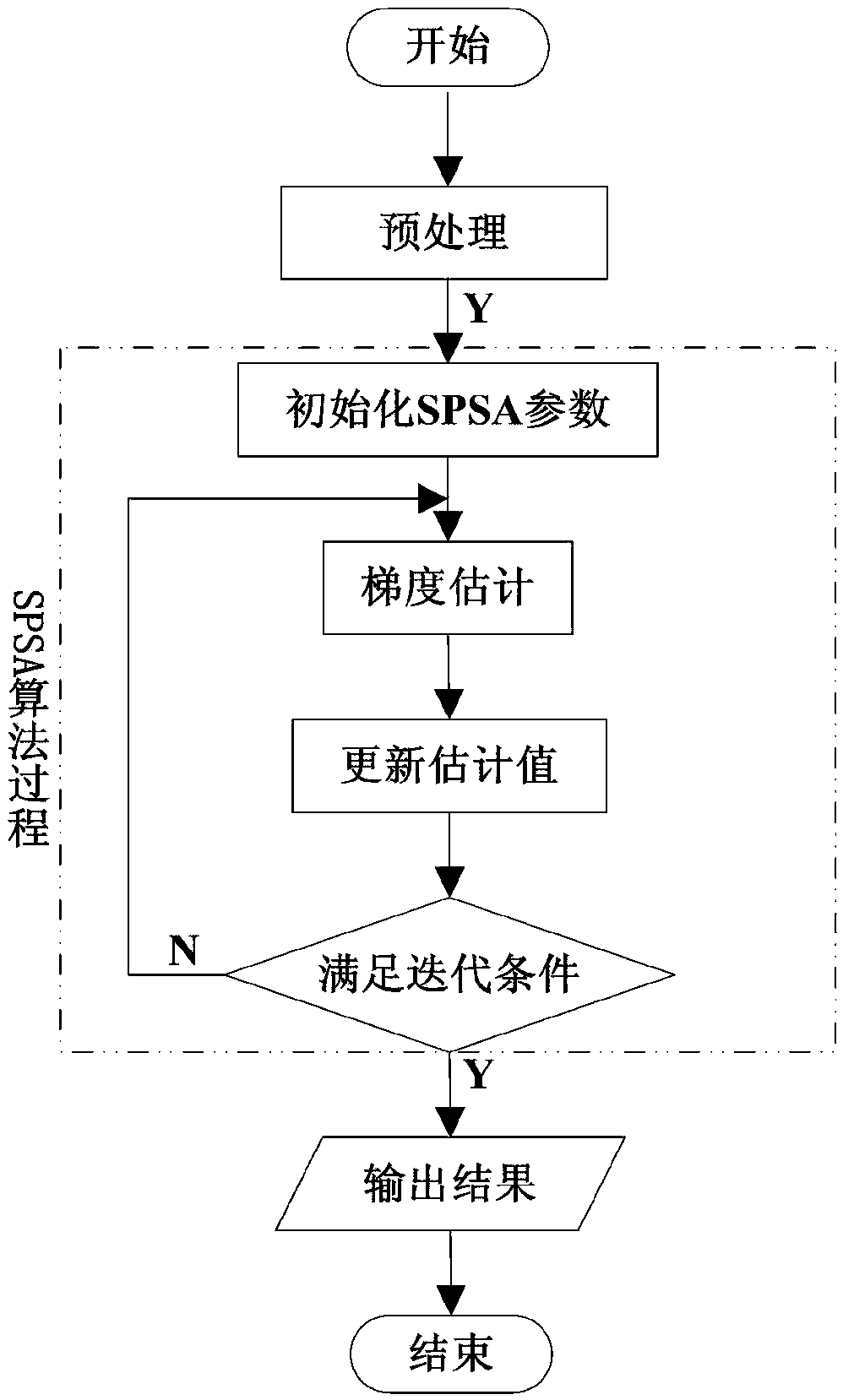
[0034] In this embodiment, the principle of occultation data assimilation is as follows: figure 1 As shown, the carrier signals of the two bands L1 and L2 continuously transmitted by the GPS navigation satellite pass through the atmosphere and are delayed and bent, and then received by the satellite receiver on the low-orbit satellite. The signal receiving end can calculate the transmission delay and bending angle profile of the carrier signal caused by the neutral atmosphere, and further obtain the atmospheric refractive index profile. By assimilating the occultation data such as bending angle and atmospheric refractivity into the numerical weather prediction model, the atmospheric state parameter vector can be solved. Such as figure 2 As shown, a SPSA meteorological parameter solution algorithm based on navigation satellite occultation data assimilation is carried out as follows:

[0035] Step 1. The current operational system used in numerical weather prediction is the a...


PUM


Abstract

The invention discloses an SPSA meteorological parameter solution method based on assimilation of navigation satellite occultation data. The method is characterized by comprising the following steps that a cost function of occultation data assimilation is established, the first-order approximation gradient of the cost function is calculated, the atmosphere state vector is updated by utilizing the approximation gradient, the cost function value under the present atmosphere state vector is solved, whether an iteration stop condition is met is determined, and if yes, the solution of the atmosphere state vector is obtained. It is not required to design a tangent operator and an adjoint operator of an observation operator, the solution algorithm of the cost function is greatly simplified, the efficiency and feasibility for solving the atmosphere state vector are improved, and the method can be widely applied.

Description

technical field [0001] The invention belongs to the field of GPS meteorology, in particular to an SPSA meteorological parameter calculation method based on navigation satellite occultation data assimilation. Background technique [0002] Radio occultation observation technology is an important subject of GPS meteorology, which uses signal delay and bending to analyze atmospheric parameters. GPS navigation satellites continuously transmit carrier signals in two bands, L1 and L2. When the carrier signal passes through the atmosphere, it will be delayed and bent, and it will be picked up by the satellite receiver on the low-orbit satellite. At the signal receiving end, the linear combination of the carrier signals of the two bands can eliminate the influence of the ionosphere, and calculate the signal transmission delay and signal bending angle profile caused by the neutral atmosphere; further, the atmospheric refraction can be obtained through Abel integral transformation ra...

Claims


Application Information

Patent Timeline
IPC IPC(8): G01W1/00
CPCG01W1/00
Inventor 夏娜许保殿
Owner HEFEI UNIV OF TECH
Why Eureka
Try Eureka