Method for extracting territorial sea baseline based on natural coastline data
A line data and natural technology, applied in the field of natural coastline thinning and territorial sea base point encryption to generate territorial sea baselines, can solve problems such as self-intersection, terrain distortion, and topological inconsistency
- Summary
- Abstract
- Description
- Claims
- Application Information
AI Technical Summary
Problems solved by technology
Method used
Image
Examples
Embodiment Construction
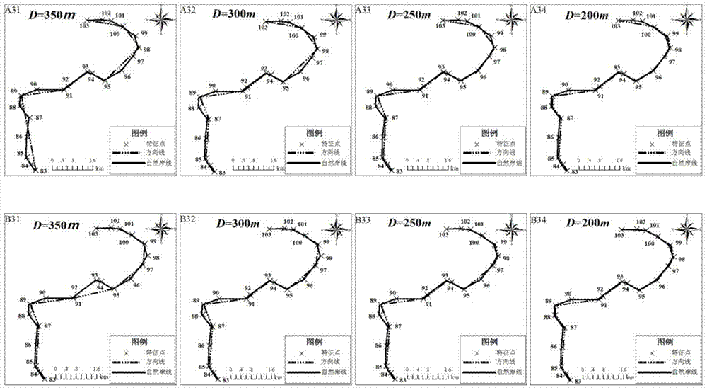
[0038] Taking the South China Sea as an example, the present invention will be described in detail according to the accompanying drawings, so as to make the technical route and operation steps of the present invention clearer.
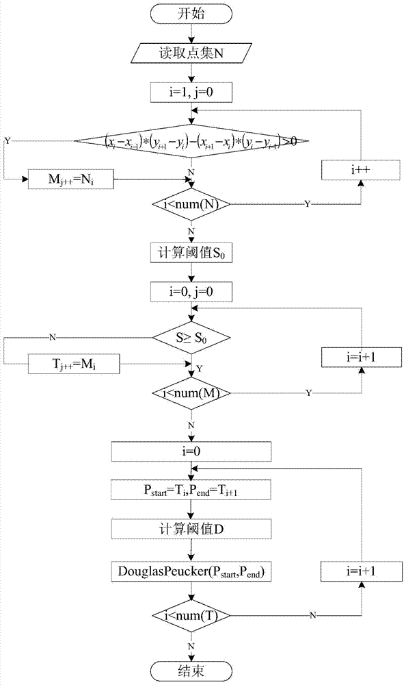
[0039] In this embodiment, the method for extracting the baseline of the territorial sea based on natural coastline data is performed by the improved segmented Douglas-Pocke algorithm (see flow chart figure 1 ) and the encryption algorithm based on the geodetic solution of the earth ellipsoid (for the flow chart, see Figure 4 ), the overall steps are as follows:
[0040] Step 1. Select salient points—for the natural coastline feature point set N, use the vector cross product formula to select salient points and store them in the point set M.
[0041]The characteristic of the Douglas-Peck algorithm is that as the distance threshold increases, the compression rate becomes larger, but the first and last points are always preserved. Therefore, the segme...
PUM
 Abstract
Description
Claims
Application Information
 - Generate Ideas
- Intellectual Property
- Life Sciences
- Materials
- Tech Scout
- Unparalleled Data Quality
- Higher Quality Content
- 60% Fewer Hallucinations
Browse by: Latest US Patents, China's latest patents, Technical Efficacy Thesaurus, Application Domain, Technology Topic, Popular Technical Reports.
© 2025 PatSnap. All rights reserved.Legal|Privacy policy|Modern Slavery Act Transparency Statement|Sitemap|About US| Contact US: help@patsnap.com


