
Beidou Navigation Satellite Regional Orbit Determination Method Based on Multiple Co-located Receivers

A Beidou navigation and receiver technology, applied in the field of satellite precise orbit determination, can solve the problems of long distance between stations, few observable arcs, and reduce the success rate of carrier phase ambiguity resolution, so as to improve the fixation rate and improve Orbit determination accuracy and the effect of improving satellite orbit determination accuracy

Inactive Publication Date: 2016-08-24
NAT TIME SERVICE CENT CHINESE ACAD OF SCI
View PDF6 Cites 0 Cited by
  • Summary
  • Abstract
  • Description
  • Claims
  • Application Information

AI Technical Summary

Problems solved by technology

Compared with the uniform distribution of tracking stations around the world, domestic tracking stations have fewer observable arcs of Beidou satellites, which hinders the full arc tracking of satellites by tracking stations
In addition, although domestic tracking stations are evenly distributed, due to my country's vast territory, the distance between stations is far away, which is not conducive to double-difference ambiguity resolution, which reduces the success rate of carrier phase ambiguity resolution, which in turn affects high-precision carrier phase observation. Applied value of value

Method used


Image

  • Beidou Navigation Satellite Regional Orbit Determination Method Based on Multiple Co-located Receivers
  • Beidou Navigation Satellite Regional Orbit Determination Method Based on Multiple Co-located Receivers
  • Beidou Navigation Satellite Regional Orbit Determination Method Based on Multiple Co-located Receivers

Examples


Embodiment Construction

[0014] The present invention will be further described below in conjunction with the accompanying drawings and embodiments, and the present invention includes but not limited to the following embodiments.

[0015] The present invention comprises the following steps:

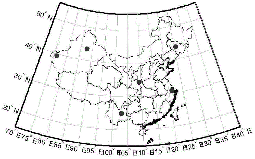
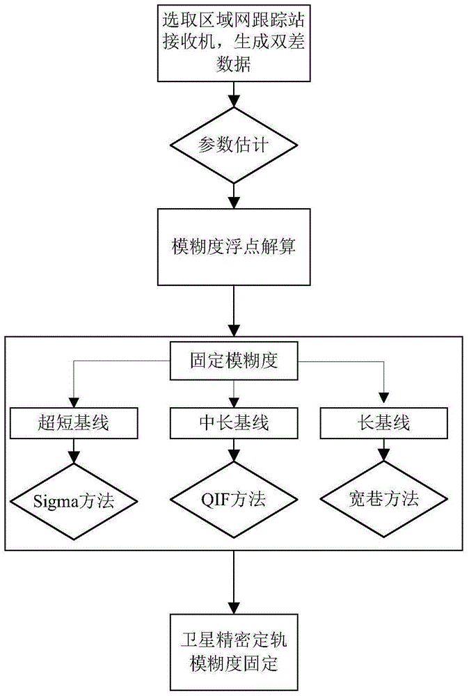
[0016] Step 1: For the China regional network tracking stations, select at least two receiver data for each station. According to the principle of the most common view observations, in addition to generating multiple medium-long baselines, multiple ultra-short baselines can also be formed.

[0017] Step 2: Based on the single-difference data of the above medium-long baseline and ultra-short baseline, generate double-difference data for preliminary precise satellite orbit determination. The main purpose is to perform ambiguity floating point resolution. Other estimated parameters include: 6 orbital elements, 9 light pressure coefficients (where D and Y constants are constrained by 1e-12 in both directions), Eart...


PUM


Abstract

The invention provides a multiple parallel address receiver-based Beidou navigation satellite region orbit determination method. The method comprises the steps of aiming at tracking stations of a China regional network, selecting data of multiple receivers at each station, and generating a medium long reference line and an ultrashort reference line according to the principle of the maximal common view observed quantities; based on single difference data of the medium long reference line and the ultrashort reference line, generating dual difference data to perform primary satellite precise orbit determination, and obtaining an ambiguity floating point solution and an estimation parameter; tracking station coordinates, and adopting different methods to calculate carrier phase ambiguity for reference lines of different lengths; using the generated carrier phase ambiguity to re-perform parameter estimation to calculate a satellite orbit. The Beidou navigation satellite region orbit determination is carried out by using multiple receivers placed in a parallel-address mode, the calculation successful rate of the carrier phase ambiguity can be improved, the value of a carrier phase observation value in the Beidou navigation satellite region orbit determination is improved and the Beidou navigation satellite orbit determination precision is finally improved.

Description

technical field [0001] The invention relates to a method for regional orbit determination of Beidou navigation satellites, relates to the field of precise satellite orbit determination, and can significantly improve the accuracy of orbit determination of Beidou navigation satellites under the condition of regional station deployment. Background technique [0002] In view of the huge role of the satellite navigation system in the military, economic and political fields, our country is actively developing its own satellite navigation system. In 1994, the Beidou-1 satellite navigation system was officially launched. The system includes 3 satellites, all in geostationary orbit. Compared with the US GPS, Beidou-1 has a small coverage area, low positioning accuracy, and cannot be used on high-speed mobile platforms. In order to break through the limit on the number of users, improve the viability of the system, expand the coverage of the system, and achieve compatibility and int...

Claims


Application Information

Patent Timeline
Patent Type & Authority Patents(China)
IPC IPC(8): B64G1/10G01C21/24G01S19/42
Inventor 孔垚孙保琪杨旭海
Owner NAT TIME SERVICE CENT CHINESE ACAD OF SCI
Learn More