Vector contour line data partitioning method with space proximity relation considered
A technology of vector contours and spatial proximity, which is applied in the intersection of geographic information and parallel computing, can solve problems such as the inability to guarantee a relatively balanced data volume, achieve good spatial aggregation, reduce difficulty, and ensure load balancing.
- Summary
- Abstract
- Description
- Claims
- Application Information
AI Technical Summary
Problems solved by technology
Method used
Image
Examples
Embodiment Construction
[0034] The specific implementation of the vector contour data division method considering the spatial proximity relationship of the present invention will be described in detail below with reference to the figures.
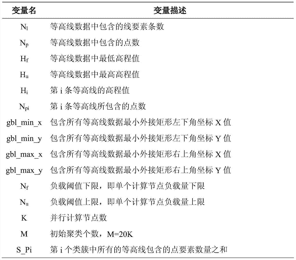
[0035] Table 1 shows the basic variables used in the vector contour data division method of the present invention considering the spatial proximity relationship.
[0036] Table 1. Variable description of vector contour data division method
[0037]
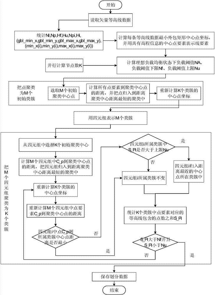
[0038] The realization step of the inventive method is as figure 1 Shown:
[0039] Step 1, read the vector contour data, and quantitatively count the characteristics of the contour data, including: the number of contour data lines N l , the total number of points N p , the lowest elevation H of the contour data f , the highest elevation H of the contour data u , the number of points N of each line element pi , the elevation H of each line element i , the boundary coordinates of the smallest bounding rectangl...
PUM
 Abstract
Description
Claims
Application Information
 - R&D Engineer
- R&D Manager
- IP Professional
- Industry Leading Data Capabilities
- Powerful AI technology
- Patent DNA Extraction
Browse by: Latest US Patents, China's latest patents, Technical Efficacy Thesaurus, Application Domain, Technology Topic, Popular Technical Reports.
© 2024 PatSnap. All rights reserved.Legal|Privacy policy|Modern Slavery Act Transparency Statement|Sitemap|About US| Contact US: help@patsnap.com


