
Vehicle-mounted integrated navigation method based on simplified inertia measurement assembly

An inertial measurement component and integrated navigation technology, applied in the field of navigation, can solve the problems of little research on the auxiliary loop of inertial navigation, low system accuracy, poor reliability, etc., to improve signal tracking performance, improve system accuracy, and improve measurement accuracy Effect

Active Publication Date: 2013-11-27
SOUTHEAST UNIV
View PDF2 Cites 10 Cited by
  • Summary
  • Abstract
  • Description
  • Claims
  • Application Information

AI Technical Summary

Problems solved by technology

[0003] In order to complete the application of low-cost and miniaturized systems in the vehicle-mounted combination system, it is very important to study the combined technology of the simplified inertial measurement unit (RIMU) / GPS. Combination and conventional tight combination research, there is little research on the tight combination and ultra-tight combination of inertial navigation auxiliary loop
Some scholars apply the research results on the IMU to the RIMU, so there will be some problems, such as differences in navigation algorithms, error models, selection of phase-locked loop noise bandwidth, and optimal combination methods. Leading to low accuracy and poor reliability of the whole system

Method used


Image

  • Vehicle-mounted integrated navigation method based on simplified inertia measurement assembly
  • Vehicle-mounted integrated navigation method based on simplified inertia measurement assembly
  • Vehicle-mounted integrated navigation method based on simplified inertia measurement assembly

Examples


Embodiment Construction

[0023] The present invention will be further explained below in conjunction with the accompanying drawings and specific embodiments.

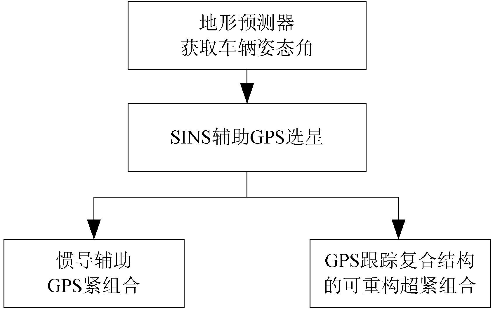
[0024] Such as figure 1 As shown, a vehicle-mounted integrated navigation method based on a simplified inertial measurement component includes the following steps:

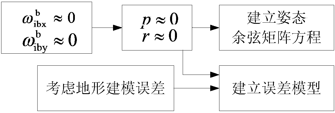
[0025] Step 1: Use RIMU to measure the data of the vehicle's running position, and obtain the vehicle's pitch and roll angle caused by the ground slope through the terrain predictor method.

[0026] Among them, RIMU is a simplified IMU, that is, it lacks complete three gyroscopes and three accelerometers, so it cannot obtain all three-axis angular rates and three-dimensional accelerations in measurement, resulting in a slightly higher navigation performance than a complete IMU. Worse. For land vehicle navigation, the commonly used RIMU configuration is a vertical gyroscope plus three accelerometers (hereinafter referred to as 3A1G) or a vertical gyroscope plus two horizontal acce...


PUM


Abstract

The invention discloses a vehicle-mounted integrated navigation method based on a simplified inertia measurement assembly. The method comprises the following steps: a first step of measuring the data of the vehicle running position by using the simplified inertia measurement assembly, and acquiring a vehicle pitch-roll angle caused by ground inclination by using a terrain predictor; a second step of judging visible satellites according to the data measured in the first step by using an SINS (Strapdown Inertial Navigation System) assisted CPS (Central Processing System) and selecting a proper satellite; a third step of acquiring information of pseudo-range, Doppler frequency, carrier phase, navigation telegraph text and the like from the satellite selected, captured and tracked in the second step, carrying out closed-loop control on a GPS (Global Positioning System) loop according to an inertia navigation aiding method by using SINS / GPS compact combined navigation filter, and assisting a GPS receiver; and a fourth step of selecting a vector tracking loop and a scalar tracking structure according to the system precision and the quality of a GPS signal by using a super-compact combined algorithm in a GPS tracking composite structure to enable the system to carry out lasting tracking. By adopting the method disclosed by the invention, the whole system is high in precision and good in reliability.

Description

technical field [0001] The invention relates to a navigation method, in particular to a vehicle integrated navigation method based on a simplified inertial measurement component. Background technique [0002] In the past 40 years, integrated navigation technology has become one of the navigation technologies with the greatest potential for application and development. The SINS / GPS integrated system has been widely used in aircraft navigation, precision approach and landing, missile precision guidance, and satellite orbit determination by taking advantage of their respective advantages and complementary characteristics. Attitude determination, aerospace remote sensing, ship navigation, gravity measurement, intelligent transportation and other sea, land and air fields, especially in the field of vehicle applications, highlight its special superior performance. Over the past two decades, the low-cost SINS / GPS loose combination or tight combination technology as an optimal solut...

Claims


Application Information

Patent Timeline
Patent Type & Authority Applications(China)
IPC IPC(8): G01C21/26G01S19/47
Inventor 张涛徐晓苏刘锡祥王立辉李佩娟李瑶
Owner SOUTHEAST UNIV
Learn More