
Spatial data storage and spatial data storage reading method and spatial data storage reading system

A spatial data and space technology, applied in the field of spatial data storage and reading methods and systems, can solve problems such as low concurrency, huge symbol library, and unfavorable data sharing, so as to improve fault tolerance, solve maintenance problems, and solve sharing problems. effect of the problem

Inactive Publication Date: 2013-06-26
方正国际软件(北京)有限公司
View PDF7 Cites 5 Cited by
  • Summary
  • Abstract
  • Description
  • Claims
  • Application Information

AI Technical Summary

Problems solved by technology

[0005] ① Symbol management concurrency problem: Due to file-based management, files must be locked during concurrency, which will lead to low concurrency efficiency;
[0007] ③Maintenance of symbol library files: file-based symbol management, if a symbol error makes the entire symbol library unusable, automatic maintenance of the symbol library will be very difficult;
[0009] ⑤ Sharing of symbol library files: Data sharing is not only about data upload, but also data download. When data is downloaded, the symbol library will also be downloaded. The symbol library in the form of files is very large, which is not conducive to data sharing. At the same time, sharing the entire symbol library also will distribute the confidential symbolic data

Method used


Image

  • Spatial data storage and spatial data storage reading method and spatial data storage reading system
  • Spatial data storage and spatial data storage reading method and spatial data storage reading system
  • Spatial data storage and spatial data storage reading method and spatial data storage reading system

Examples


Embodiment approach 1

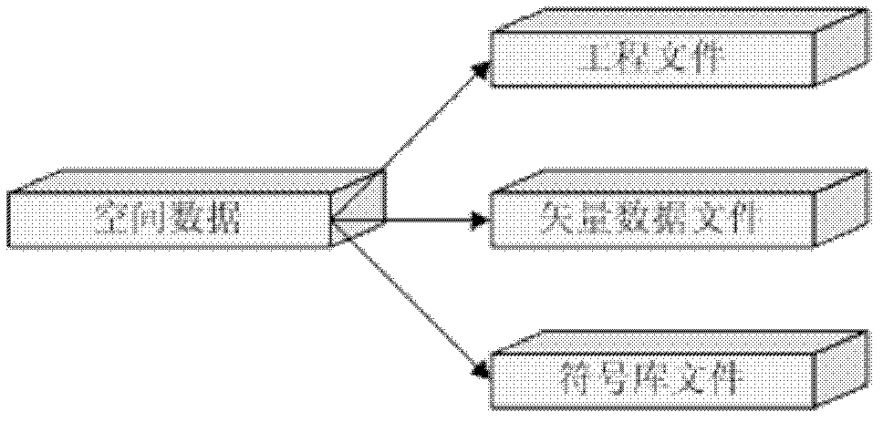
[0050] Such as figure 1 As shown, the spatial data in this embodiment includes project files, vector data files and symbol library files. The project file stores symbol information of vector data (such as symbol id, symbol size, symbol color, etc.), label information (such as label field, label font, label size and position, etc.), and control information of various vector data (such as layer's field of view, border, etc.). The vector data file stores the coordinate information describing the features and the index information of the spatial data. The symbol library file stores the symbols used by the spatial data, and the symbol ID in the project file indexes the symbols in the symbol library.

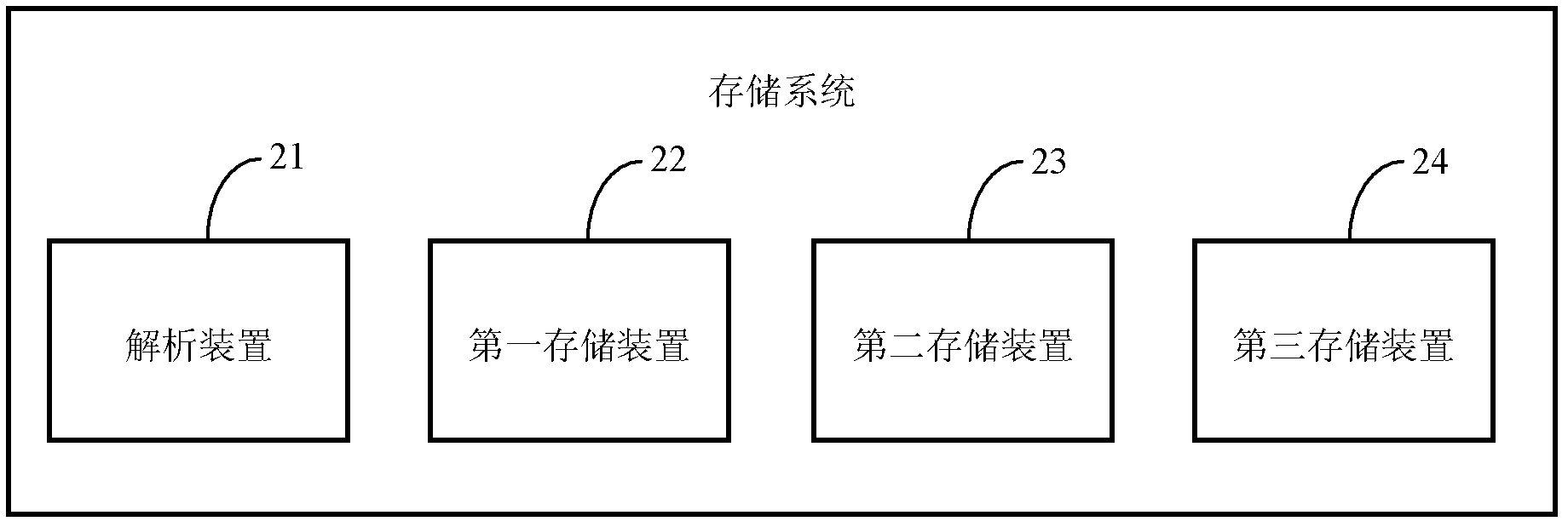
[0051] Such as figure 2 As shown, the spatial data storage system in this embodiment includes an analysis device 21, a first storage device 22, a second storage device 23, and a third storage device 24, and the second storage device 22 includes a serialization unit ( figure 2 no...

Embodiment approach 2

[0060] Such as Figure 6 As shown, the reading system adopting the spatial data stored in the system described in Embodiment 1 in this embodiment includes a vector data extraction device 61, a symbol data extraction device 62, an annotation data extraction device 63, a project file rewriting device 64 and a package device65.

[0061] The vector data extraction device 61 is used to extract vector data from the spatial database to generate vector data files. The symbol data extraction device 62 is used to retrieve the required symbols according to the vector data, extract the symbol list from the spatial database, and write them into the symbol library file one by one. The annotation data extracting means 63 is used for extracting annotation data from the spatial database. The project file rewriting device 64 is used to rewrite the project file according to the vector data, symbol data and label data. Packing device 65 is used to pack all data.

[0062] Such as Figure 7 an...


PUM


Abstract

The invention relates to a spatial data storage method. The method comprises the steps: firstly analyzing a spatial data package, decomposing data in the spatial data package into vector data, symbol data and label data; then storing the vector data in a spatial data bank; decomposing the symbol data into symbols of smallest units and storing the symbols in the spatial data bank; and analyzing the label data into a file and storing the file in the spatial data bank. The invention further relates to a spatial data storage system and the method and the system for reading the spatial data stored through the storage method. Through decomposing a symbol library into symbols of smallest units, fault tolerance of the symbol library is greatly improved, and the maintaining problem of the symbol library is solved.

Description

technical field [0001] The invention belongs to the technical field of data access, and in particular relates to a method and system for storing and reading spatial data. Background technique [0002] Map symbols are the basic means of expressing the content of maps. They can not only express the spatial position, shape, quality and quantity characteristics of things, but also express the interrelationships between things and the overall characteristics of the region. Graphic symbols are composed of three basic factors of shape, size and color, and have systematic characteristics; markers are an important part of map symbols, and they also have differences in shape, size and color. According to the characteristics of the distribution of things, map symbols can be divided into points, lines and surfaces. [0003] Maps use graphic symbols that are easy to be felt by people to represent the ground scenery. The use of symbols has the following effects: ① Selectively represent t...

Claims


Application Information

Patent Timeline
IPC IPC(8): G06F17/30
Inventor 曹五丰程永辉焦洁庞奎李强蒋孝金
Owner 方正国际软件(北京)有限公司
Learn More