Mining subsidence monitoring information mobile acquisition terminal system and acquisition method thereof
A technology for mining subsidence and monitoring information, applied in the direction of measuring devices, instruments, etc., can solve the problems of low degree of informatization, single method, backward means, etc., to achieve the effect of centralized data management, saving human resources, and improving efficiency
- Summary
- Abstract
- Description
- Claims
- Application Information
AI Technical Summary
Problems solved by technology
Method used
Image
Examples
Embodiment 1
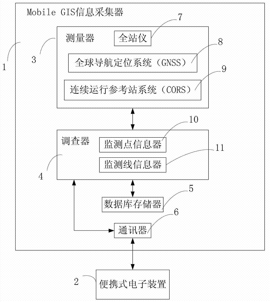
[0023] see figure 1 , the mining subsidence monitoring information mobile collection terminal system of the present invention includes a Mobile GIS information collector 1 and a portable electronic device 2 . The Mobile GIS information collector 1 and the portable electronic device 2 are connected to the portable electronic device 2 through bluetooth or a data line, and the information of the Mobile GIS information collector 1 is displayed on the portable electronic device 2 for analysis and storage, so as to realize the portable The operability of the electronic device 2 to the Mobile GIS information collector 1 . The portable electronic device 2 can be a PDA or a notebook computer.
[0024] The Mobile GIS information collector 1 includes a measuring device 3 , an investigator 4 , a database storage 5 , and a communicator 6 . The measuring device 3 and the database memory 5 are respectively connected to the survey device 4 , one end of the communicator 6 is connected to the...
Embodiment 2
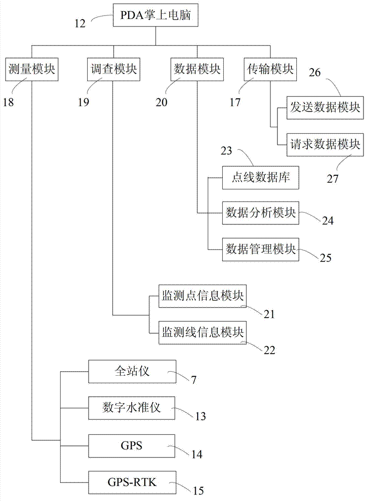
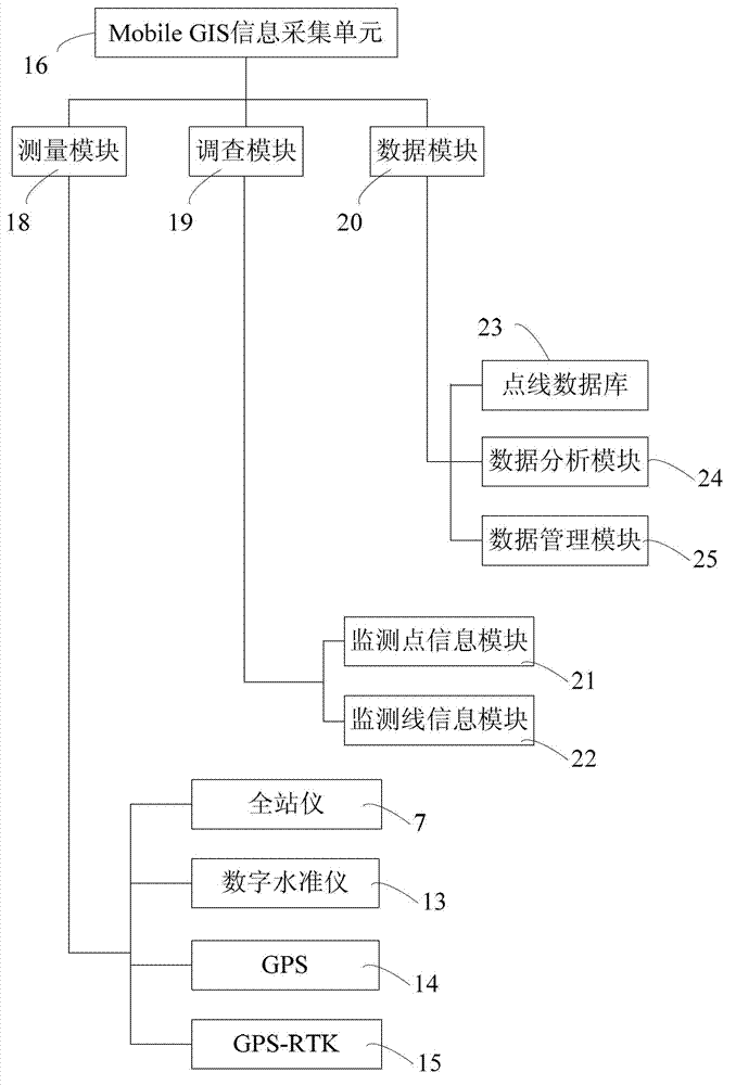
[0031] Please also refer to figure 2 , image 3 and Figure 4 , in combination with Embodiment 1, the system can also be arranged on the PDA handheld computer 12 by adopting software design, and adopting Mobile GIS as the data acquisition, management and analysis platform. Thereby the software type point line monitoring information mobile collection system of the present invention can be applicable to various brands, various types of total station 7, digital level 13, GPS14, GPS-RTK15, CORS and other measuring equipment, measuring equipment through bluetooth or data The line is connected with the system to realize the real-time and two-way transmission function of data, and the data information is recorded in the point line information database in the PDA.
[0032] Such as figure 2 As shown, the point-line monitoring information mobile collection system includes image 3 The mobile GIS information collection unit 16 and the transmission module 17 are shown. The Mobile GIS...
PUM
 Abstract
Description
Claims
Application Information
 - R&D
- Intellectual Property
- Life Sciences
- Materials
- Tech Scout
- Unparalleled Data Quality
- Higher Quality Content
- 60% Fewer Hallucinations
Browse by: Latest US Patents, China's latest patents, Technical Efficacy Thesaurus, Application Domain, Technology Topic, Popular Technical Reports.
© 2025 PatSnap. All rights reserved.Legal|Privacy policy|Modern Slavery Act Transparency Statement|Sitemap|About US| Contact US: help@patsnap.com


