Wireless communication system and method to provide geo-spatial related event data
a technology of geo-spatial related data and wireless communication, applied in the direction of data switching network, data switching details, instruments, etc., can solve the problem that systems do not provide complex geo-spatial related data (information) to users
- Summary
- Abstract
- Description
- Claims
- Application Information
AI Technical Summary
Benefits of technology
Problems solved by technology
Method used
Image
Examples
Embodiment Construction
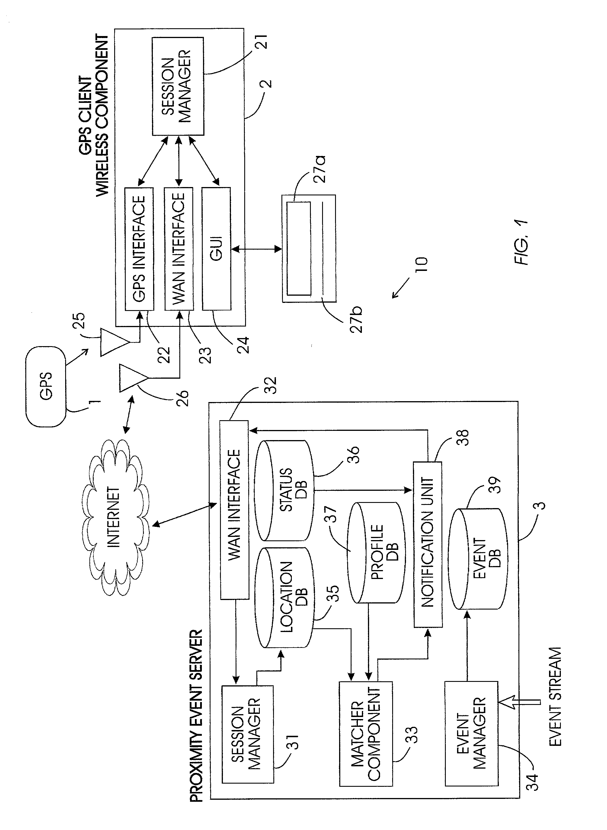
[0017]The purpose of this invention is to present a global positioning satellite-based wireless component user with a geo-spatial activated system and method. An exemplary implementation of system hardware of the invention is shown in FIG. 1. The event proximity activated system 10 includes two main components: a GPS client wireless component 2 and a proximity event server 3.
[0018]As illustrated in FIG. 1, a typical configuration of an information handling / wireless communication system in accordance with the invention has a central processing units in both the server 3 and the wireless component 2. Each of these central processing unit could include various mapping units, weighting units, classification units, clustering units, filters, adders, subtractors, comparators, etc. Alternatively, as would be known by one ordinarily skilled in the art given this disclosure, multiple specialized CPU's (or other similar individual functional units) could perform the same processing, mapping, ...
PUM
 Abstract
Description
Claims
Application Information
 - R&D
- Intellectual Property
- Life Sciences
- Materials
- Tech Scout
- Unparalleled Data Quality
- Higher Quality Content
- 60% Fewer Hallucinations
Browse by: Latest US Patents, China's latest patents, Technical Efficacy Thesaurus, Application Domain, Technology Topic, Popular Technical Reports.
© 2025 PatSnap. All rights reserved.Legal|Privacy policy|Modern Slavery Act Transparency Statement|Sitemap|About US| Contact US: help@patsnap.com


