
Weather information network including graphical display

a weather information network and weather information technology, applied in the field of weather information networks, can solve the problems of limited use of radar systems, inability to penetrate clouds and detect weather conditions on the other side, and inability to provide weather within a few hundred mile radius of aircraft, so as to enhance pilot situational awareness, improve flight economy and safety, and improve the effect of informed and intelligent decisions

Inactive Publication Date: 2006-04-11
HONEYWELL INT INC
View PDF28 Cites 85 Cited by
  • Summary
  • Abstract
  • Description
  • Claims
  • Application Information

AI Technical Summary

Benefits of technology

[0010]The present invention addresses the foregoing shortcomings in the art by providing a method of and system for providing pilots with the information and tools they need to make more informed and intelligent decisions when approaching adverse weather. Such method and apparatus enhances the pilot's situational awareness by displaying near real-time weather information for regions all over the world, thus improving flight economy and safety and increasing the likelihood of an on-time arrival.
[0011]In one aspect, the present invention relates to an apparatus for providing weather information onboard an aircraft. The apparatus includes a processor unit that processes weather information after it is received onboard the aircraft from a ground-based source and a graphical user interface that provides a graphical presentation of the weather information to a user onboard the aircraft. By “graphical presentation” it is meant that at least some types of weather information are illustrated pictorially rather than merely in text form. An example of a graphical display of weather information is an image or pattern superimposed on a map of a geographic region, wherein the image or pattern indicates the location or characteristics of a particular weather phenomenon, such as convection, turbulence, icing, cloud cover, precipitation, etc. Another example would be a cross-sectional display of weather information taken along a route of the aircraft. The graphical user interface also includes one or more user-selectable options for graphically displaying at least one of convection information, turbulence information, icing information, weather satellite information, SIGMET information, significant weather prognosis information, and winds aloft information. Preferably, the graphical user interface further includes a user-selectable option that allows the user to request specific weather information for transmission from the ground-based source to the aircraft. Advantageously, this option, or another option, allows the user to select what weather information is automatically transmitted from the ground-based source.

Problems solved by technology

The usefulness of such radar systems, however, is limited.
Even the most advanced radar systems can only provide a glimpse of weather within a few hundred mile radius of the aircraft.
In addition, heavy rain sometimes can overcome the aircraft's radar so that it is unable to penetrate clouds and detect weather conditions on the other side of the clouds.
Finally, pilots require a myriad of weather information that onboard weather radar systems do not provide.
This can be a difficult and stressful task, especially when trying to navigate an aircraft in inclement weather.
None of these types of information, however, provides a complete and accurate picture of the location and severity of convective activity.
This scenario is even more difficult for turbulence and icing hazards, as radar mosaics and lightning images do not provide any indication of these hazards.
This is a time consuming and mentally exhausting exercise that can distract the pilot from the task at hand—flying the aircraft.
Moreover, errors in judgment can potentially endanger the passengers and crew, not to mention waste time and fuel spent back-tracking or on misguided detours.
Another significant drawback of the system described in the '606 patent is its failure to provide for two-way communication between the onboard user interface and the ground station.
Broadcasts are inherently unreliable, so if only a portion of a broadcast is received, or perhaps none of it at all, the pilot is unable to request retransmission of the broadcast from the ground station.
Instead, the pilot must wait for the next broadcast, which, depending on the proximity and severity of adverse weather ahead, could be too late.
Additionally, the foregoing system does not permit pilots to request information that may not normally be broadcast in the region in which they are flying, nor does it allow pilots to limit what types of information are transmitted to the aircraft, or how frequently such information is updated, based on their individual preferences.

Method used


Image

  • Weather information network including graphical display
  • Weather information network including graphical display
  • Weather information network including graphical display

Examples


Embodiment Construction

[0061]The present invention is directed to an entire weather information network, including the collection and processing of weather information at a data center, the communication of that information to an aircraft, and the display of such information to a user onboard the aircraft.

1. The Data Center

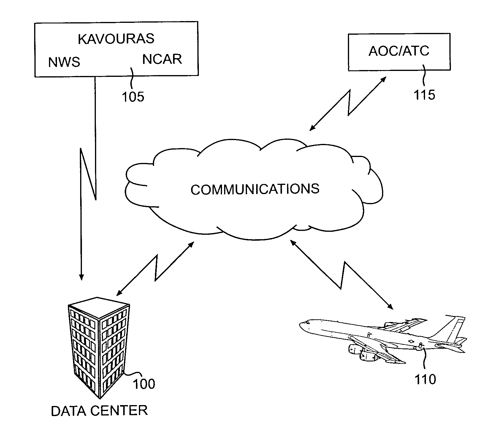
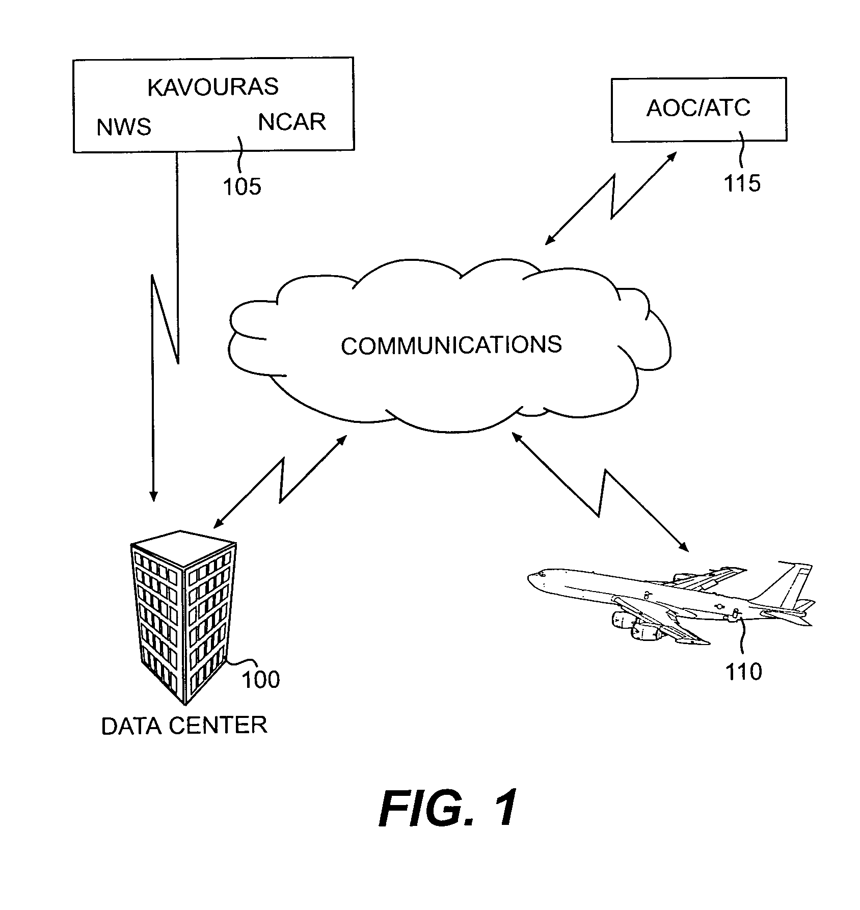
[0062]As depicted in FIG. 1, the data center 100 collects weather information from a variety of weather sources 105. The weather information then is compiled, packaged, and queued for further transmission to an aircraft 10 via one of several possible communication routes, such as shown in FIGS. 2–6.

[0063]The weather sources 105 may include commercial providers such as, for example, Kavouras, the National Center for Atmospheric Research (NCAR), the National Weather Service (NWS), Weather Service Information (WSI), and the like. Weather information may also come from other sources, such as the Federal Aviation Administration (FAA), Airline Operations Communication (AOC), or even aircrafts...


PUM


Abstract

An apparatus for providing weather information onboard an aircraft includes a processor unit and a graphical user interface. The processor unit processes weather information after it is received onboard the aircraft from a ground-based source, and the graphical user interface provides a graphical presentation of the weather information to a user onboard the aircraft. Preferably, the graphical user interface includes one or more user-selectable options for graphically displaying at least one of convection information, turbulence information, icing information, weather satellite information, SIGMET information, significant weather prognosis information, and winds aloft information.

Description

GOVERNMENT RIGHTS[0001]This invention was made under Contract No. NCC-1-288, awarded by NASA. The government has certain rights in the invention.BACKGROUND OF THE INVENTION[0002]1. Field of the Invention[0003]The present invention relates generally to a weather information network, and, more particularly, to a method of and a system for providing graphical weather information to an aircraft.[0004]2. Description of the Related Art[0005]Conventionally, to acquire real-time graphical information about oncoming weather while en route, aircraft pilots had to rely upon onboard weather radar systems. The usefulness of such radar systems, however, is limited. Even the most advanced radar systems can only provide a glimpse of weather within a few hundred mile radius of the aircraft. In addition, heavy rain sometimes can overcome the aircraft's radar so that it is unable to penetrate clouds and detect weather conditions on the other side of the clouds. This phenomenon, known as precipitation ...

Claims


Application Information

Patent Timeline
IPC IPC(8): G08B23/00G01S13/00B64D43/00G01W1/04
CPCB64D43/00G01W1/04G08G5/0021G08G5/0091G08G5/0013G01C23/00G01W2001/003
Inventor LEGER, DANIEL R.BURDON, DAVIDSON, ROBERT S.MARTIN, KEVIN D.HARRISON, JOHNHUGHES, KEITH R.
Owner HONEYWELL INT INC
Learn More