
Location-based facility management system using mobile device

a technology of facility management and mobile device, applied in the field of facility management system, can solve the problems of difficult to clearly recognize a marker on an image, difficult to display a virtual object, i.e., an augmented reality object, on a screen, etc., and achieve the effect of rapid finding confirming the position of a facility

Inactive Publication Date: 2016-06-16
V&I
View PDF7 Cites 4 Cited by
  • Summary
  • Abstract
  • Description
  • Claims
  • Application Information

AI Technical Summary

Benefits of technology

The present invention provides a facility management system that can automatically extract a characterizing point based on an image obtained through a camera of a mobile device and improve the accuracy of measuring the distance between the mobile device and a target object. It can also correct an error rate of an internal parameter value through the use of an auto calibration technique, thereby improving the accuracy of augmented reality matching and enhancing the performance of the system. The system can manage history data of a facility, monitor the operation state of the facility, and manage the facility on a real time basis. It can confirm the position of a facility through the use of a mobile device regardless of the location and manage the operation state of the facility on a real time basis. The system can also manage a facility through the use of a GPS-information-based augmented reality service which employs a camera calibration position information technique and an augmented-reality-platform-based core technique.

Problems solved by technology

However, in case of an augmented reality contents output system of marker type, there is a problem in that it is difficult to clearly recognize a marker on an image.
That is to say, if the marker is positioned far away, it is impossible for a camera to recognize the marker.
This makes it difficult to display a virtual object, i.e., an augmented reality object, on a screen.
However, the mapping method has a shortcoming in that it is only possible to know the x and y coordinate information of a relevant position based on the GPS position information and it is impossible to know the height information of the relevant position.
For that reason, the augmented reality technique using a GPS suffers from a problem in that, depending on the position of a terminal, an object is displayed as if it is floating in the sky or positioned below a ground surface.
Furthermore, there is a problem in that the GPS position information used in a small mobile device such as a smartphone or the like is inaccurate because a positional error of about 50 m is generated due to the error of a GPS sensor.
Thus an error exists in an internal parameter value.
This makes it difficult to confirm the position of a facility installed in an open terrain and to manage the state of a facility on a real time basis.

Method used


Image

  • Location-based facility management system using mobile device
  • Location-based facility management system using mobile device
  • Location-based facility management system using mobile device

Examples


Embodiment Construction

[0035]One preferred embodiment of a location-based facility management system using a mobile device according to the present invention will now be described in detail with reference to the accompanying drawings.

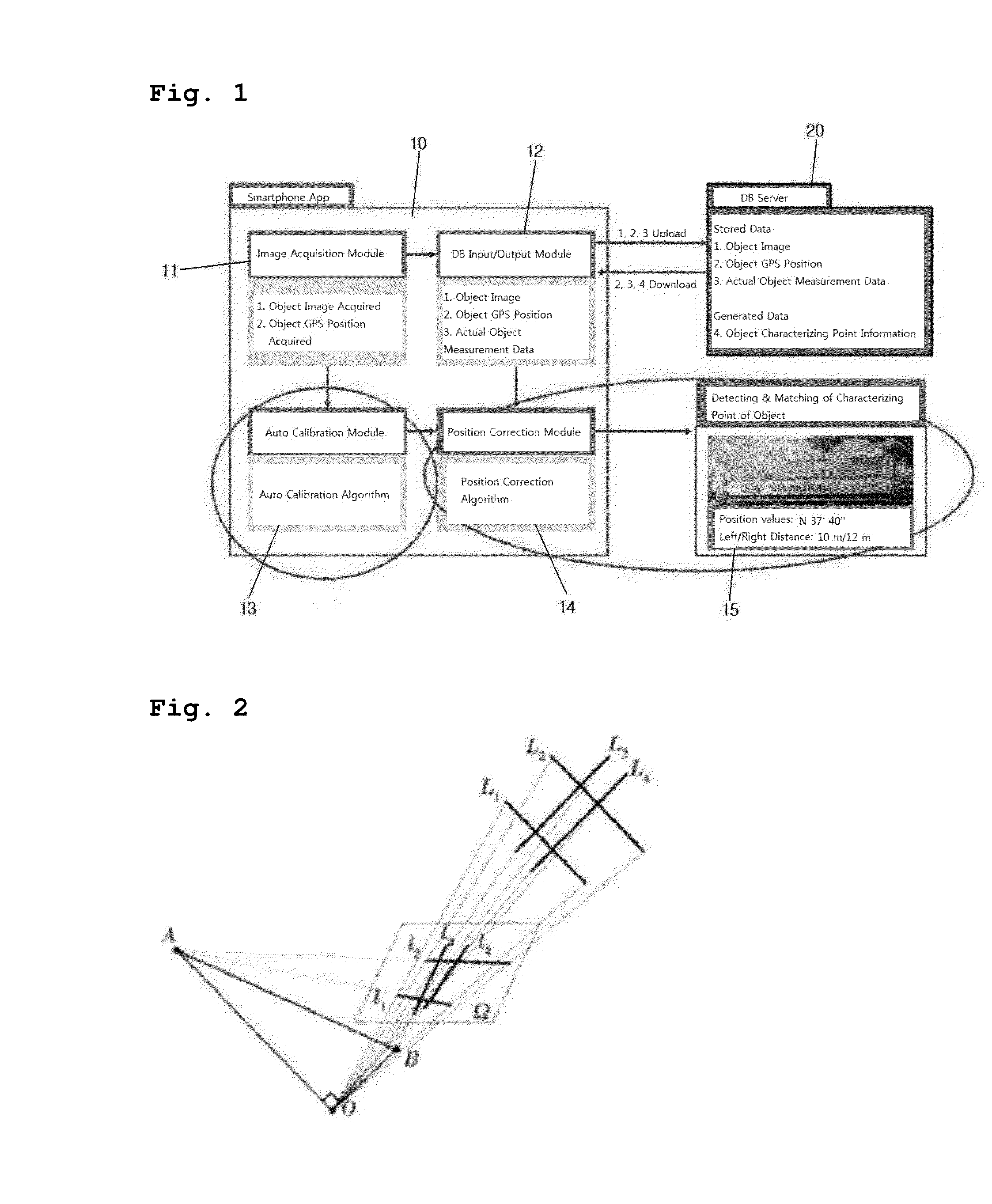
[0036]Referring to FIGS. 1 to 7, a location-based facility management system using a mobile device according to the present invention includes: a database server 20 configured to store object information on a management target facility acquired in advance as a database; an image acquisition module 11 configured to acquire an object image and GPS information; an auto calibration module 12 provided with an auto calibration algorithm which decides an internal parameter for the image; a DB input / output module 13 configured to store the object information in the database server 20 and to receive the object information from the database server 20; a position correction module 14 provided with a position correction algorithm which corrects the GPS information of the object image usi...


PUM


Abstract

A location-based facility management system includes a database server configured to store object information on a management target facility acquired in advance as a database, an image acquisition module configured to acquire an object image and GPS information, an auto calibration module provided with an auto calibration algorithm which decides an internal parameter for the image, a DB input / output module configured to store the object information in the database server and to receive the object information from the database server, a position correction module provided with a position correction algorithm which corrects the GPS information of the object image using the internal parameter decided by the auto calibration module and the object information received from the DB input / output module, and a mobile device provided with a facility management application which detects a characterizing point of an object image acquired by a camera.

Description

FIELD OF THE INVENTION[0001]The present invention relates to a facility management system for informing positions of various kinds of facilities existing on roads or industrial sites. More particularly, the present invention pertains to a location-based facility management system using a mobile device which can manage management target facilities on a real time basis regardless of locations by detecting a characterizing point of an object image obtained by a camera of a mobile device and applying an augmented reality correction technique.BACKGROUND OF THE INVENTION[0002]In recent years, an augmented reality (AR) technique is utilized in many different fields along with the popularization of mobile devices such as a smartphone and the like. The augmented reality technique refers to a technique which overlaps a virtual object with a real world seen in the eyes of a user. The augmented reality technique is also referred to as a mixed reality (MR) technique, because the augmented realit...

Claims


Application Information

Patent Timeline
Patent Type & Authority Applications(United States)
IPC IPC(8): G01B11/14G06T7/00H04N5/44G06F17/30G06T19/00
CPCG01B11/14G06F17/30247G06T7/004G06T19/006H04N5/44G06F17/30876G06T2207/10021G06T2207/30244G06T7/85G06F16/58G06F16/583G06F16/9537G06Q50/10H04W4/02
Inventor LIM, HYUK KYUKIM, YOUNG SEOP
Owner V&I
Learn More