Spatial protocol for peer to peer networking using spatial binary active matrix
a technology of binary active matrix and peer-to-peer networking, applied in data switching networks, digital transmission, electrical equipment, etc., can solve the problems of reducing the resources available, the overhead of bandwidth used for self-managing communication, and the bandwidth used to manage ad hoc networks, so as to minimize bandwidth, the effect of reducing the computation time and minimizing the bandwidth
Inactive Publication Date: 2012-09-27
BUTLER JAMES M
View PDF4 Cites 3 Cited by
- Summary
- Abstract
- Description
- Claims
- Application Information
AI Technical Summary
Benefits of technology
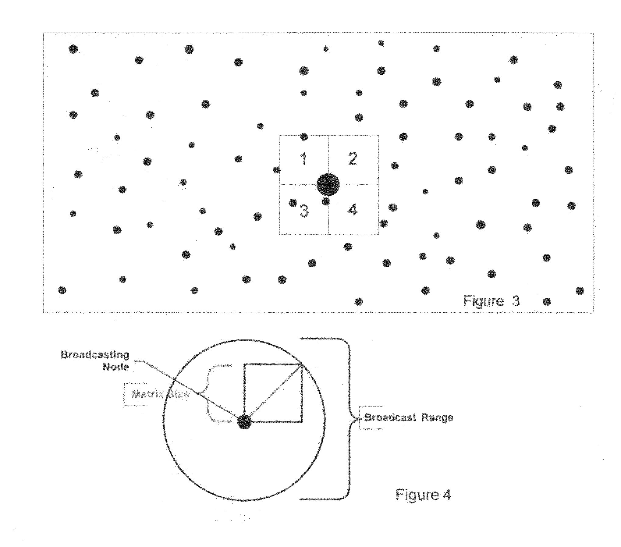
[0017]Since I have not found the 4 directions of passage from the subject node I will increase the size of the matrix to a 4×4. If you visually inspect the matrix you can see that an Easterly passage is possible if a data packet is sent from the subject node to square 10, 14, 15 then 16. Next we can also see that once we arrive at square 16 we can move north 12, 8, 4 to arrive at a North passage. So, with the 4×4 matrix we can transmit in 4 directions to North, South, East and West by following the matrix.
[0023]Any data packet negotiating its destination can finds its way away from the subject node. If we store this matrix on adjacent nodes for incoming packets, we can provide correct mapping going in or out of this node despite some complex spatial negotiating.
[0024]The problem with most spatial systems is minimizing bandwidth, resources and the computation time to calculate and adjust to changing environments, so we will simplify this process. We will use binary data to communicate the position of an available node given the fact that all squares are the same size and all of the Matrices are oriented by North is up as FIG. 6 demonstrates. Squares with nodes are equal to one and squares absent nodes are zeros.
[0032]Lets compare this SBAM table storage data to current methods in terms of node storage in memory, computation time and communication time to copy this table to another node. An ASCII format would require 16 pair of coordinates using GPS format of 9 digits. So, (16*2)*(8 bits)*9=2304 bits of data required to process or communicate the table details, which is 144 times the SBAM method. Conversely, SBAM is 144 times faster and more suitable for sending and receiving routes. SBAM has also predetermined the successful 4 directional passage paths so that processing time in ad hoc environments is minimized. These numbers are a general indication that spatial tables can be communicated faster using fewer resources.Topology Changes
Problems solved by technology
The most challenging tasks for spatial protocols are:1) Navigation to a destination given time and space constraints—packets may get trapped in looping routes, dead ends or changing topology.2) Bandwidth overhead for self-managing communication—this is the bandwidth used to manage ad hoc networks, which are very high due to the complexity of moving peers.
The amount of spatial data that must be stored is extensive which reduces the resources available.
The computations necessary for calculating directional decisions are complex which also occupies resources.
Method used
View moreImage
Smart ImageViewing Examples

Examples
Embodiment Construction
[0046]See summary of the invention
Login to View More PUM
 Abstract
Binary data is used to describe relative location and can be used to determine routing topology in wired or wireless network environments. A standardized matrix is populated based on capacity, bandwidth, and location. This method requires less data and is reduced to binary form for faster process at the Transport layer. Furthermore, the same binary sequence communicates the relative topology and is used to route data in complex and moving environments. Each numeric sequence can also communicate the bandwidth, capacity and node rating.
Description
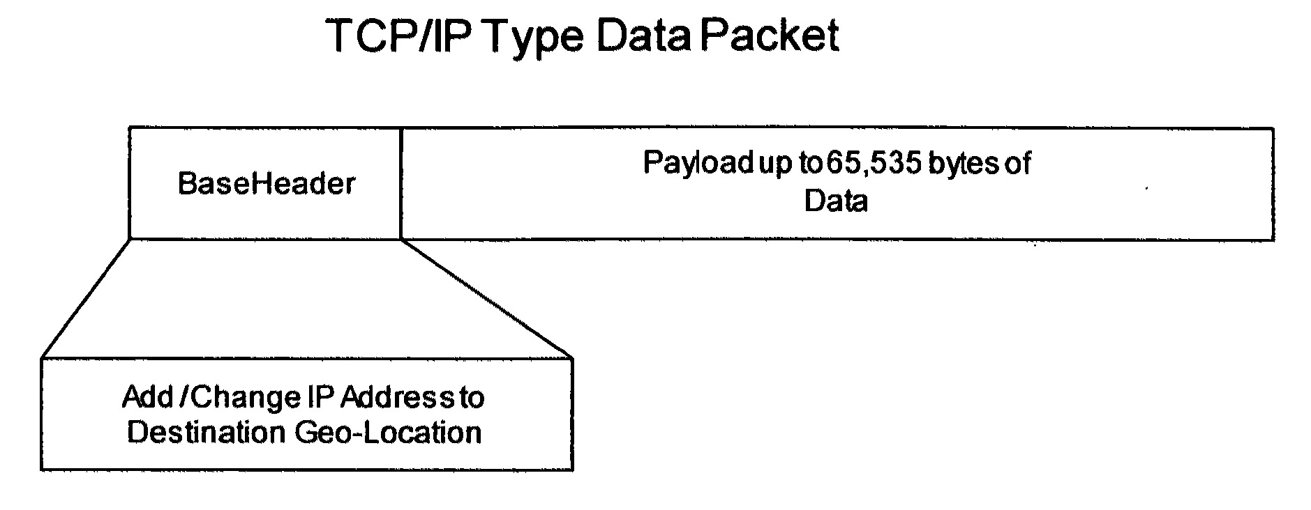
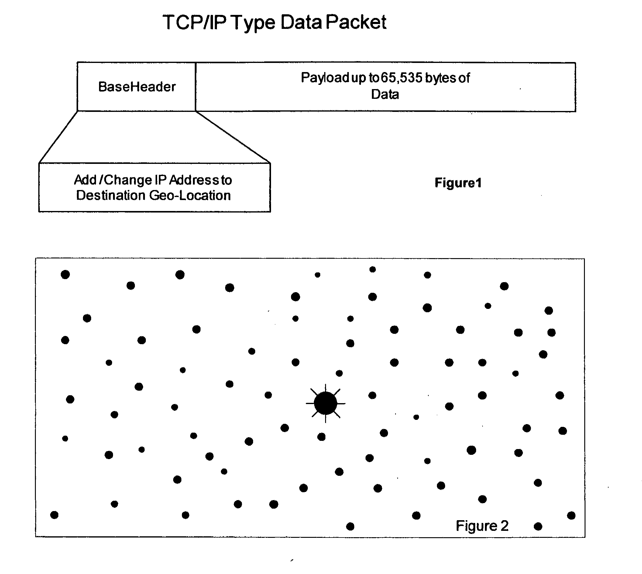
CROSS REFERENCE TO RELATED APPLICATIONS[0001]Not applicableSTATEMENT REGARDING FEDERALLY SPONSORED RESEARCH OR DEVELOPMENT[0002]Not applicableREFERENCE TO SEQUENCE LISTING, A TABLE, OR A COMPUTER PROGRAM LISTING COMPACT DISC APPENDIX[0003]Not applicableBACKGROUND OF THE INVENTION[0004]Geographic or position based fixed and mobile protocols have been toyed with much in academia for about a decade between the mid 1990's to mid 2000's. They are broken down into 3 categories greedy forwarding, restricted directional flooding, and hierarchical methods. Furthermore, the above groups can be broken down into proactive, reactive and hybrid systems.[0005]We use the term ‘spatial’ instead of ‘geographic’ since actual longitude at latitude coordinates, or earth related data, is not necessary to route spatial traffic. Any spatial system can be used to route data given a logic coordinate system. Absent a coordinate system, a triangulation algorithm will suffice to derive distance and direction. G...
Claims
Login to View More Application Information
Patent Timeline
 Patent Type & Authority Applications(United States)
IPC IPC(8): H04L12/28
CPCH04L45/125H04W40/30H04L45/02H04L45/126H04L45/124
Inventor BUTLER, JAMES M.
Owner BUTLER JAMES M
Features
- R&D
- Intellectual Property
- Life Sciences
- Materials
- Tech Scout
- Unparalleled Data Quality
- Higher Quality Content
- 60% Fewer Hallucinations
Learn More Browse by: Latest US Patents, China's latest patents, Technical Efficacy Thesaurus, Application Domain, Technology Topic, Popular Technical Reports.
© 2025 PatSnap. All rights reserved.Legal|Privacy policy|Modern Slavery Act Transparency Statement|Sitemap|About US| Contact US: help@patsnap.com