
Method for providing reliability of reckoning location and mobile terminal therefor

a mobile terminal and reckoning location technology, applied in the direction of road vehicle traffic control, measurement devices, instruments, etc., can solve the problems of deteriorating efficiency of gps and achieve the effect of increasing utility and increasing efficiency of gps satellite based positioning navigation technology

Inactive Publication Date: 2012-07-12
SAMSUNG ELECTRONICS CO LTD
View PDF2 Cites 18 Cited by
  • Summary
  • Abstract
  • Description
  • Claims
  • Application Information

AI Technical Summary

Benefits of technology

[0015]In accordance with an exemplary aspect of the present invention, a method of providing reliability of a reckoning location further includes: calculating speed using GPS satellite information inputted from the GPS receiving unit, wherein the second and third threshold values are set differently according to the calculated speed. Calculating a moving distance preferably calculates the moving distance with the reckoning location using map information stored in the storage unit or altitude information inputted from the sensor unit.
[0018]Controlling a satellite signal intensity of GPS satellite information includes: reducing the satellite signal intensity of the GPS satellite information stored in a storage unit when the displacement is greater than the fourth threshold value; and increasing the satellite signal intensity when the displacement is less than the fourth threshold value to update the increase satellite signal intensity in the storage unit. The fourth threshold value is set differently according to speed information input from the sensor unit.
[0019]In accordance with an exemplary aspect of the present invention, a method of providing reliability of a reckoning location further includes: calculating speed using GPS satellite information input from the GPS receiving unit, wherein the fourth threshold value is set differently according to the calculated speed.
[0023]As illustrated above, a method and a mobile terminal implementing the same according to exemplary aspects of the present invention provides reliability for reckoning location information to increase efficiency of GPS satellite based positioning navigation technology. In addition, the present invention may increase utility of all types of application programs requiring location information.

Problems solved by technology

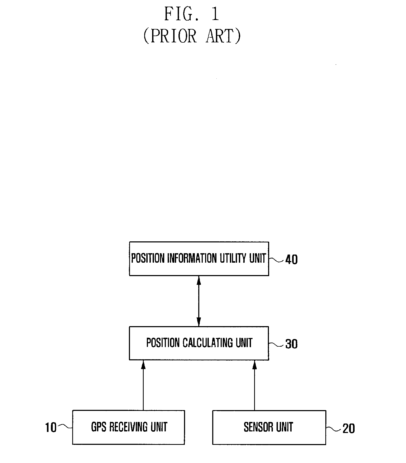
That is, such application programs determine that location information, i.e., estimation location information, provided without the GPS satellite information is unreliable, and therefore does not to use the location information deemed to be unreliable.
This rejection of certain location information due to unreliability deteriorates efficiency in a GPS based positioning navigation technology.

Method used


Image

  • Method for providing reliability of reckoning location and mobile terminal therefor
  • Method for providing reliability of reckoning location and mobile terminal therefor
  • Method for providing reliability of reckoning location and mobile terminal therefor

Examples


Embodiment Construction

[0029]Exemplary embodiments of the present invention are described with reference to the accompanying drawings in detail. The same reference numbers are used throughout the drawings to refer to the same or like parts. For the purposes of clarity and simplicity, detailed descriptions of well-known functions and structures incorporated herein may be omitted to avoid obscuring appreciation of the subject matter of the present invention by a person of ordinary skill in the art.

[0030]Hereinafter, a method providing reliability of a reckoning location and a mobile terminal implementing the same according to an exemplary embodiment of the present invention will be described in detail with reference to the accompanying drawings.

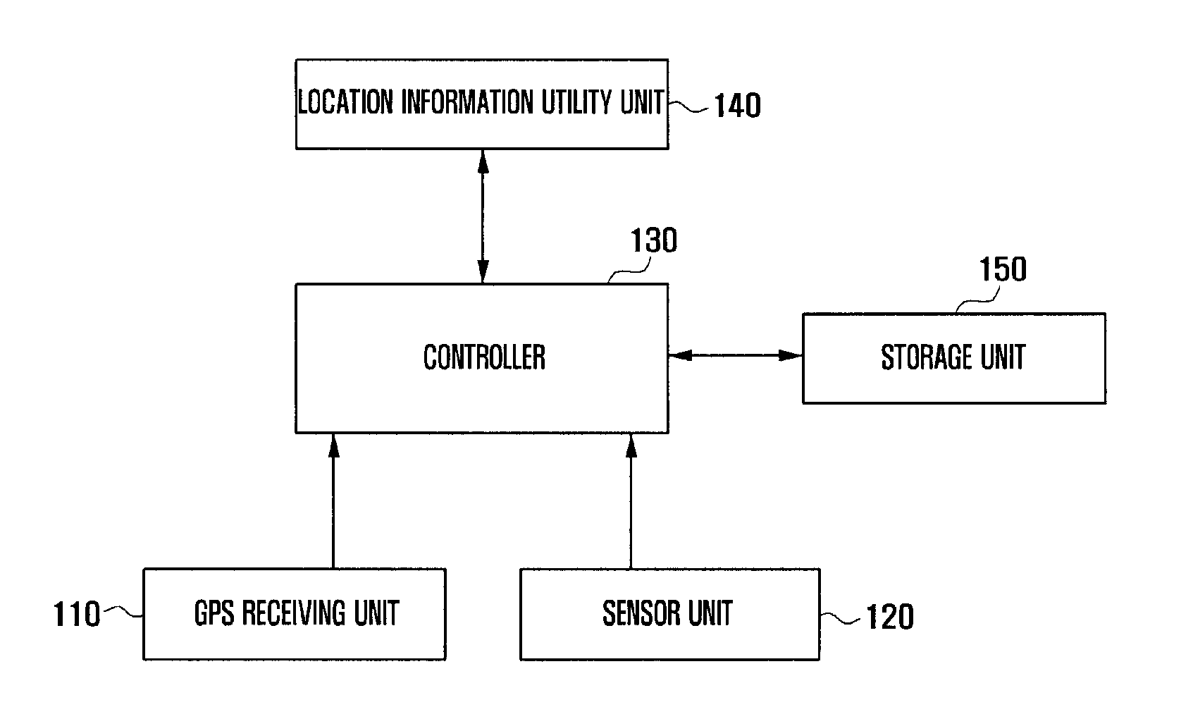
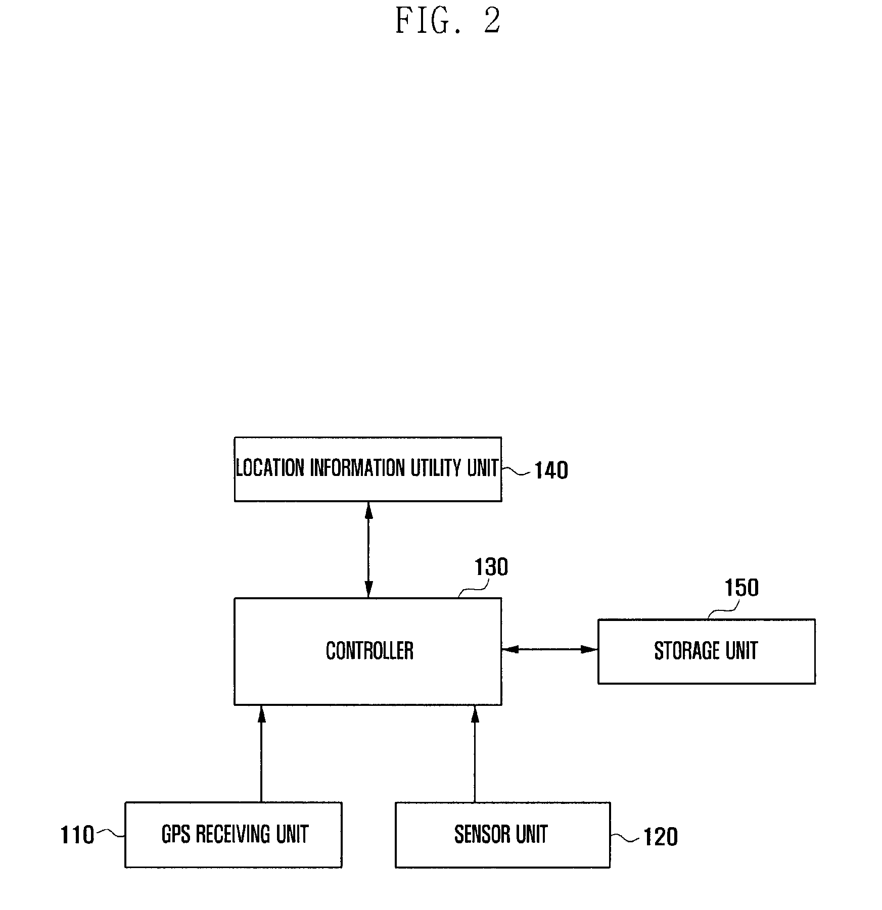
[0031]FIG. 2 and FIG. 3 are block diagrams illustrating a configuration of a mobile terminal according to an embodiment of the present invention.

[0032]Referring now to FIG. 2, a mobile terminal of the present invention preferably includes a GPS receiving unit 110, a ...


PUM


Abstract

Disclosed are method and apparatus for evaluating reliability of reckoning location information and providing reliability information. A mobile terminal implementing the method provides a user with a handheld device to provide accurate location information. The method for providing reliability of a reckoning location preferably includes: reckoning a location using speed and direction information input from a sensor unit when satellite signal intensity of GPS satellite information is less than a first threshold value; calculating a moving distance using the reckoning location for a reckoned time of the location; evaluating the reliability of the reckoning location according to the moving distance; and providing the reckoning location and the reliability to a location information utility unit such that the location information utility unit determines presence of utility of the reckoning location according to the reliability.

Description

CLAIM OF PRIORITY[0001]This application claims the benefit of priority under 35 U.S.C. §119 from Korean Patent Application No. 10-2011-0002182 filed Jan. 10, 2011, the contents of which are incorporated by reference in its entirety.BACKGROUND OF THE INVENTION[0002]1. Field of the Invention[0003]The present invention relates to systems that provide positioning and navigation, including the Positioning, Navigation, Car / Vehicle Navigation System (CNS) & Dead Reckoning ((DR); positioning navigation technology using inertial sensor)), Pedestrian Navigation System (PNS) & Pedestrian Dead Reckoning(PDR), Geo-Tagging, and Location Based Service (LBS). More particularly, the present invention relates to a method of evaluating reliability with respect to location information reckoned in a positioning shade zone to provide reliability information of reckoning location information, and an apparatus for implementing the same.[0004]2. Description of the Related Art[0005]Typical Global Positioning...

Claims


Application Information

Patent Timeline
IPC IPC(8): G01S19/45
CPCG01S19/48G01S19/40G01S19/49G01S19/01G08G1/0969G01C21/26
Inventor SHIN, GYE JOONG
Owner SAMSUNG ELECTRONICS CO LTD
Learn More