
System for collecting and managing rainfall attenuation and rainfall intensity on satellite communications system

a satellite communication system and rainfall intensity technology, applied in meteorology, instruments, measurement devices, etc., can solve the problems of inability to obtain accurate time information, inability to accurately match rainfall intensity data and rainfall attenuation data according to regions, and inability to accurately measure rainfall attenuation and rainfall intensity

Inactive Publication Date: 2012-06-07
ELECTRONICS & TELECOMM RES INST
View PDF0 Cites 14 Cited by
  • Summary
  • Abstract
  • Description
  • Claims
  • Application Information

AI Technical Summary

Benefits of technology

[0011]An aspect of the present invention provides a system that may measure rainfall attenuation and rainfall intensity using a single apparatus, and transmit the measured rainfall attenuation and rainfall intensity to a data managing apparatus over an Ethernet communication network, thereby enabling rainfall attenuation data and rainfall intensity data to be automatically transmitted in real time and be managed.
[0012]Another aspect of the present invention also provides a system that may measure rainfall intensity in a plurality of regions based on a valid path length of rainfall attenuation and thereby collect and manage accurate rainfall attenuation data and rainfall intensity data.
[0013]Another aspect of the present invention also provides a system that may extract time information from a Global Positioning System (GPS) signal and may assign the time information to rainfall attenuation data and rainfall intensity data and thereby accurately match rainfall attenuation data and rainfall intensity data that are generated at the same time.

Problems solved by technology

However, the rainfall attenuation and the rainfall intensity has been measured without using a valid path length of rainfall attenuation and thus, it was difficult to accurately measure the rainfall attenuation and the rainfall intensity depending on regions.
However, when a time error occurs in the general purpose computer, or when the general purpose computer malfunctions, accurate time information may not be obtained.
Accordingly, due to inaccurate generation time information associated with the rainfall attenuation data and the rainfall intensity data, the rainfall attenuation data and the rainfall intensity data may not be accurately matched.

Method used


Image

  • System for collecting and managing rainfall attenuation and rainfall intensity on satellite communications system
  • System for collecting and managing rainfall attenuation and rainfall intensity on satellite communications system
  • System for collecting and managing rainfall attenuation and rainfall intensity on satellite communications system

Examples


Embodiment Construction

[0020]Reference will now be made in detail to exemplary embodiments of the present invention, examples of which are illustrated in the accompanying drawings, wherein like reference numerals refer to the like elements throughout. Exemplary embodiments are described below to explain the present invention by referring to the figures.

[0021]When it is determined detailed description related to a related known function or configuration they may make the purpose of the present invention unnecessarily ambiguous in describing the present invention, the detailed description will be omitted here. Also, terminologies used herein are defined to appropriately describe the exemplary embodiments of the present invention and thus may be changed depending on a user, the intent of an operator, or a custom. Accordingly, the terminologies must be defined based on the following overall description of this specification.

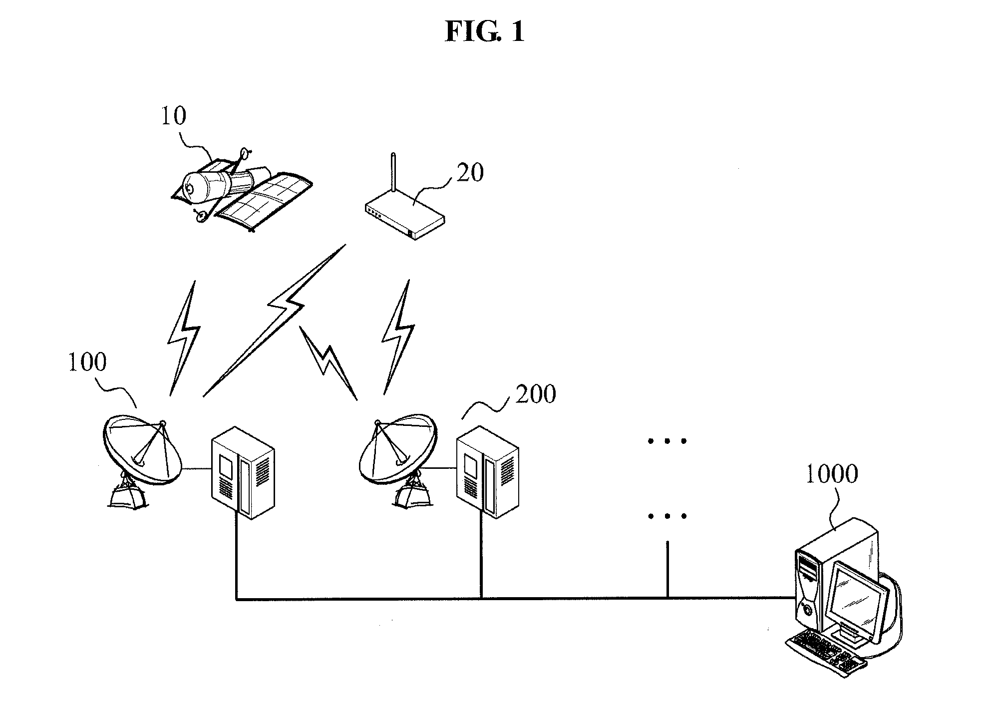
[0022]FIG. 1 is a diagram illustrating a system for collecting and managing rainfall a...


PUM


Abstract

Provided is a system for collecting and managing rainfall attenuation data and rainfall intensity data in a satellite communication system. The system may include: a satellite transmitter to transmit a satellite beacon signal; a Global Positioning System (GPS) to transmit a GPS signal; at least one data collecting apparatus to generate rainfall attenuation data about the satellite beacon signal when the satellite beacon signal is received from the satellite transmitter, and to generate rainfall intensity data within a valid path length of rainfall attenuation, to extract time information from the GPS signal, and to assign the time information to the rainfall attenuation data and the rainfall intensity data; and a data managing apparatus to receive, from the at least one data collecting apparatus, the rainfall attenuation data and the rainfall intensity data assigned with the time information, and to manage the received rainfall attenuation data and rainfall intensity data.

Description

CROSS-REFERENCE TO RELATED APPLICATION[0001]This application claims the priority benefit of Korean Patent Application No. 10-2010-0121313, filed on Dec. 1, 2010, in the Korean Intellectual Property Office, the disclosure of which is incorporated herein by reference.BACKGROUND[0002]1. Field of the Invention[0003]Embodiments of the present invention relate to a system for collecting and managing rain attenuation data and rainfall intensity data in a satellite communication system.[0004]2. Description of the Related Art[0005]A satellite beacon signal used in a satellite communication system may be transmitted from a satellite transmitter that is positioned at the attitude of about 36,000 km.[0006]The satellite beacon signal may be scattered and be attenuated due to raindrop, snow, and the like. An attenuation level of the satellite beacon signal occurring due to the raindrop is referred to as rainfall attenuation.[0007]In general, an attenuation amount of the satellite beacon signal ma...

Claims


Application Information

Patent Timeline
Patent Type & Authority Applications(United States)
IPC IPC(8): G01S19/26
CPCG01W1/14G01S19/14
Inventor CHOI, KYUNG SOOKIM, JAE HOONAHN, DO SEOB
Owner ELECTRONICS & TELECOMM RES INST
Learn More