
Systems and methods for modeling floods

a flood system and flood technology, applied in the field of systems and methods for modeling floods, can solve the problems of limiting the effectiveness and usefulness of flood maps, difficulty in predicting flooding, and current techniques for estimating the amount of water that overflows the banks of streams or rivers are much less accura

Active Publication Date: 2012-03-01
BARON SERVICES
View PDF6 Cites 11 Cited by
  • Summary
  • Abstract
  • Description
  • Claims
  • Application Information

AI Technical Summary

Problems solved by technology

However, accurately predicting which geographic areas will flood and the severity of floods can be difficult and problematic potentially limiting the effectiveness and usefulness of inundation maps.
The difficulty of predicting flooding is pronounced when a flowing body of water, such as a stream or river, is a source of flooding.
However, current techniques for estimating the amount of water that overflows the banks of a stream or river are much less accurate.
Estimating and modeling the flow of water out of and around a stream or river can be very difficult and fraught with errors.
Further, any estimation errors in water accumulation in one part of a stream or river have an effect on the estimates downstream such that errors may accumulate downstream in any model used to generate an inundation map.
Thus, it can be extremely difficult to generate a reliable inundation map when the flooded area is affected by the presence of water from a stream or river, yet streams and rivers typically contribute significantly to many devastating or dangerous floods for which accurate inundation maps are highly desired.
Accordingly, a heretofore unaddressed need exists in the art for systems and methods for accurately predicting floods or estimating floods in real-time, particularly in areas that are affected by flowing bodies of water, such as streams or rivers.

Method used


Image

  • Systems and methods for modeling floods
  • Systems and methods for modeling floods
  • Systems and methods for modeling floods

Examples


Embodiment Construction

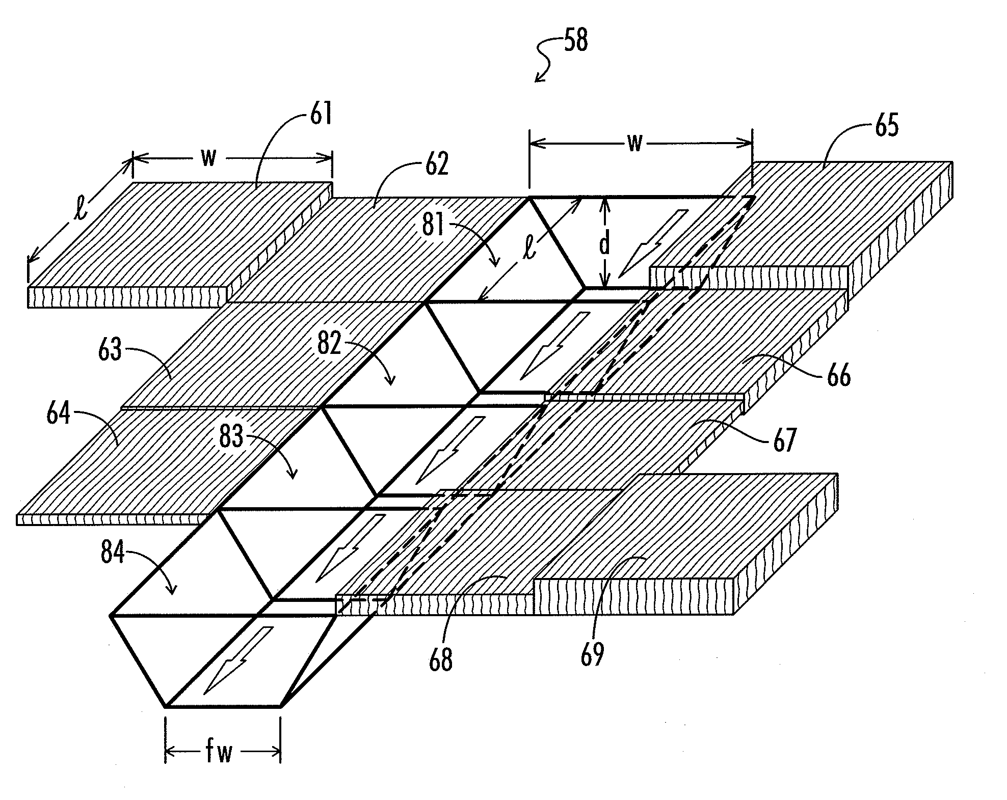
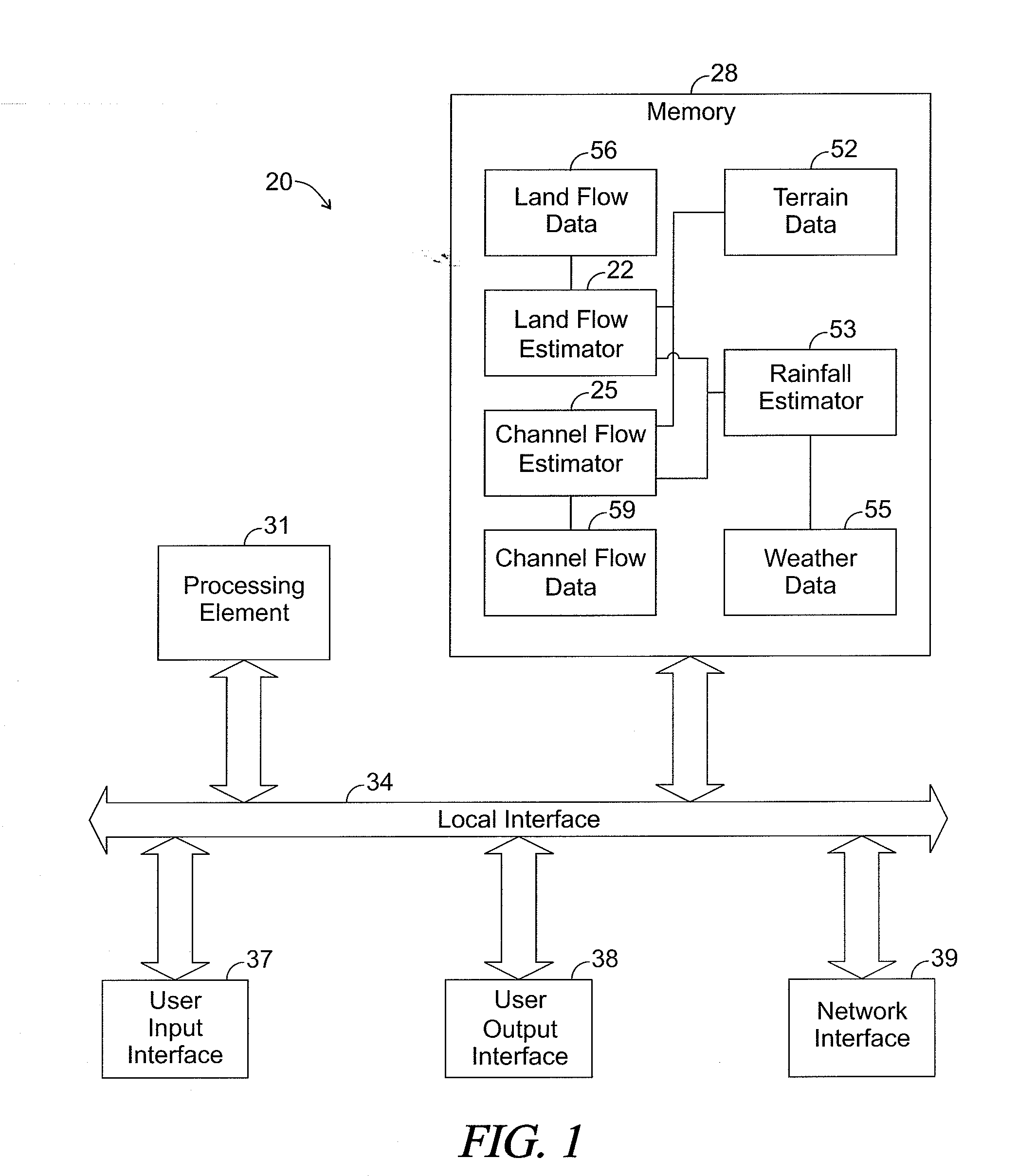
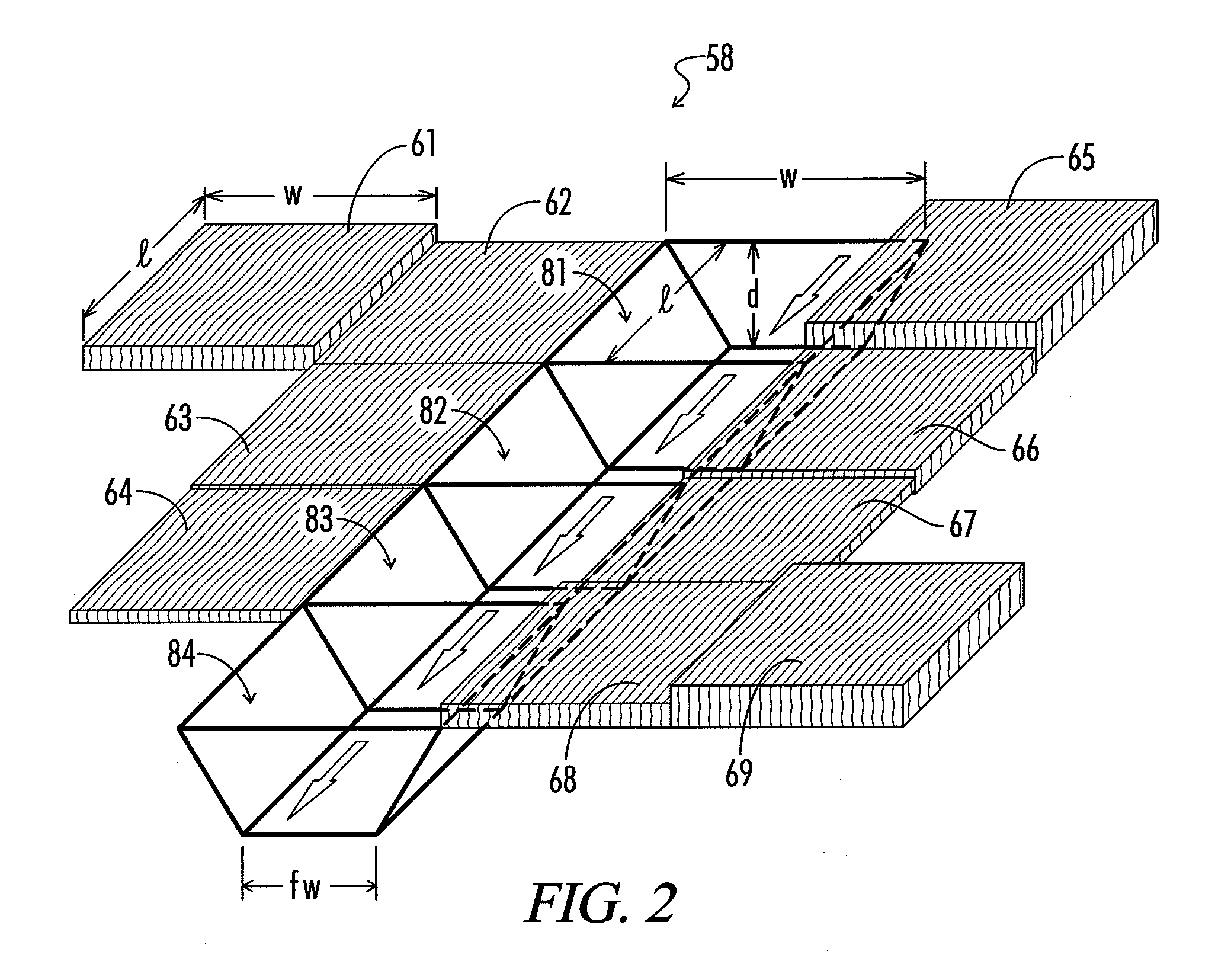
[0025]The present disclosure generally pertains to systems and methods for modeling floods. A flood modeling system in accordance with one exemplary embodiment of the present disclosure defines cells, which virtually represents different areas of a geographic region. Some of the cells, referred to as “channel cells,” represent areas within a channel for a moving body of water, such as a stream or river. Other cells, referred to as “land cells,” represent areas external to the channels within the geographic region. The flow of water through the geographic region is modeled as a virtual flow of water through the channel cells and the land cells. The virtual flow of water through the channel cells is modeled via one algorithm, referred to as a “channel flow algorithm,” and the virtual flow of water through the land cells is modeled via another algorithm, referred to as a “land flow algorithm.”

[0026]The virtual flow of water over time is estimated in a series of time steps in which each...


PUM


Abstract

A flood modeling system defines virtual cells of a geographic region. Some of the cells, referred to as “channel cells,” represent areas within a channel for a moving body of water, such as a stream or river. Other cells, referred to as “land cells,” represent areas external to the channels within the geographic region. The flow of water through the geographic region is modeled as a virtual flow of water through the channel cells and the land cells. The virtual flow of water through the channel cells is modeled via a channel flow algorithm, and the virtual flow of water through the land cells is modeled via a land flow algorithm. For each time step, the system calculates the amount of water that virtually flows out of one cell into adjacent cells. Thus, for any given time step, each cell has an estimated amount of water virtually contained within the cell. The water estimated to virtually flow above ground represents flood water and can be quantified for each cell. Thus, data indicative of the amount of water estimated to be above ground for the land cells can be used to generate an inundation map or for other purposes, such as initiating flood warnings for areas that are modeled to experience a significant amount of flooding.

Description

CROSS REFERENCE TO RELATED APPLICATION[0001]This application claims priority to U.S. Provisional Application No. 61 / 357,723, entitled “Systems and Methods for Modeling Floods” and filed on Jun. 23, 2010, which is incorporated herein by reference.RELATED ART[0002]An inundation map is a geographical map indicating areas flooded or likely to be flooded due to receiving an inundation of water, such as from rain, a dam bursting, a tsunami, a storm surge, or the like. Such maps are useful for providing flood warnings and helping individuals to plan for or avoid the effects of a flooding event. However, accurately predicting which geographic areas will flood and the severity of floods can be difficult and problematic potentially limiting the effectiveness and usefulness of inundation maps.[0003]The difficulty of predicting flooding is pronounced when a flowing body of water, such as a stream or river, is a source of flooding. In this regard, models for estimating or predicting rainfall hav...

Claims


Application Information

Patent Timeline
IPC IPC(8): G06G7/57
CPCG06F2217/16G06F17/5009G06F30/20G06F2111/10Y02A10/40
Inventor MCHENRY, JOHN N.COATS, CARLIE J.
Owner BARON SERVICES
Learn More