Seismic measuring system including GPS receivers

a technology of seismic measurement and receiver, applied in the field of seismic data collection system, to achieve the effect of enhancing acquisition and tracking performan

Active Publication Date: 2005-02-10
NOVATEL INC
View PDF19 Cites 26 Cited by
  • Summary
  • Abstract
  • Description
  • Claims
  • Application Information

AI Technical Summary

Benefits of technology

[0008] To determine the precise positions of a given DU, the associated slave GPS receiver uses the tracking assistance information to acquire and track GPS satellite signals from those satellites that are in the receiver's view. The slave GPS receiver then produces associated range information and provides the information to the data recording and control center. The data recording and control center collects the range information over an extended period of time, such as hours or days, as necessary. The center then batch processes the information, to produce a single computed position. By processing the information collected over an extended period of time, the system can determine the position of the slave GPS receiver to within the tight vertical and horizontal tolerances required for seismic measurements, as long as the slave GPS receiver is able to observe and collect data from at least two satellites simultaneously for 3 or 4 relatively short time intervals at various sky positions during the extended period. The batch processing thus eliminates the need to continuously track the GPS satellite signals and / or to track the signals from the same set of satellites over the respective intervals.

Problems solved by technology

Further, the system produces the precise positioning information and the synchronized timing signals in an environment in which GPS receivers operating in a conventional manner typically can not do so, because of, for example, foliage cover that interferes with the receipt of the GPS satellite signals at the respective GPS receivers.

Method used


Image

  • Seismic measuring system including GPS receivers
  • Seismic measuring system including GPS receivers
  • Seismic measuring system including GPS receivers

Examples


Embodiment Construction

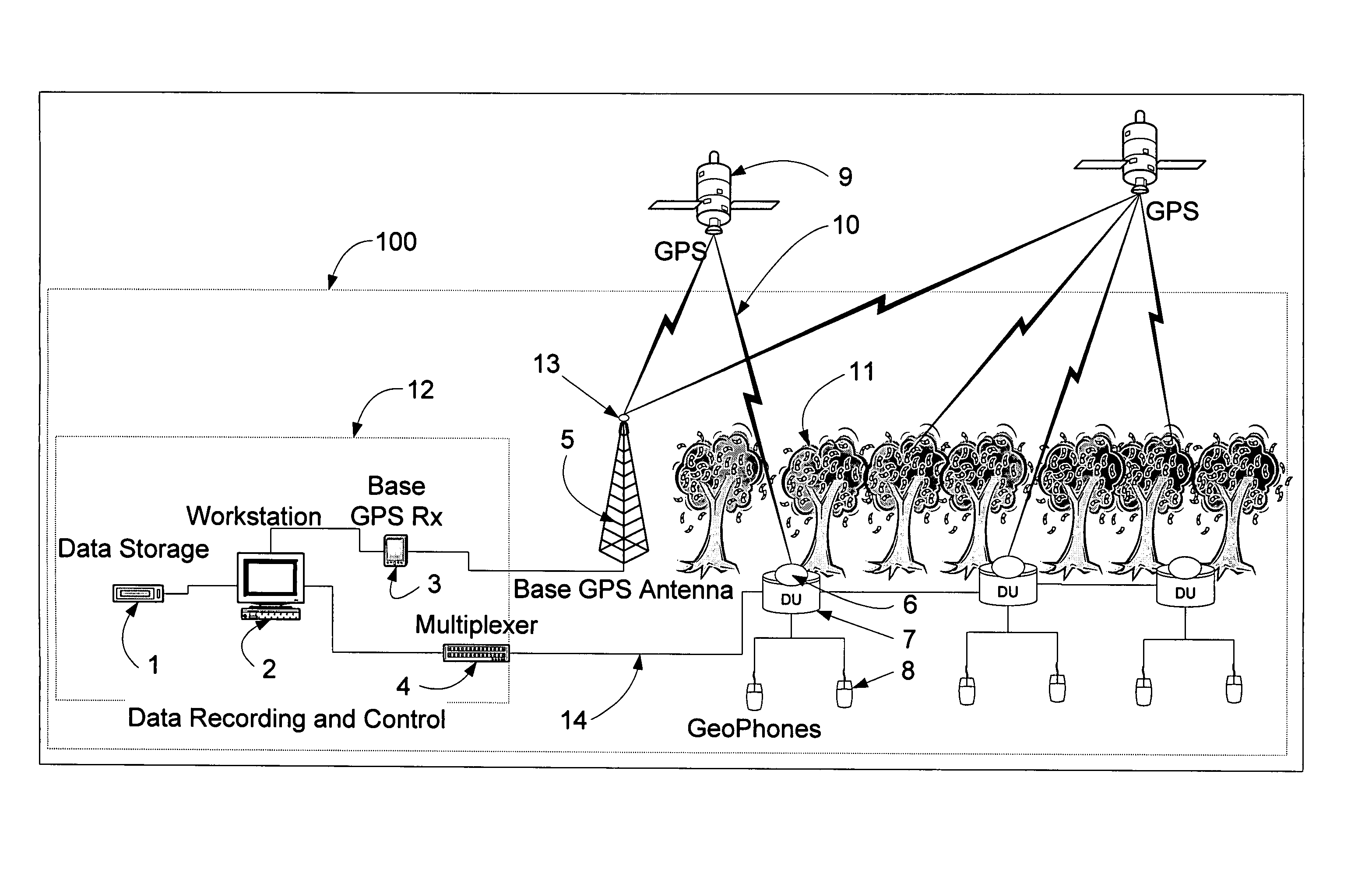
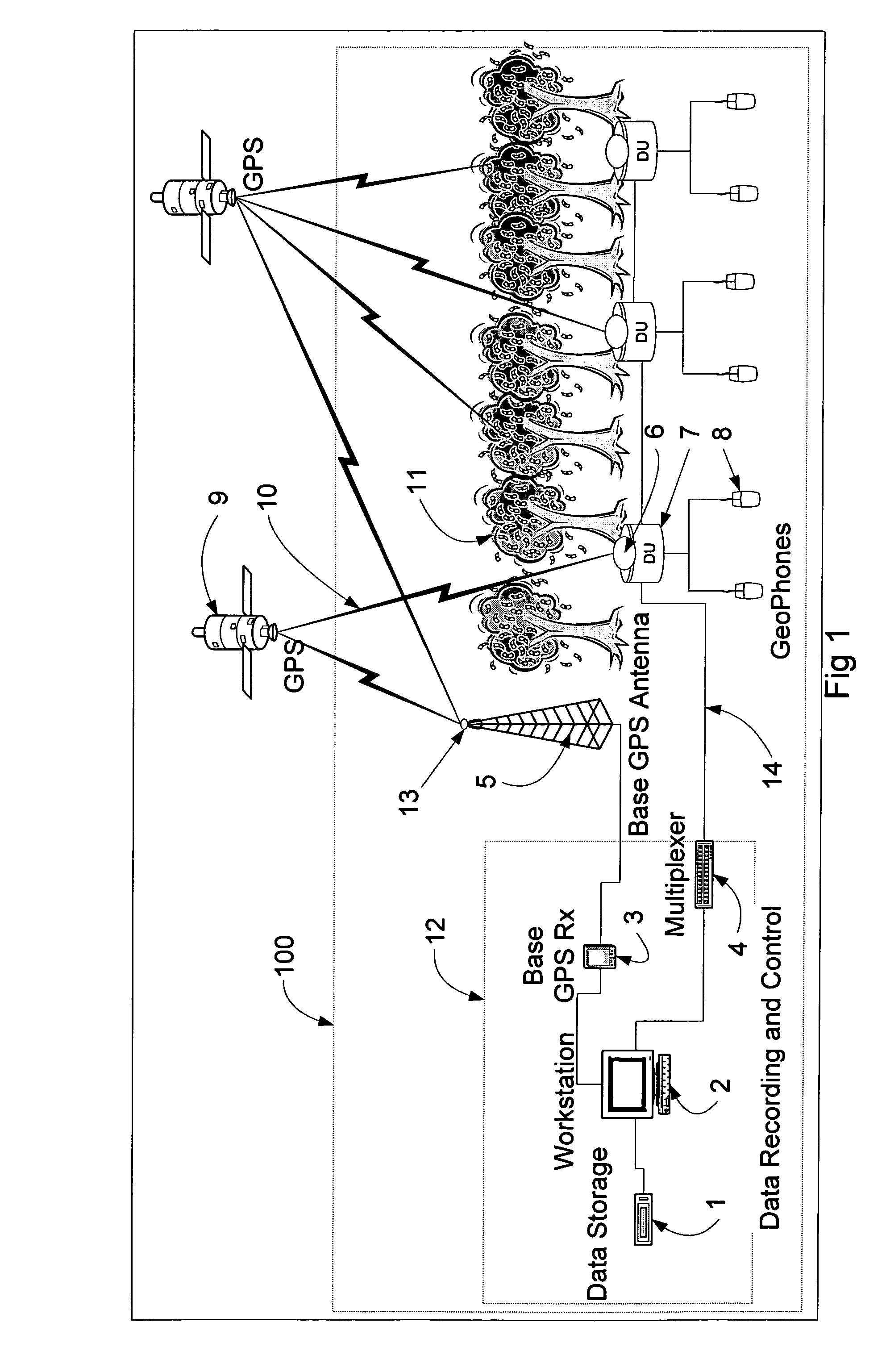
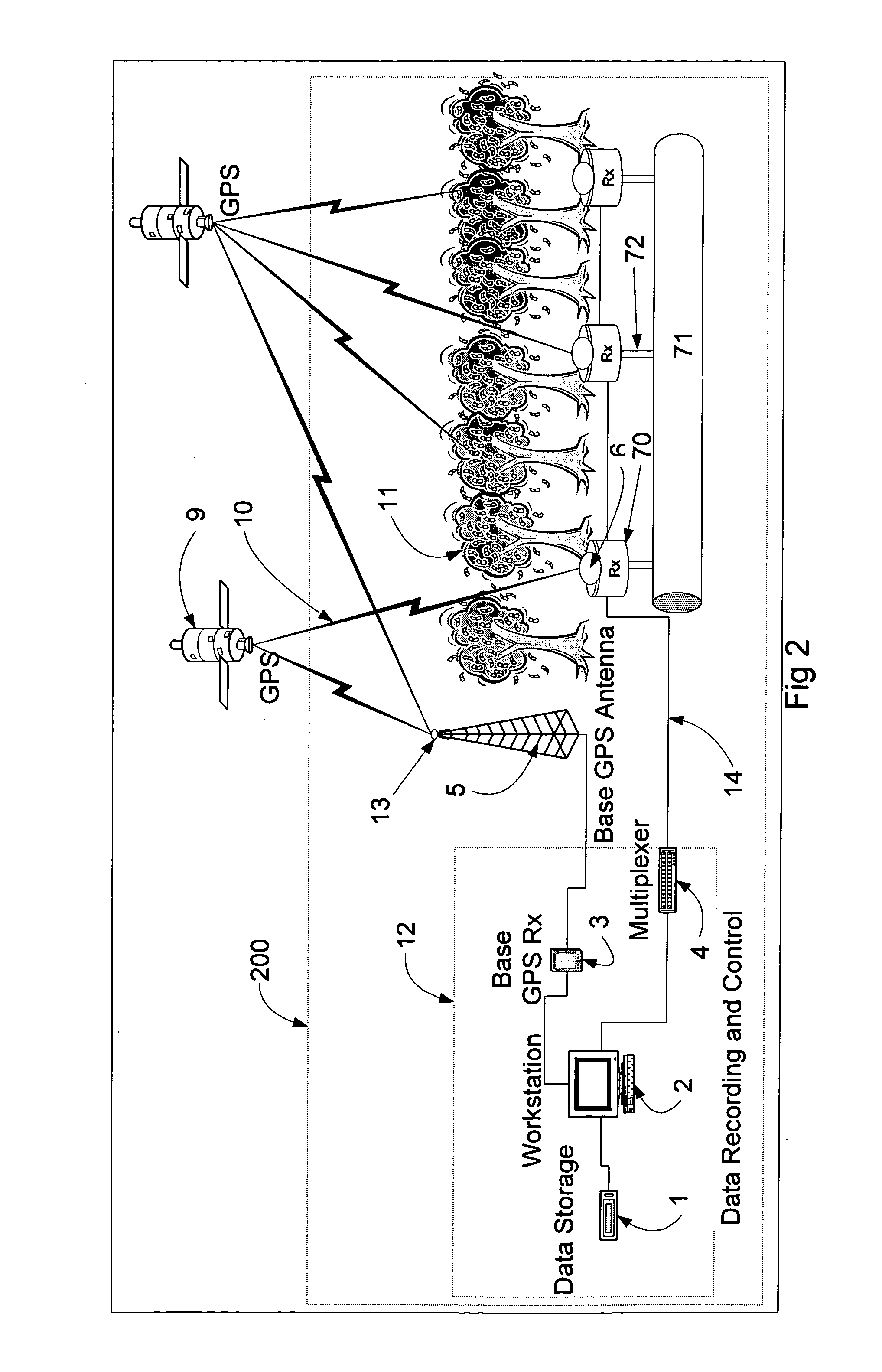
[0014] Referring to the FIG. 1, a system 100 for collecting and analyzing seismic measurements is depicted. The system 100 includes a plurality of geophones 8 that supply seismic data to a data recording and control center 12 through DUs 7. The DUs are located in selected locations over a site of interest and are connected to the center by cables 14. The center 12 includes one or more workstations 2 and data storage devices 1 that process and store the data collected by the geophones. The signals from various cables 14 (only one of which is shown in the drawing) are supplied to the one or more workstations 2 through a multiplexer 4, which operates in a conventional manner. The system generally includes thousands of DUs, each with an associated configuration of geophones.

[0015] The data recording and control center 12 further includes a base Global Positioning System (GPS) receiver 3 that receives signals from various GPS satellites 9 using a base GPS antenna 13, which is positioned...


PUM


Abstract

A system for analyzing three-dimensional seismic data includes a plurality of digitizer units, each with a configuration of geophones, a data recording and control center, a base GPS receiver with an associated antenna with a substantially unrestricted view of the sky and at the respective digitizer units low-power slave GPS receivers that acquire and track GPS satellite signals using tracking assistance information provided by the base GPS receiver. The slave GPS receivers use the tracking assistance information to acquire and track GPS satellite signals that may be relatively weak at the receivers, due to conditions at the site, such as foliage canopies and so forth. The system processes range information provided by the slave GPS receivers over an extended period of time. In this way, the precise positions of the respective slave GPS receivers, and thus, the digitizer units, can be calculated, even if the slave GPS receivers are able to observe and collect data from sets of two or more satellites for only three or four relatively short time intervals at various sky positions during the extended period. The slave GPS receivers then locally produce for the digitizer units timing signals that are based on the GPS codes and synchronized across the system. If a given slave GPS receiver cannot, at a given time, track any GPS satellite signals, a nearby slave GPS receiver supplies the timing information required for the geophone data gathering operations.

Description

CROSS-REFERENCE TO RELATED APPLICATIONS [0001] The present application claims the benefit of U.S. Provisional Patent Application Ser. No. 60 / 488,124, which was filed on Jul. 17, 2003, by Patrick C. Fenton for A SEISMIC MEASURING SYSTEM INCLUDING GPS RECEIVERS and is hereby incorporated by reference.FIELD OF THE INVENTION [0002] The invention relates generally to seismic data collection systems and, in particular, to systems for collecting and analyzing three-dimensional seismic data. BACKGROUND OF THE INVENTION [0003] Systems for analyzing three-dimensional seismic data collect seismic measurements from configurations of geophones that are attached to and communicate with digitizer units (DUs), which that produce signals that correspond to the seismic measurements. The DUs, which are placed at selected locations along cables that span a site of interest, take readings from the configurations of geophones and send corresponding signals over the cables to a data recording and control ...

Claims


Application Information

Patent Timeline
Patent Type & Authority Applications(United States)
IPC IPC(8): G01S5/14G01S19/05G01S19/11G01S19/19G01S19/44G01S19/46G01V1/00G01V1/26
CPCG01S19/05G01S19/44G01V1/003G01V3/28G01V1/22G01V1/26G01V1/16
Inventor FENTON, PATRICK C.
Owner NOVATEL INC
Why Eureka
Try Eureka