
Method for creating a digital map for an automated vehicle

a technology for creating a digital map and a vehicle, applied in the direction of vehicle position/course/altitude control, process and machine control, instruments, etc., can solve the problem of poor localization quality, and achieve the effect of slam process and digital map creation

Active Publication Date: 2021-11-02
ROBERT BOSCH GMBH
View PDF18 Cites 4 Cited by
  • Summary
  • Abstract
  • Description
  • Claims
  • Application Information

AI Technical Summary

Benefits of technology

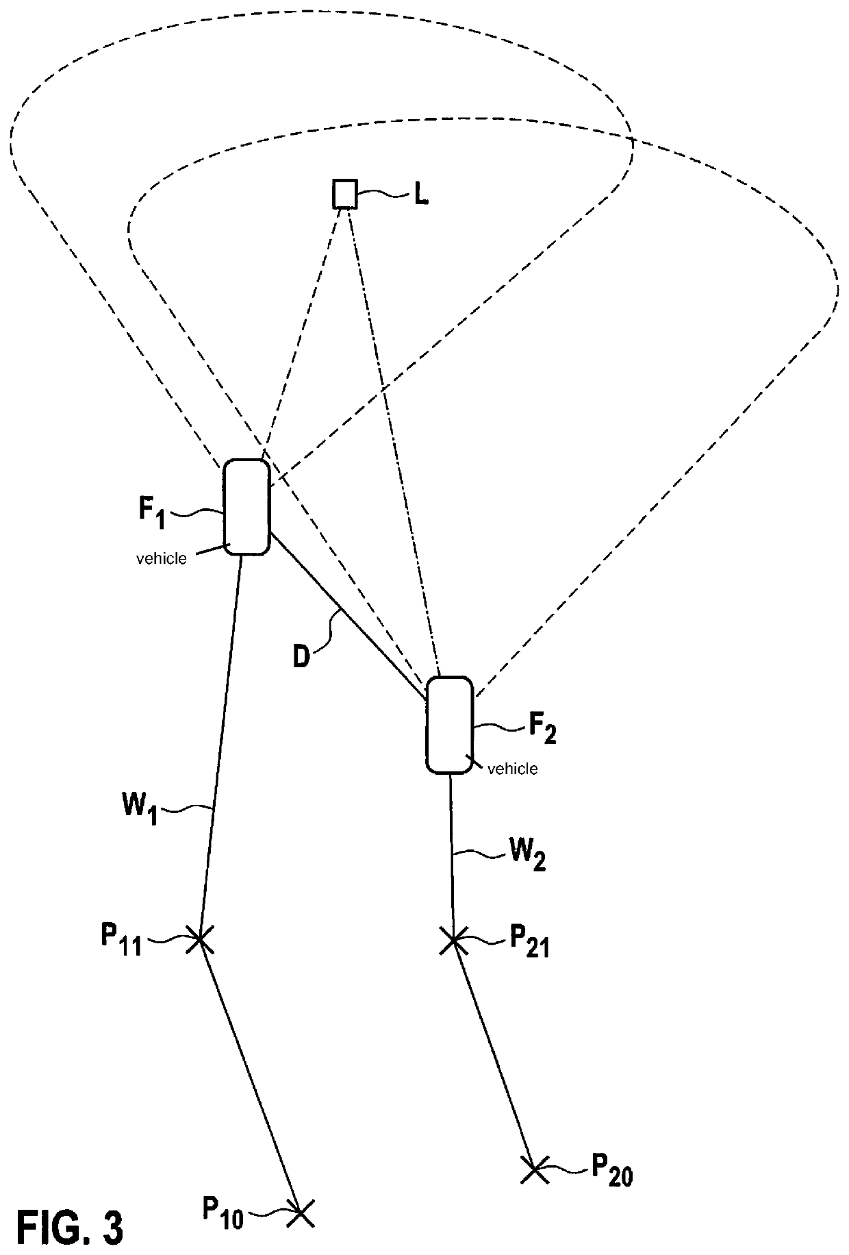
The patent text describes a method for improving digital maps by using data from other vehicles. This data is transferred into a graph, which helps in optimizing the map. The method does not require any localization data and can be used for interior localization maps. The GPS data of the vehicles can also be detected and transmitted to the creation unit to further improve the digital map. The data can be buffered and transmitted in real-time or with a time delay. This method has the advantage of providing more data to the creation unit, resulting in an improved optimization of the map.

Problems solved by technology

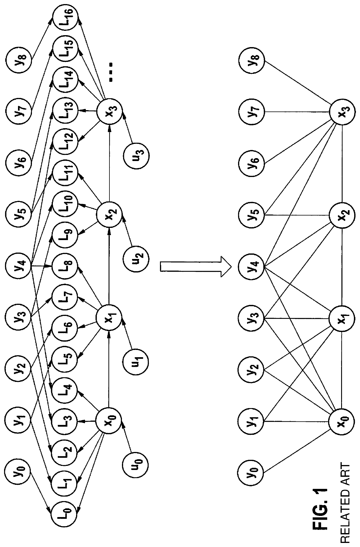
One disadvantage of the described methods is shown in FIG. 1, which illustrates a principle of SLAM without local reference.
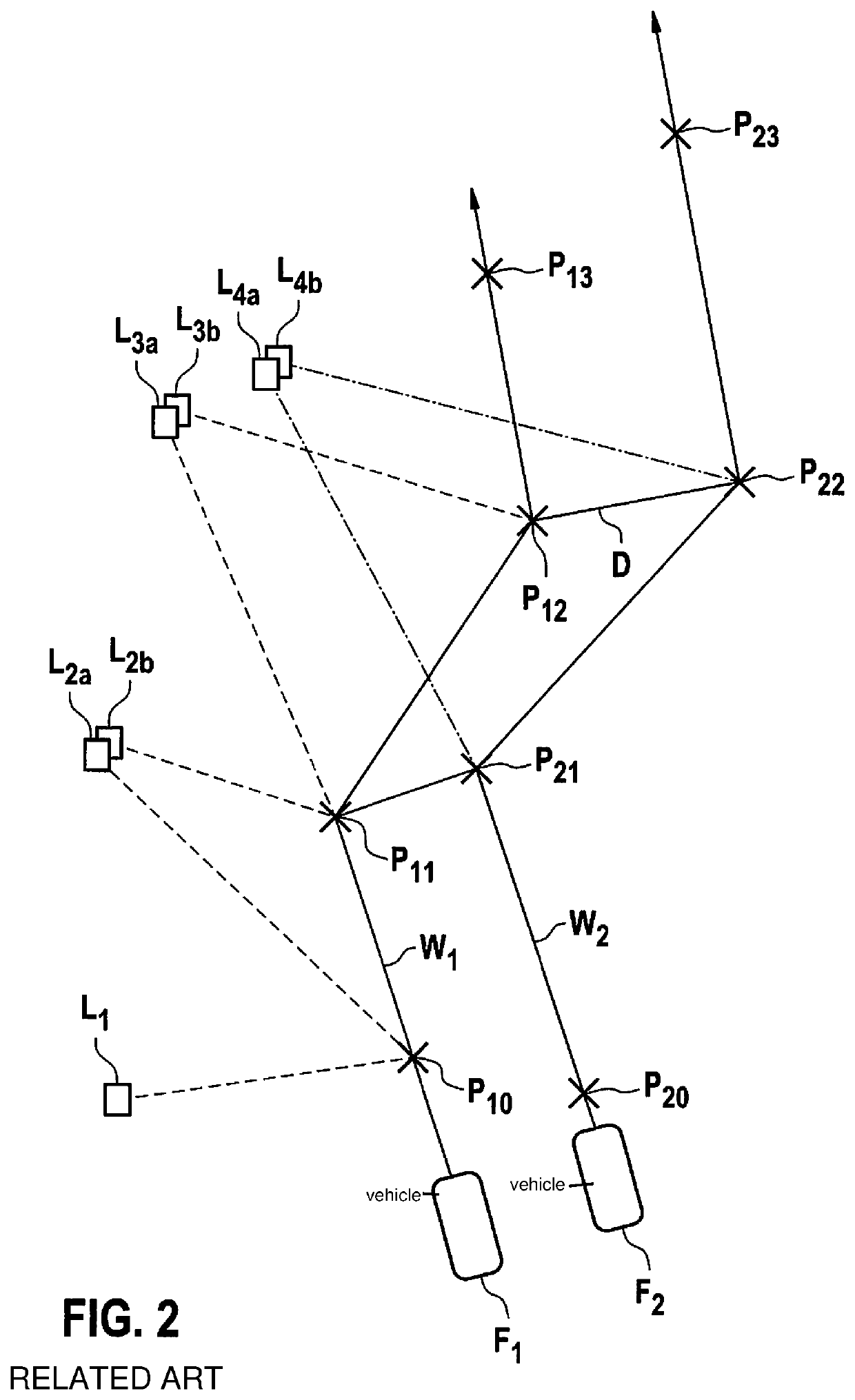
In reality, route sections exist in which many and very useful landmarks are present, as well as sections in which a poor coverage of landmarks exists, so that this may in some circumstances result in a poor quality of the localization.

Method used


Image

  • Method for creating a digital map for an automated vehicle
  • Method for creating a digital map for an automated vehicle
  • Method for creating a digital map for an automated vehicle

Examples


Embodiment Construction

[0032]Hereafter, an automated motor vehicle shall synonymously also be understood to mean a semi-automated motor vehicle, an autonomous motor vehicle, and a semi-autonomous motor vehicle.

[0033]The present invention in particular includes creating a digital map for an automated vehicle according to the SLAM principle in an improved manner.

[0034]The conventional graph SLAM algorithm may be divided into two fundamental steps:

[0035]1. SLAM Front-end

[0036]In this step, identical measuring positions between two trips of the same area are ascertained by a comparison of observed landmarks. The identified relation between the described measuring positions from different trips is represented in a graphical illustration expressed as distances (“edges”).

[0037]2. SLAM back-end

[0038]In this step, an optimization of the graph resulting from the preceding front-end step is carried out with the goal of finding an optimal approach that meets all boundary conditions.

[0039]A mode of action of the conve...


PUM


Abstract

A method for creating a digital map for an automated vehicle, including identifying a first vehicle by a second vehicle or the second vehicle by the first vehicle, the first vehicle and / or the second vehicle being identified as data-detecting members of a creation process of the digital map; ascertaining a distance of the first vehicle from the second vehicle and / or a distance of the second vehicle from the first vehicle; and transmitting defined data of the vehicles and the distance between the vehicles to a creation unit for creating the digital map.

Description

CROSS REFERENCE[0001]The present application claims the benefit under 35 U.S.C. § 119 of German Patent Application No. 102017210070.2 filed on Jun. 14, 2017, which is expressly incorporated herein by reference in its entirety.FIELD[0002]The present invention relates to a method for creating a digital map for an automated vehicle. The present invention furthermore relates to a device for creating a digital map for an automated vehicle. The present invention furthermore relates to a computer program product.BACKGROUND INFORMATION[0003]Techniques are available from the field of simultaneous localization and mapping (SLAM) to create surroundings maps for individual measuring vehicles or large vehicle fleets with the aid of sensor data. Corresponding applications can be found above all in the fields of robotics, logistics, automotive engineering, aviation, consumer goods, etc.[0004]To create exact surroundings maps from vehicle sensor observations (for example, in the form of radar, vide...

Claims


Application Information

Patent Timeline
Patent Type & Authority Patents(United States)
IPC IPC(8): G05D1/02
CPCG05D1/0212G05D1/0231G05D1/0255G05D1/0257G05D1/0274G05D1/0278G05D1/0291G01C21/32
Inventor ALAWIEH, ALIZAUM, DANIELABELING, PETER CHRISTIAN
Owner ROBERT BOSCH GMBH
Learn More