Coarse positioning method for remote sensing image based on Fourier-Mellin transformation
A remote sensing image and coarse positioning technology, applied in the field of remote sensing, can solve the problems of polygon approximation, difficulty in achieving uniform scale, accurate acquisition of local features, and establishment of corresponding relationships
- Summary
- Abstract
- Description
- Claims
- Application Information
AI Technical Summary
Problems solved by technology
Method used
Image
Examples
Embodiment Construction
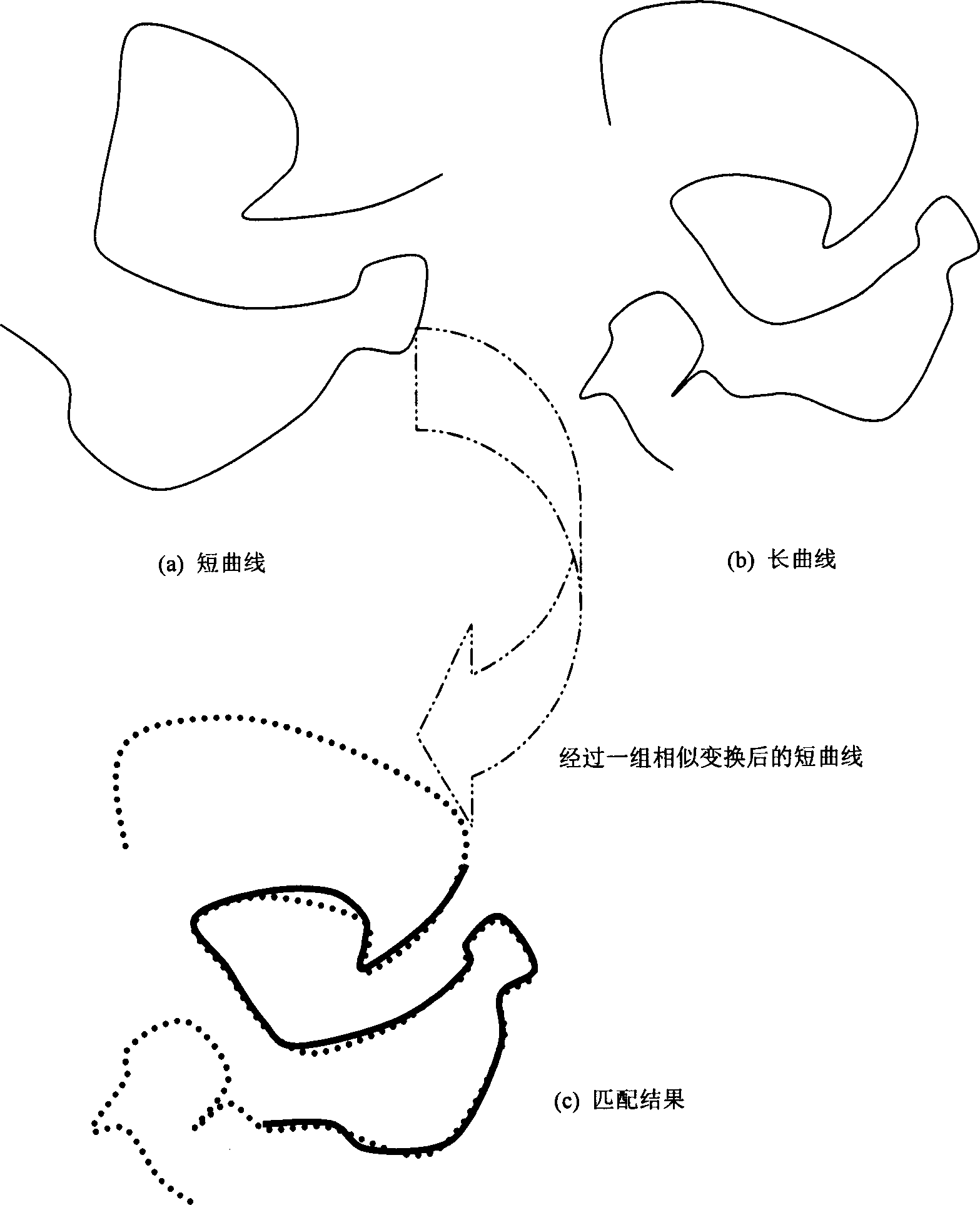
[0058] figure 1 In, (a) the short curve. (b) Long curve. A short curve after a set of similar transformations. (c) Matching results.
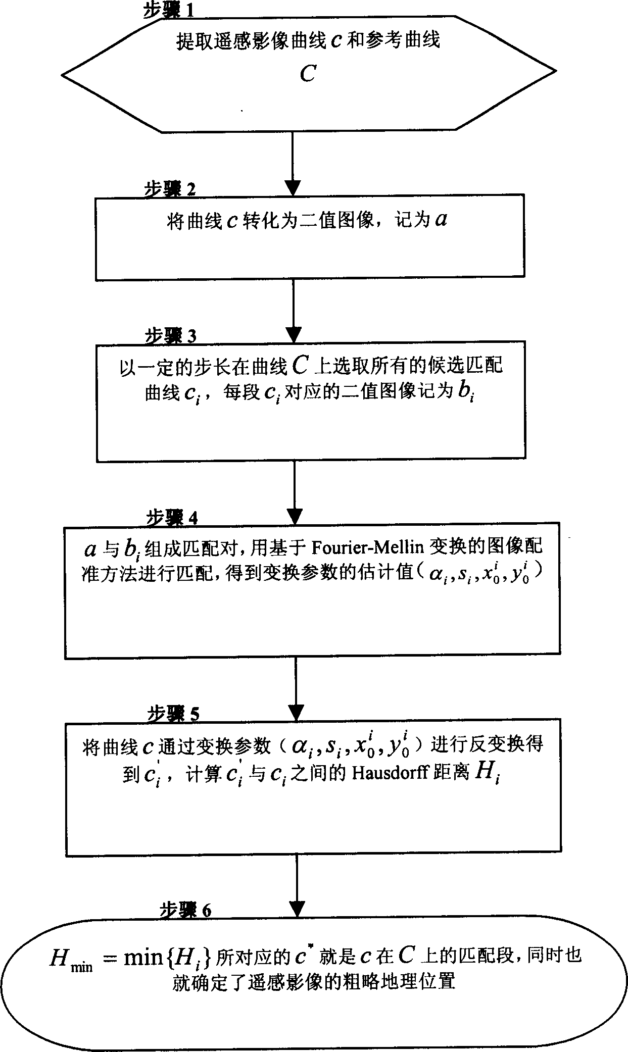
[0059] figure 2 Process flow of image curve rough matching method based on Fourier-Mellin transform. (It has been described in 3.2, the specific implementation of the positioning method, and is omitted here)
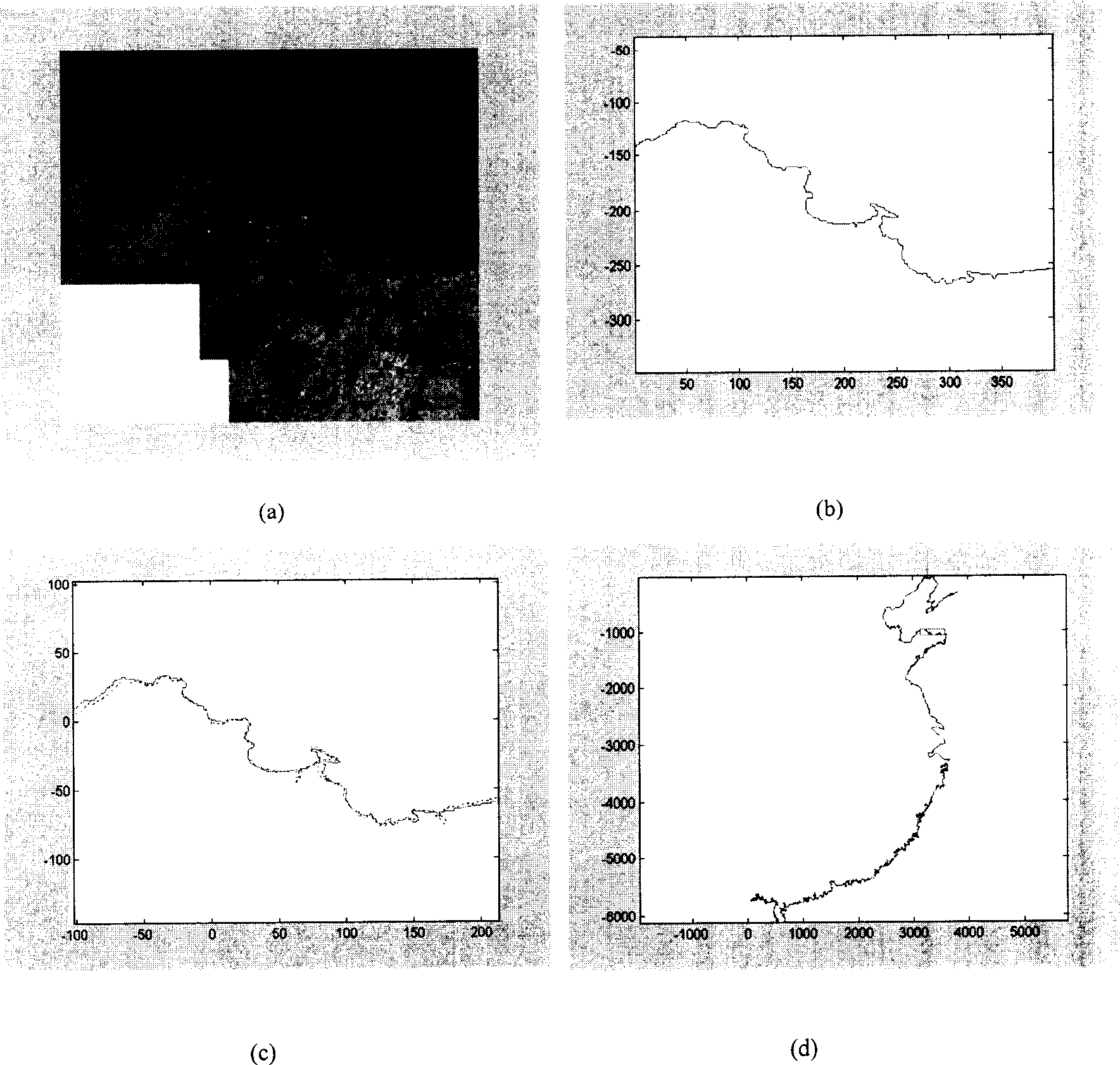
[0060] image 3 In (a) the original remote sensing image. (b) The coastline extracted from the original image. (c) The matching result of the coastline and the corresponding part of the coastline layer in the electronic map. The dotted line indicates the coastline in the electronic map, and the solid line indicates the coastline extracted from the remote sensing image. (d) The rectangle box is the rough position of the remote sensing image in the electronic map.
[0061] Figure 4 In (a) the original remote sensing image. (b) The coastline extracted from the original image. (c) The matching result of the coastline and the cor...
PUM
 Abstract
Description
Claims
Application Information
 - R&D
- Intellectual Property
- Life Sciences
- Materials
- Tech Scout
- Unparalleled Data Quality
- Higher Quality Content
- 60% Fewer Hallucinations
Browse by: Latest US Patents, China's latest patents, Technical Efficacy Thesaurus, Application Domain, Technology Topic, Popular Technical Reports.
© 2025 PatSnap. All rights reserved.Legal|Privacy policy|Modern Slavery Act Transparency Statement|Sitemap|About US| Contact US: help@patsnap.com


