Ocean acoustic survey space-time sampling overall planning method
A marine and acoustic technology, applied in the field of overall planning of space-time sampling for marine acoustic surveys, can solve the problems of high time and cost, uneconomical and unrealistic, and huge time-consuming and expensive.
- Summary
- Abstract
- Description
- Claims
- Application Information
AI Technical Summary
Problems solved by technology
Method used
Image
Examples
Embodiment 1
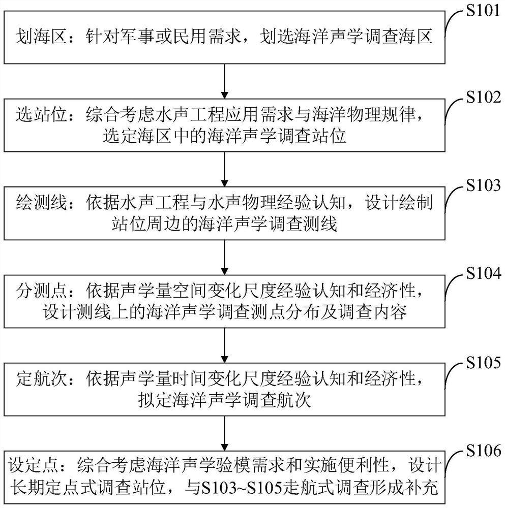
[0081] The practical ocean acoustic survey spatiotemporal planning method provided by the embodiment of the present invention includes the following steps:
[0082] (1) "Sea area" - for military or civilian needs, the marine acoustic survey sea area is selected;
[0083] (2) "Selection of stations" - comprehensively considering the application requirements of hydroacoustic engineering and the laws of marine physics, select the marine acoustics survey stations in the sea area;
[0084] (3) "Drawing survey line" - according to the experience of hydroacoustic engineering and hydroacoustic physics, design and draw the marine acoustic survey line around the station;
[0085] (4) "Sub-measurement points" - according to the empirical cognition and economy of the spatial variation scale of acoustic quantities, the distribution and investigation content of marine acoustic survey points on the design survey line;
[0086] (5) "Determined Voyages" - according to the empirical cognition ...
Embodiment 2
[0096] The purpose of the present invention is to provide a practical marine acoustic survey time-space planning method, which can not only obtain survey results satisfying the application of underwater acoustic engineering, but also improve survey efficiency and control survey costs.
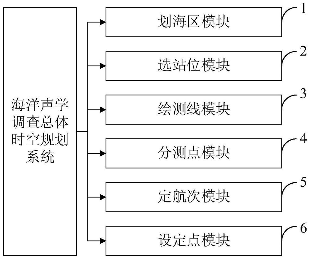
[0097] In order to achieve the above purpose, the present invention provides a practical ocean acoustic survey spatio-temporal planning method, which includes the following steps: (1) "demarcation of the sea area" - according to military or civil needs, the marine acoustic survey sea area is selected; (2) "selected sea area" "Station" - comprehensively considering the application requirements of hydroacoustic engineering and the laws of marine physics, select the marine acoustics survey station in the sea area; (3) "mapping line" - based on the experience and cognition of hydroacoustic engineering and hydroacoustic physics, Design and draw the marine acoustic survey line around the station; (4) ...
Embodiment 3
[0106] like figure 2 and Figure 4 As shown, the main steps included in the method of the embodiment of the present invention and the main factors that need to be analyzed and considered in the planning process of each step are as follows:
[0107] Step S1 may be referred to as "sea zone" for short. According to the protection of maritime rights and interests (that is, military needs), or the needs of marine resources development (that is, civilian needs), the marine acoustic survey sea area is selected on the chart. ①The surveyed sea area should of course cover the hot spots of marine rights and interests; ② the surveyed sea area should include waterways entering and exit these rights and interests hotspots; ③ the surveyed sea area should include the surrounding fortress areas set up to protect these rights and interests hotspots.
[0108] Step S2 may be referred to as "selection of a site" for short. Investigate the distribution of seabed topography (isobath), mesoscale ...
PUM
 Abstract
Description
Claims
Application Information
 - R&D Engineer
- R&D Manager
- IP Professional
- Industry Leading Data Capabilities
- Powerful AI technology
- Patent DNA Extraction
Browse by: Latest US Patents, China's latest patents, Technical Efficacy Thesaurus, Application Domain, Technology Topic, Popular Technical Reports.
© 2024 PatSnap. All rights reserved.Legal|Privacy policy|Modern Slavery Act Transparency Statement|Sitemap|About US| Contact US: help@patsnap.com


