
Full-information lossless conversion method for space coordinate system and projection of digital topographic map

A technology of spatial coordinate system and conversion method, applied in the field of full information lossless conversion of spatial coordinate system and projection of digital topographic map, can solve the problems of uneven deformation, high cost, time-consuming and laborious, etc., to ensure conversion accuracy and conversion speed. , the effect of high conversion accuracy

Inactive Publication Date: 2022-05-27
长江水利委员会水文局 +1
View PDF3 Cites 0 Cited by
  • Summary
  • Abstract
  • Description
  • Claims
  • Application Information

AI Technical Summary

Problems solved by technology

The first method is a rigorous method, but it will consume a lot of manpower, time and effort, and high cost; the second method is expensive, and will cause the loss of a lot of original feature attribute information; the third method will produce Uneven deformation seriously affects the conversion accuracy of topographic maps

Method used


Image

  • Full-information lossless conversion method for space coordinate system and projection of digital topographic map
  • Full-information lossless conversion method for space coordinate system and projection of digital topographic map
  • Full-information lossless conversion method for space coordinate system and projection of digital topographic map

Examples


Embodiment 1

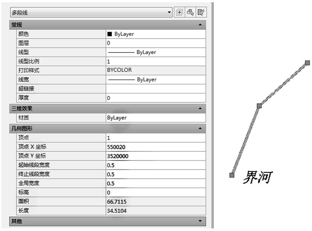
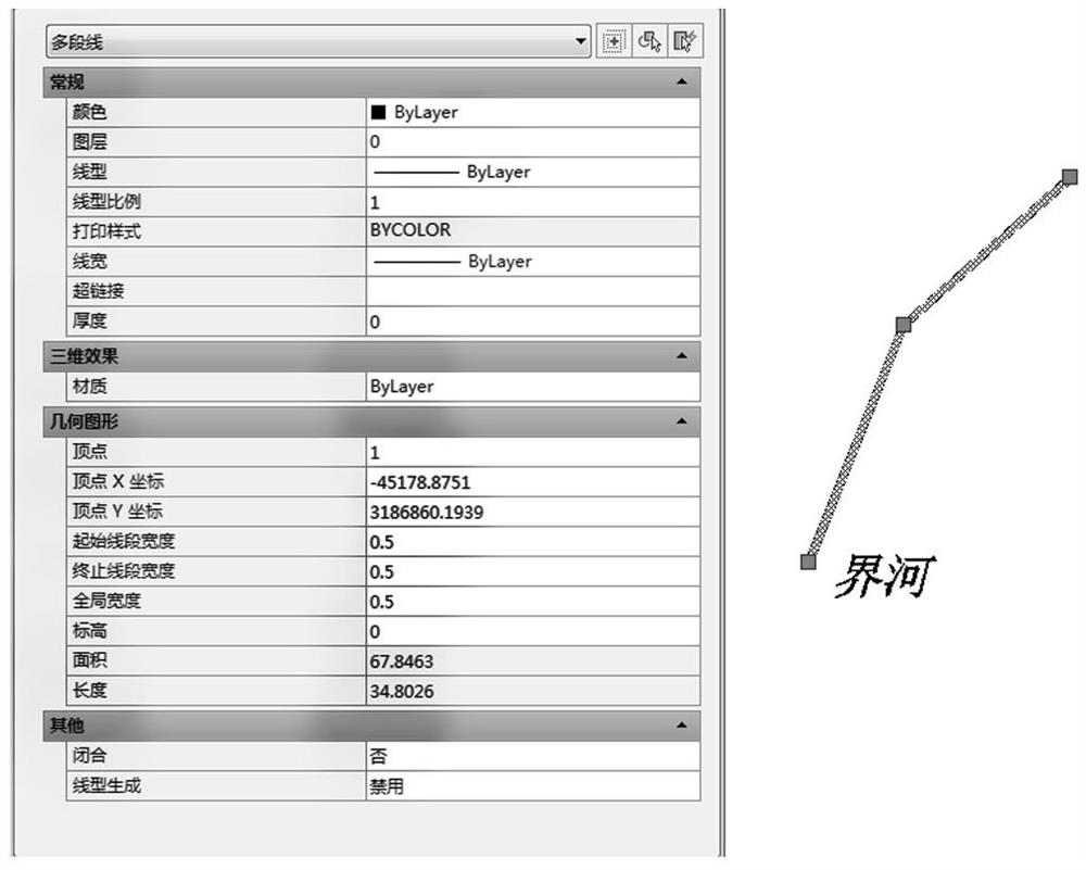
[0095] A topographic map data file contains a polyline (PolyLine) object with 3 nodes (the main attribute is: line width is 0.5m, the color is red), and a "river" Text object (the main attribute is: the color is Green) Green), the original coordinate system is the 1954 Beijing coordinate system, Gaussian conformal projection, the projected central meridian is 120 degrees, it needs to be converted to the Mercator Projection under the WGS-84 coordinate system, and the projected central meridian is 121 degrees. , The reference latitude is 31 degrees.

[0096] The spatial seven-parameter model transformation is adopted, and the transformation parameters are assumed to be:

[0097] , , , , , ,

[0098] The coordinates of the "river" Text object in the original coordinate system are (550000, 3520000), and the starting point coordinates of the PolyLine object in the original coordinate system are (550020, 3520000)

[0099] The digital topographic map is saved in DXF f...


PUM


Abstract

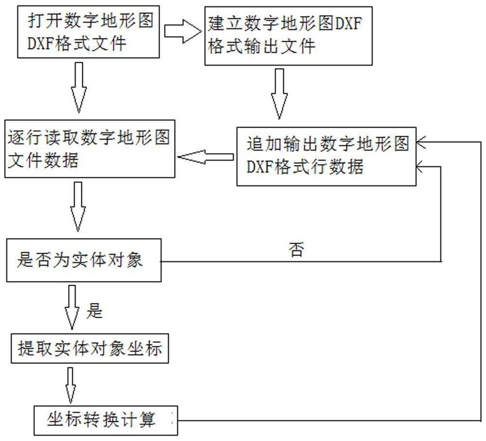
The invention provides a digital topographic map space coordinate system and projection full-information lossless conversion method, which comprises the following steps of: preparing data, carrying out preliminary translation and rotation processing on an original data file, enabling ground object coordinates displayed in a digital topographic map to be consistent with actual coordinates, and storing as a digital topographic map in a DXF (Digital Exchange Format) format; a computer high-level language is adopted for programming, and the digital topographic map in the DXF format is read; analyzing and judging the read data of the digital topographic map in the DXF format, and adopting different calculation processing operations according to different read information contents; and recombining and outputting the processed data information. By adopting the method for data processing, the drawing efficiency of the digital topographic map can be remarkably improved, the conversion precision of the topographic map is ensured, and a large amount of cost is saved.

Description

technical field [0001] The invention relates to the fields of geodesy and geographic information mapping, in particular to a full-information lossless conversion method of a digital topographic map spatial coordinate system and projection. Background technique [0002] In surveying and mapping work and geographic information mapping, according to the needs of the work, the mathematical foundations of cartography are different. As far as the coordinate system is concerned, the coordinate systems we may use are the Beijing coordinate system in 1954, the Xi'an coordinate system in 1980, the WGS-84 coordinate system, and the national 2000 coordinate system; in terms of projection methods, Gauss- Gauss-Kruger projection, Mercator projection, UTM (Universal Transverse Mercator) projection, Lambert Conformal Conic, etc. [0003] The diversity of coordinate systems and projections, most of the engineering applications use the Gauss-Kruger Projection in the urban coordinate system o...

Claims


Application Information

Patent Timeline
IPC IPC(8): G06F16/11G09B29/00
CPCG06F16/116G09B29/005
Inventor 吴敬文王露付五洲刘大伟胡浩钱辉唐敏炯
Owner 长江水利委员会水文局
Learn More