
Mechanical arm action planning method and system based on outdoor antenna calibration site position

An outdoor antenna and planning system technology, applied in the direction of manipulators, program-controlled manipulators, manufacturing tools, etc., can solve the problem that satellites cannot completely cover the antenna disk.

Pending Publication Date: 2022-04-05
WUHAN UNIV
View PDF0 Cites 0 Cited by
  • Summary
  • Abstract
  • Description
  • Claims
  • Application Information

AI Technical Summary

Problems solved by technology

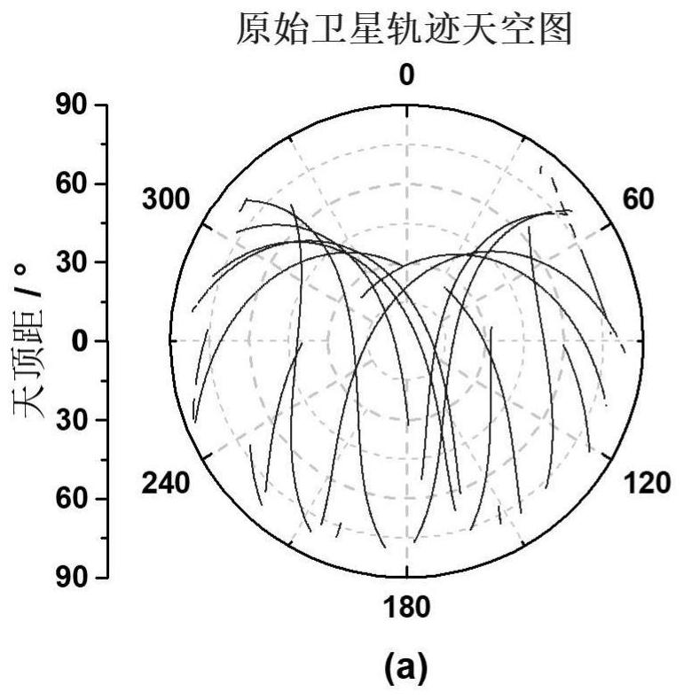
[0007] The technical problem to be solved by the present invention is: in the outdoor absolute calibration of the GNSS antenna, due to the limitation of the calibration site and constellation design, the satellite cannot completely cover the defect of the entire antenna disk. Therefore, based on the position information of the calibration site, a mechanical arm is proposed. A method of planning movements so that satellites can evenly cover the antenna

Method used


Image

  • Mechanical arm action planning method and system based on outdoor antenna calibration site position
  • Mechanical arm action planning method and system based on outdoor antenna calibration site position
  • Mechanical arm action planning method and system based on outdoor antenna calibration site position

Examples


Embodiment Construction

[0045] The specific implementation manners of the present invention will be further described in detail below in conjunction with the embodiments and accompanying drawings. The following examples are used to illustrate the present invention, but are not intended to limit the scope of the present invention.

[0046] The present invention aims at the ground satellite navigation system (Global Navigation Satellite System, GNSS) receiving antenna calibration process, due to the influence of the geographical location of the station and the satellite navigation constellation design, there may be uneven coverage of observations and no coverage of observations in the antenna disk. A motion planning scheme of the manipulator based on the geographical location of the station and the design of the satellite constellation is proposed. The invention has the advantage of being able to adaptively plan the movement of the manipulator according to the position information of the calibration si...


PUM


Abstract

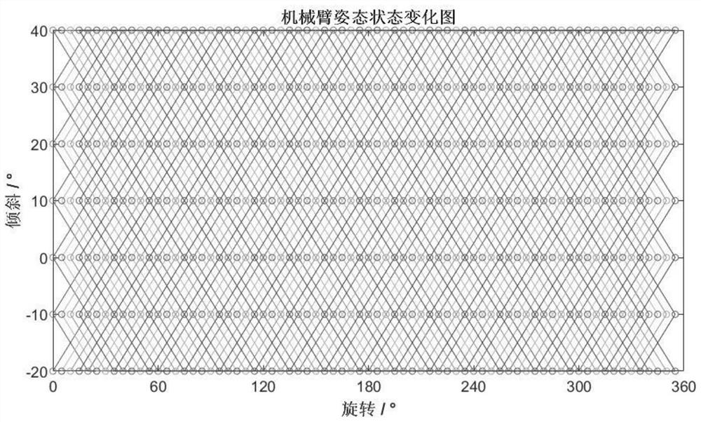
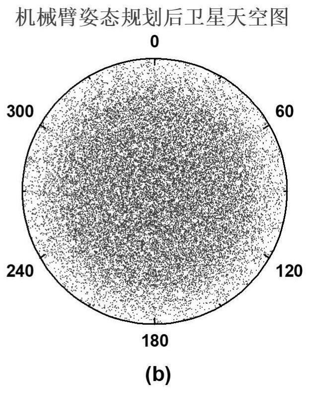
The invention provides a mechanical arm action planning method and system based on an outdoor antenna calibration field position, and the method comprises the steps: calculating the latitude and longitude of a calibration field according to the coordinates of an outdoor calibration field; according to the satellite ephemeris, calculating the maximum elevation angle of the calibration place in a static state in a sub-satellite point repetition period; according to the calibration field coordinates and the maximum elevation angle of the satellite under the actual measurement data, the mechanical arm action is determined, the mechanical arm action starts from the starting point, a certain amount of stepping is conducted on the inclination angle and the rotation angle at the same time, and when the inclination angle or the rotation angle reaches the physical tolerance of the mechanical arm, stepping is conducted in the opposite direction; and calculating the satellite coverage condition of the antenna disc surface according to the actual satellite track and the mechanical arm motion planning, and checking the mechanical arm motion planning effect. According to the calibration site position information and the satellite constellation design, adaptive planning can be carried out on the action of the mechanical arm, so that observation values in the antenna disc face are evenly and comprehensively covered, and the antenna phase calibration precision and calibration speed are improved.

Description

technical field [0001] The invention belongs to the field of antenna measurement technology and satellite navigation and positioning, and specifically relates to a technical scheme of manipulator action planning based on outdoor antenna calibration site position, which realizes manipulator action planning in outdoor absolute calibration of ground receiver antenna phase center. Background technique [0002] For ground receiving antennas, the phase receiving position of the signal changes as the signal is incident from different azimuths, resulting in differences in phase observations in different directions, which has a greater impact on high-precision satellite navigation applications. Therefore, in practical applications, it is necessary to calibrate the antenna phase center model (Antenna Phase Model, APC) and establish a corresponding antenna phase correction model. [0003] Due to the constellation design, for a fixed calibration field, the trajectory of the satellite ch...

Claims


Application Information

Patent Timeline
IPC IPC(8): B25J9/16
Inventor 胡志刚周仁宇赵齐乐
Owner WUHAN UNIV
Learn More