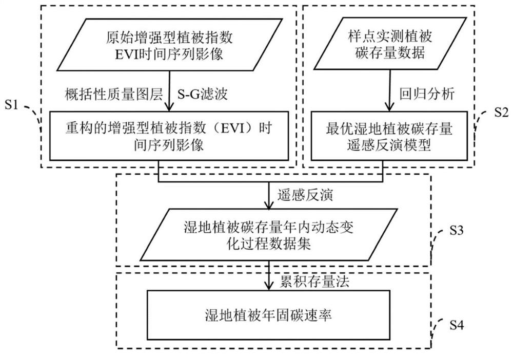
Wetland vegetation carbon sequestration rate remote sensing estimation method based on reconstructed vegetation index time sequence image
A technology of wetland vegetation and time series, which is applied in the field of remote sensing estimation, can solve problems such as limited estimation, and achieve the effects of simple operation, removal of remote sensing image errors, and low cost
- Summary
- Abstract
- Description
- Claims
- Application Information
AI Technical Summary
Problems solved by technology
Method used
Image
Examples
Embodiment 1
[0048] Take Poyang Lake Wetland, a typical wetland ecosystem, as an example.
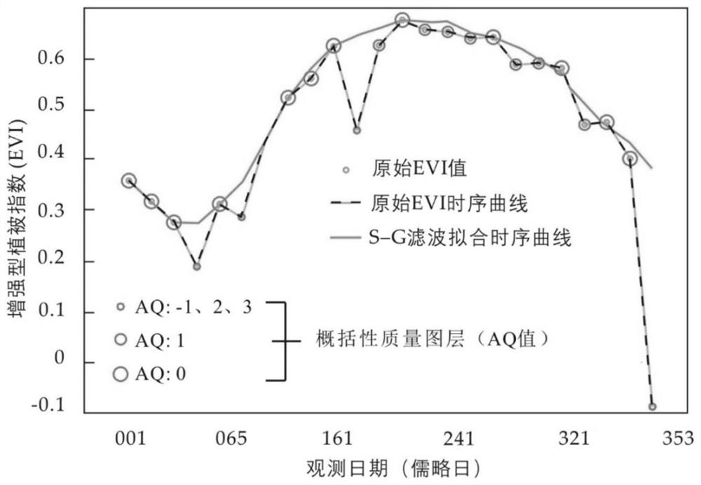
[0049] figure 2 Schematic diagram of the method for reconstructing high-quality remote sensing observation vegetation index time-series images. Based on the AQ value (Ancillary Quality value, AQ) of the generalized quality layer (Band Pixel Reliability), the pixels without data (AQ=-1), snow / ice covered pixels (AQ=2) and cloud pollution Pixels (AQ=3) are eliminated, and only high-quality pixels and medium-quality pixels with AQ values of 0 and 1 in the original EVI image are retained. Fit the EVI time series curve with S-G filter to complete the interpolation to eliminate outliers. from figure 2 It can be seen from the figure that compared with the original EVI annual change curve, the reconstructed MODIS EVI time-series curve is more reasonable in describing the dynamic changes of vegetation in Poyang Lake wetland, removing many noise points, and capturing the sex-grass The two-season chara...
PUM
 Abstract
Description
Claims
Application Information
 - Generate Ideas
- Intellectual Property
- Life Sciences
- Materials
- Tech Scout
- Unparalleled Data Quality
- Higher Quality Content
- 60% Fewer Hallucinations
Browse by: Latest US Patents, China's latest patents, Technical Efficacy Thesaurus, Application Domain, Technology Topic, Popular Technical Reports.
© 2025 PatSnap. All rights reserved.Legal|Privacy policy|Modern Slavery Act Transparency Statement|Sitemap|About US| Contact US: help@patsnap.com


