Remote sensing image building accurate segmentation method
A technology of remote sensing images and buildings, applied in image analysis, neural learning methods, image enhancement, etc., can solve problems such as difficulty in capturing image details and inaccurate identification of building edge areas
- Summary
- Abstract
- Description
- Claims
- Application Information
AI Technical Summary
Problems solved by technology
Method used
Image
Examples
Embodiment Construction
[0039] The specific implementation manner and working principle of the present invention will be further described in detail below in conjunction with the accompanying drawings.
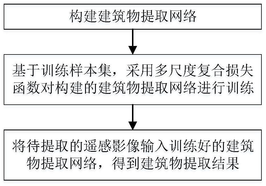
[0040] Such as figure 1 As shown, a method for accurately segmenting buildings in remote sensing images, the specific steps are as follows:
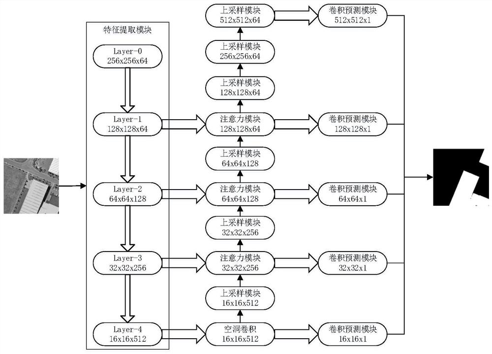
[0041] Step 1: Build a building extraction network including feature extraction module, dilated convolution module, attention module, upsampling module and convolution prediction module, such as figure 2 shown, where:
[0042] The feature extraction module is used to perform multi-scale feature extraction on the input remote sensing image to obtain a multi-scale feature map;
[0043] Specifically, the specific process of the feature extraction module performing multi-scale feature extraction on the input remote sensing image is as follows:
[0044] The pre-trained residual network without the fully connected layer in the building extraction network is used ...
PUM
 Abstract
Description
Claims
Application Information
 - Generate Ideas
- Intellectual Property
- Life Sciences
- Materials
- Tech Scout
- Unparalleled Data Quality
- Higher Quality Content
- 60% Fewer Hallucinations
Browse by: Latest US Patents, China's latest patents, Technical Efficacy Thesaurus, Application Domain, Technology Topic, Popular Technical Reports.
© 2025 PatSnap. All rights reserved.Legal|Privacy policy|Modern Slavery Act Transparency Statement|Sitemap|About US| Contact US: help@patsnap.com


