Active attack mine inertial navigation and magnetic compass error angle compensation method

A compensation method and magnetic compass technology, applied in the direction of measuring devices, instruments, etc., can solve the problems that the installation error angle cannot be controlled by the process, and the installation error angle of the optical instrument cannot be used.

Active Publication Date: 2021-05-18
中国船舶重工集团有限公司第七一0研究所
View PDF5 Cites 0 Cited by
  • Summary
  • Abstract
  • Description
  • Claims
  • Application Information

AI Technical Summary

Problems solved by technology

Since the two systems are installed on different platforms, the installation error angle between the two cannot be obtained by means of aiming measurement with optical instruments, nor can it be obtained by the method of process control and error transfer calculation. The installation error angle

Method used


Image

  • Active attack mine inertial navigation and magnetic compass error angle compensation method
  • Active attack mine inertial navigation and magnetic compass error angle compensation method
  • Active attack mine inertial navigation and magnetic compass error angle compensation method

Examples


Embodiment Construction

[0042] The present invention will be described in detail below with reference to the accompanying drawings and examples.

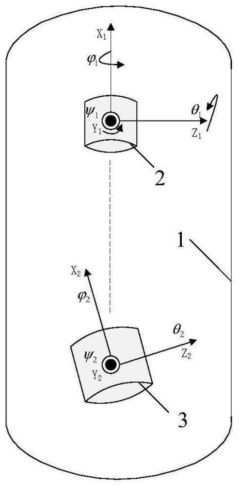
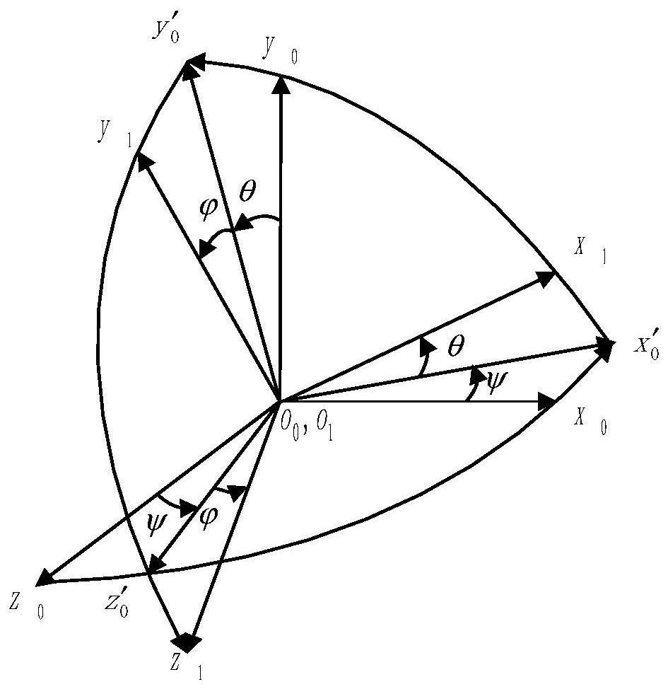
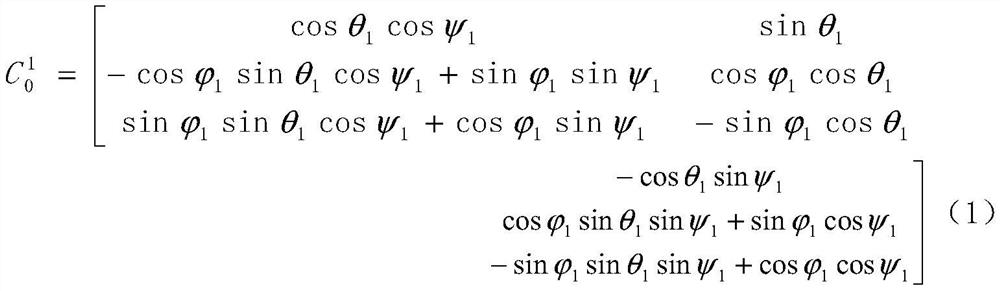
[0043]The present invention proposes a method for compensating the error angle of the mine inertial navigation and magnetic compass. An installation interface identical to that of the magnetic compass is processed on the magnetic compass installation base of the platform head cover (if the magnetic compass is easy to disassemble and install, the magnetic compass can be directly used installation interface), process a set of devices capable of measuring orthogonal three-axis acceleration as a tooling, the installation interface of the tooling is consistent with the installation interface of the magnetic compass and the measuring axis, and the volume and structure of the tooling are adapted to be carried out through the operating hole of the platform head cover. Install. Use industrial computer + special cable or special support equipment as calibration equi...


PUM


Abstract

The invention provides a mine inertial navigation and magnetic compass error angle calibration and compensation method. According to the uniqueness principle of a state cosine matrix between two space coordinate systems, a calculation result obtained after measurement in a first state is used for calculation of a measurement result in a second state; the limitation condition of 90-degree rotation around the X axis does not exist between the two states of the mine in the Y-axis direction and the Z-axis direction, the requirements for calibration equipment and operation are simplified, and implementation is easy; a calibration result obtained by aiming at each mine is written into a trajectory control computer, and unification of azimuth and attitude references of a target detection system and a trajectory control system is realized through compensation, so that system errors caused by equipment installation are effectively eliminated, and the accuracy of the active attack mine to implement guidance attack on a target is ensured; and the method is verified by lake and sea tests at a certain model scheme stage.

Description

technical field [0001] The invention belongs to the technical field of sea mine ballistic control, and in particular relates to an active attack sea mine inertial navigation and magnetic compass error angle compensation method. Background technique [0002] At present, my country's active attack mines are mainly moored platforms + large-scale rocket floating anchor mines with combat loads. To control the underwater ballistics of combat loads and improve the accuracy of striking targets, it is necessary to introduce targets into its guidance loop. information such as position and velocity. The target information comes from the target detection system, and its azimuth and attitude references are established through a magnetic compass; the azimuth and attitude references of the ballistic control system are established through inertial navigation. Only by unifying the azimuth and attitude reference of the target detection system with the reference of the ballistic control system...

Claims


Application Information

Patent Timeline
IPC IPC(8): G01C25/00
CPCG01C25/00
Inventor 舒旭光陈杰杨光徐良波熊童满王维
Owner 中国船舶重工集团有限公司第七一0研究所
Why Eureka
Try Eureka