Unmanned aerial vehicle for geographic information data acquisition and control method thereof
A technology of geographic information data and control methods, which is applied in the field of unmanned aerial vehicles and its control for geographic information data collection, and can solve problems such as poor high-frequency vibration suppression effect
- Summary
- Abstract
- Description
- Claims
- Application Information
AI Technical Summary
Problems solved by technology
Method used
Image
Examples
Embodiment Construction
[0042] The standard parts used in the present invention can be purchased from the market, and the special-shaped parts can be customized according to the instructions and the accompanying drawings. The specific connection methods of each part adopt mature bolts, rivets, welding in the prior art , pasting and other conventional means, no longer described in detail here.
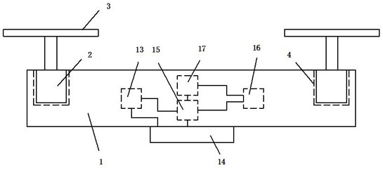
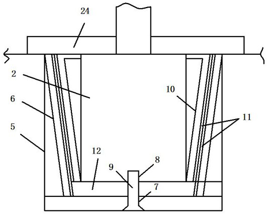
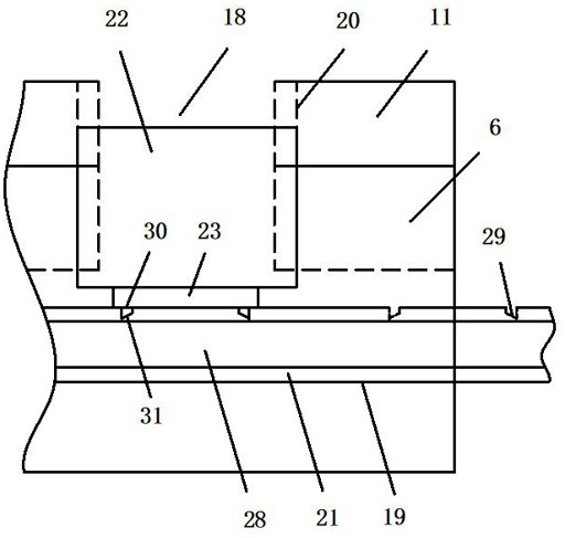
[0043] refer to Figure 1-5 , an unmanned aerial vehicle for geographic information data collection, comprising:
[0044]Fuselage 1, drive motor 2 is installed on the fuselage 1, drive motor 2 is connected with propeller 3, and vibration damping mechanism 4 is installed on the outside of drive motor 2; The inner side of the hole 5 is annularly fixed with several outer support pieces 6, the bottom of the outer support piece 6 is inclined towards the center of the installation hole 5, the center of the bottom of the installation hole 5 is provided with a through hole 7, and the bottom of the drive motor 2 is pr...
PUM
 Abstract
Description
Claims
Application Information
 - Generate Ideas
- Intellectual Property
- Life Sciences
- Materials
- Tech Scout
- Unparalleled Data Quality
- Higher Quality Content
- 60% Fewer Hallucinations
Browse by: Latest US Patents, China's latest patents, Technical Efficacy Thesaurus, Application Domain, Technology Topic, Popular Technical Reports.
© 2025 PatSnap. All rights reserved.Legal|Privacy policy|Modern Slavery Act Transparency Statement|Sitemap|About US| Contact US: help@patsnap.com


