Power transmission line forest fire monitoring, early warning and positioning system and method thereof
A transmission line, monitoring and early warning technology, applied in closed-circuit television systems, fire alarms, forest fire alarms, etc., can solve problems such as difficult maintenance, many layouts, and high failure rate
- Summary
- Abstract
- Description
- Claims
- Application Information
AI Technical Summary
Problems solved by technology
Method used
Image
Examples
Embodiment 1
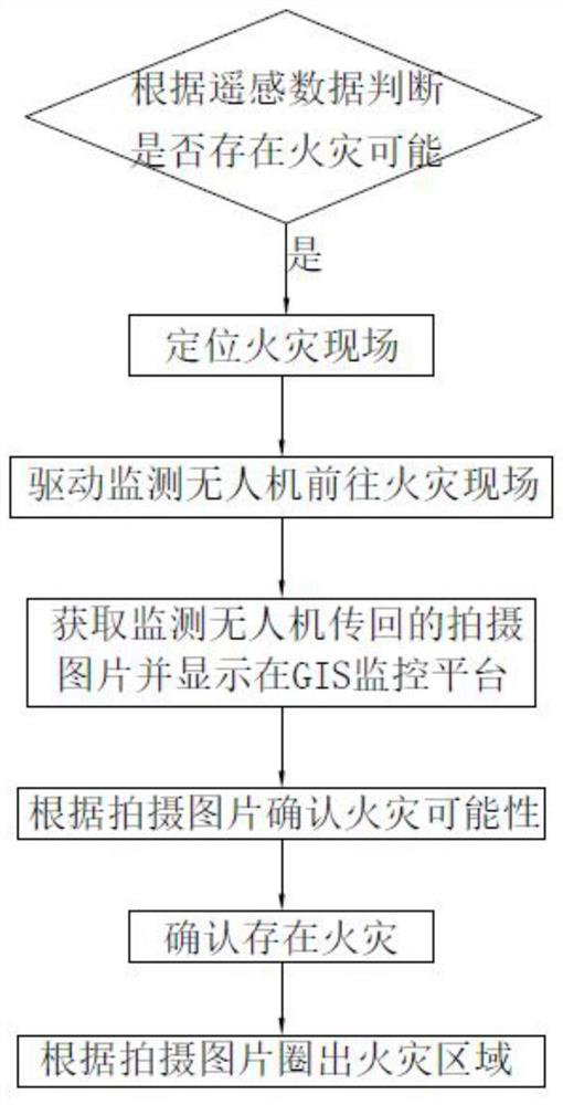
[0054] like figure 1 As shown, this embodiment discloses a method for monitoring, early warning and positioning of mountain fires on transmission lines, including the following steps:
[0055] S1. According to the remote sensing data of the geostationary orbit satellite, it is judged whether there is a fire possibility, if so, the fire scene is located by the remote sensing image target positioning algorithm and step S2 is executed;
[0056] The remote sensing image target location algorithm can be carried out through the following steps: wavelet decomposition, feature detection and feature description, feature matching, similarity judgment and target location. Of course, when it is put into use, remote sensing image target positioning algorithms of other technologies can also be used to locate the fire scene.
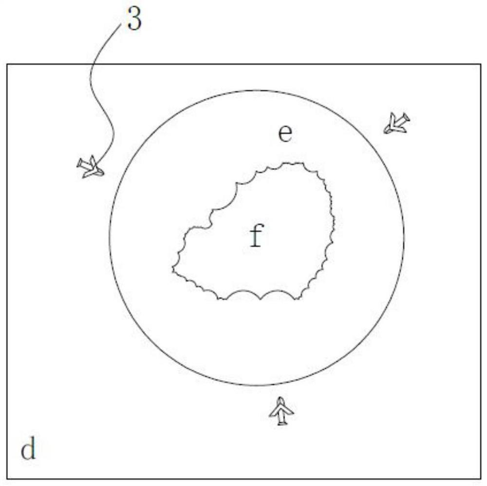
[0057] S2. Drive at least one monitoring drone 3 to the fire scene; this embodiment preferably dispatches multiple monitoring drones each time, and multiple monitorin...
Embodiment 2
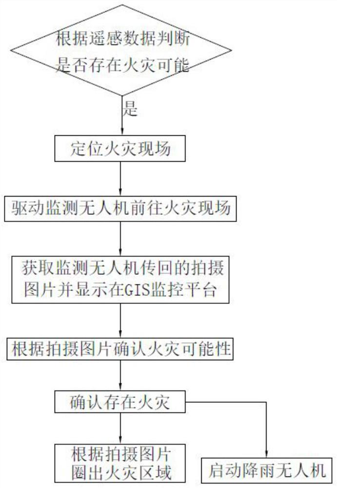
[0079] like image 3 As shown, this embodiment is similar to Embodiment 1, except that the system of this embodiment also includes a rain drone, and the method of this embodiment also includes step S5:
[0080] S5. Start the rain drone 4 when it is confirmed that there is a fire;
[0081] Here, the rain drone 4 can be started manually by the staff according to the situation at that time, or the rain drone 4 can be automatically started by the GIS monitoring platform 1 . The GIS monitoring platform 1 can start the rain drone 4 when it is confirmed that there is a fire, and can also obtain meteorological data when it is confirmed that there is a fire, and automatically start the rain drone 4 according to the weather conditions in the weather data, such as in cloudy conditions If the rain falls, the rain drone 4 can be started, and the rain drone will not be started on a sunny day.
[0082] Specifically, the rainfall UAV 4 has a temperature sensor and an artificial rainfall cat...
Embodiment 3
[0094] like Image 6 As shown, the present embodiment discloses a transmission line mountain fire monitoring and early warning and positioning system based on the above method, including a GIS monitoring platform 1, and the GIS monitoring platform 1 includes a mountain fire monitoring and positioning module and a command and dispatch module, The mountain fire monitoring and positioning module is connected to the geostationary orbit satellite system 2 and stores a remote sensing image target positioning algorithm;
[0095] The command and dispatch module is connected with the monitoring UAV 3 and the rainfall UAV 4, and the monitoring UAV 3 includes the first master of the UAV and the first master connected to the UAV. Camera, the first GPS module, the first wireless module and the first temperature sensor, described monitoring drone 3 is connected to the command and dispatch module of GIS monitoring platform 1 by described first wireless module; Described rainfall drone 4. It...
PUM
 Abstract
Description
Claims
Application Information
 - R&D
- Intellectual Property
- Life Sciences
- Materials
- Tech Scout
- Unparalleled Data Quality
- Higher Quality Content
- 60% Fewer Hallucinations
Browse by: Latest US Patents, China's latest patents, Technical Efficacy Thesaurus, Application Domain, Technology Topic, Popular Technical Reports.
© 2025 PatSnap. All rights reserved.Legal|Privacy policy|Modern Slavery Act Transparency Statement|Sitemap|About US| Contact US: help@patsnap.com


