Remote sensing scene classification method and system based on multi-scale feature fusion
A multi-scale feature and scene classification technology, applied in the field of image processing, to achieve the effect of improving classification precision and accuracy
- Summary
- Abstract
- Description
- Claims
- Application Information
AI Technical Summary
Problems solved by technology
Method used
Image


Examples
Embodiment Construction
[0054] It should be understood that the specific embodiments described here are only used to explain the present invention, not to limit the present invention.
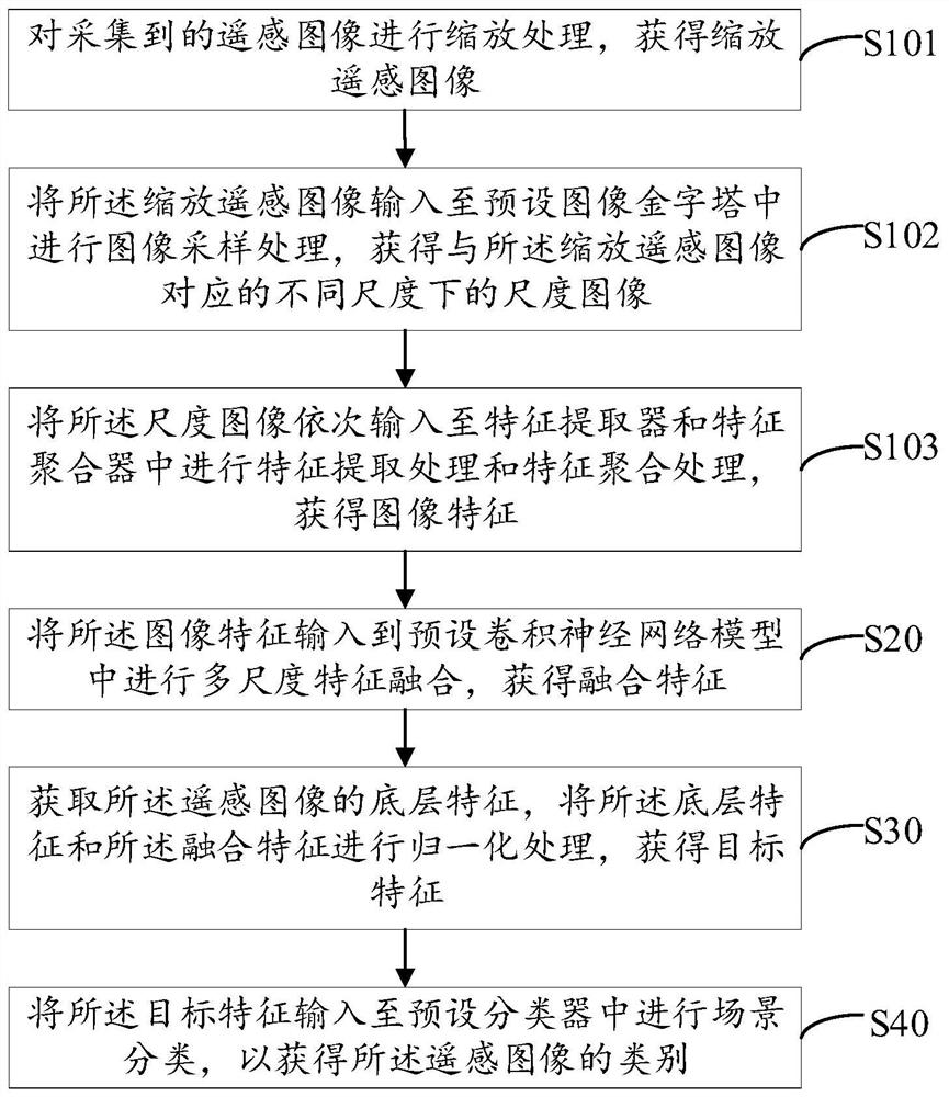
[0055] The embodiment of the present invention provides a remote sensing scene classification method based on multi-scale feature fusion, refer to figure 1 , figure 1 It is a schematic flowchart of the first embodiment of the remote sensing scene classification method based on multi-scale feature fusion in the present invention.
[0056] In this embodiment, the remote sensing scene classification method based on multi-scale feature fusion includes the following steps:
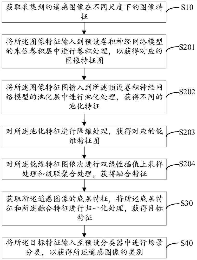
[0057] Step S10: Obtain the image features of the collected remote sensing images at different scales;
[0058] It is easy to understand that in order to avoid the occurrence of large intra-category differences caused by remote sensing images being taken from multiple angles and directions (remote sensing images of the same category of ground object ...
PUM
 Abstract
Description
Claims
Application Information
 - Generate Ideas
- Intellectual Property
- Life Sciences
- Materials
- Tech Scout
- Unparalleled Data Quality
- Higher Quality Content
- 60% Fewer Hallucinations
Browse by: Latest US Patents, China's latest patents, Technical Efficacy Thesaurus, Application Domain, Technology Topic, Popular Technical Reports.
© 2025 PatSnap. All rights reserved.Legal|Privacy policy|Modern Slavery Act Transparency Statement|Sitemap|About US| Contact US: help@patsnap.com