
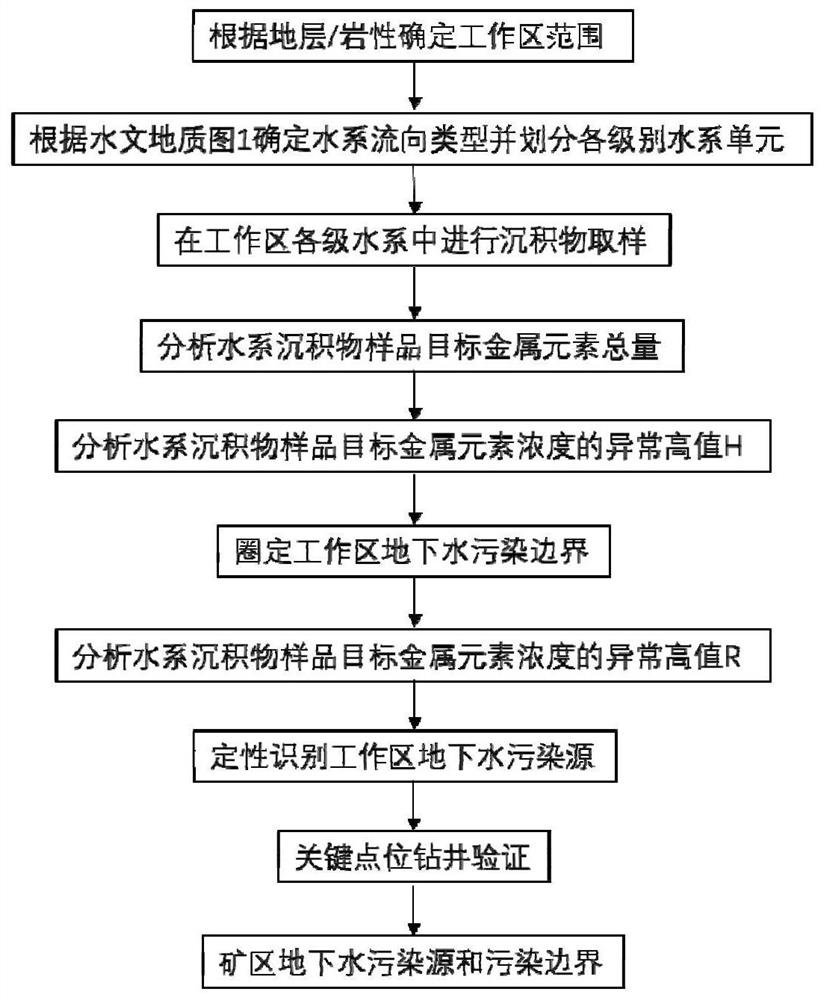
A method for analyzing heavy metal pollution sources and pollution boundaries of groundwater in metal mining areas using water system sediments

A water system sediment and heavy metal technology, applied in the field of environmental pollution prevention and control, can solve the problems of strong randomness of monitoring wells, high cost, and deviation in determining the scope of groundwater pollution, and achieve the effect of reducing investigation costs, improving efficiency, and promoting technological progress in the industry

Active Publication Date: 2022-06-03
CENT SOUTH UNIV
View PDF31 Cites 0 Cited by
  • Summary
  • Abstract
  • Description
  • Claims
  • Application Information

AI Technical Summary

Problems solved by technology

However, monitoring wells are highly random, costly, and time-consuming, and it is impossible to build large-scale monitoring wells. At the same time, due to the inhomogeneity of the formation and the uncertainty of hydrogeological parameters, the accuracy of tracer methods such as fluorescence is low, and accurate and rapid identification cannot be achieved. Groundwater sources and pollution ranges in mining areas are prone to deviations in the determination of groundwater pollution ranges, resulting in poor results in later pollution assessment and treatment and difficult to guarantee cost control

Method used


Image

  • A method for analyzing heavy metal pollution sources and pollution boundaries of groundwater in metal mining areas using water system sediments
  • A method for analyzing heavy metal pollution sources and pollution boundaries of groundwater in metal mining areas using water system sediments
  • A method for analyzing heavy metal pollution sources and pollution boundaries of groundwater in metal mining areas using water system sediments

Examples


Embodiment Construction

[0031] Below in conjunction with the accompanying drawings and specific embodiments, the present invention and other related features are described in further detail:

[0032] Take the source analysis of arsenic pollution in groundwater in an arsenic-bearing metal mining area and its pollution boundary discrimination as an example.

[0033] Step 1. Determine the scope of the work area according to the strata and lithology of the primary halo of the arsenic deposit in the mining area: There are 3 kinds of strata and 4 kinds of lithology distributed in the area where the primary halo of the arsenic deposit in the mine is located, namely Silurian, Ordovician, Cambrian System and carbonate rocks (limestone and dolomite), calcareous shale, hydrothermal siliceous rock, breccia. Therefore, the aquifer area of ​​these 3 strata and 4 lithologic combinations is the scope of the working area, and the surface area corresponding to the continuous and uninterrupted distribution area of ​​th...


PUM


Abstract

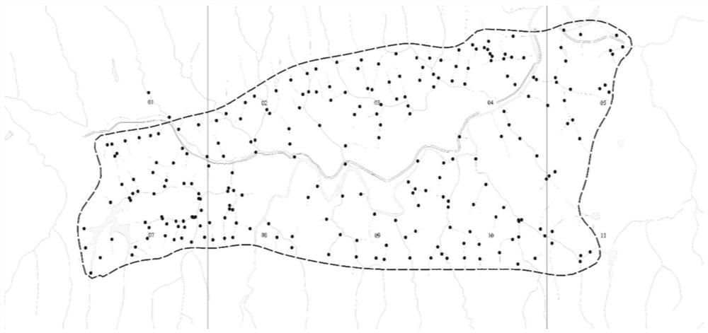
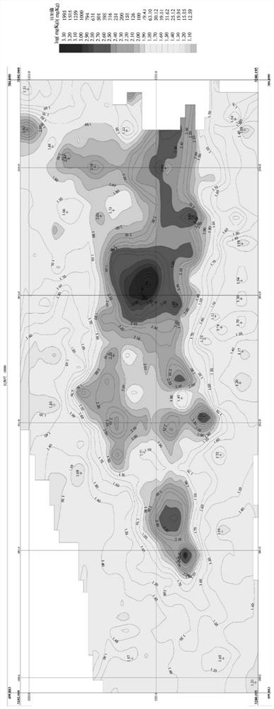
The invention discloses a method for analyzing heavy metal pollution sources in underground water of metal mines and identifying pollution boundaries. This technology uses the hydrogeological data of the mining area to define the lithology and stratum range where the primary halo of the metal deposit is located as the working area. Centering on the mining, dressing and smelting area of ​​the mining area, the direction of the surface water system in the mining area is determined through on-site surveys and comprehensive hydrogeological maps, and the water systems at all levels are divided. The unit collects sediment samples of various levels of water system and analyzes the content of characteristic pollution elements; uses geographic information system technology to draw a spatial distribution map of heavy metal content, and combines the background values ​​of chemical elements in the soil of the mining area to invert the source of heavy metal pollution in the groundwater of the mining area and its pollution boundary. This technology is the first to build an integrated analysis technology for groundwater pollution based on the stratum / lithology type where the mineral deposits are located and the hydrogeological characteristics of the mining area. It is economical and fast, has strong operability, high accuracy, and stable on-site application effects. It is ideal for analyzing the source of groundwater pollution in mining areas. An effective method to determine its pollution boundary.

Description

technical field [0001] The invention belongs to the technical field of environmental pollution prevention and control, relates to a method for rapidly identifying pollution sources and pollution boundaries in groundwater, and in particular relates to a method for source analysis of heavy metal pollution elements in shallow groundwater characteristics of metal mines and identification of pollution boundaries. Background technique [0002] Groundwater is an important part of the water cycle, has high ecological and economic value, and meets the water quantity and quality requirements of life, agriculture and industry. However, due to various reasons such as soil strata, lithology and human activities, the groundwater in the mining area has the characteristics of high heavy metal content. Therefore, it is urgent to carry out the accurate identification of the pollution source and scope of heavy metal pollution in the groundwater of the mining area, so as to realize the effective...

Claims


Application Information

Patent Timeline
Patent Type & Authority Patents(China)
IPC IPC(8): G01N33/18G01N1/28G01N1/34G01N1/44
CPCG01N33/18G01N33/1826G01N1/286G01N1/34G01N1/44G01N2001/2866Y02A20/20
Inventor 郭朝晖冉洪珍易立文肖细元彭驰张云霞胡志浩
Owner CENT SOUTH UNIV
Learn More