Forest fire risk assessment method based on space Logistic
A forest fire and risk assessment technology, applied in the field of forest fire risk assessment, can solve the problems of low accuracy of forest fire risk detection or assessment, failure to form a forest fire risk probability model, and inability to scientifically manage and prevent forest fires.
- Summary
- Abstract
- Description
- Claims
- Application Information
AI Technical Summary
Problems solved by technology
Method used
Image
Examples
Embodiment Construction
[0033] The scheme of the present invention is described in detail below in conjunction with accompanying drawing, the scheme of the embodiment of the present invention comprises the following steps:
[0034] 1) collect the surface temperature data set;
[0035] 2) collect normalized vegetation index data set;
[0036] 3) Collect GDP spatial distribution data set and vegetation type spatial distribution data set;
[0037] 4) Collect DEM digital elevation datasets and surface climate data monthly value datasets;
[0038] 5) Calculate the vegetation drought index by formula;
[0039] 6) Establish a spatial Logistic forest fire risk probability model;
[0040] 7) Assess the forest fire risk in the area to be tested.
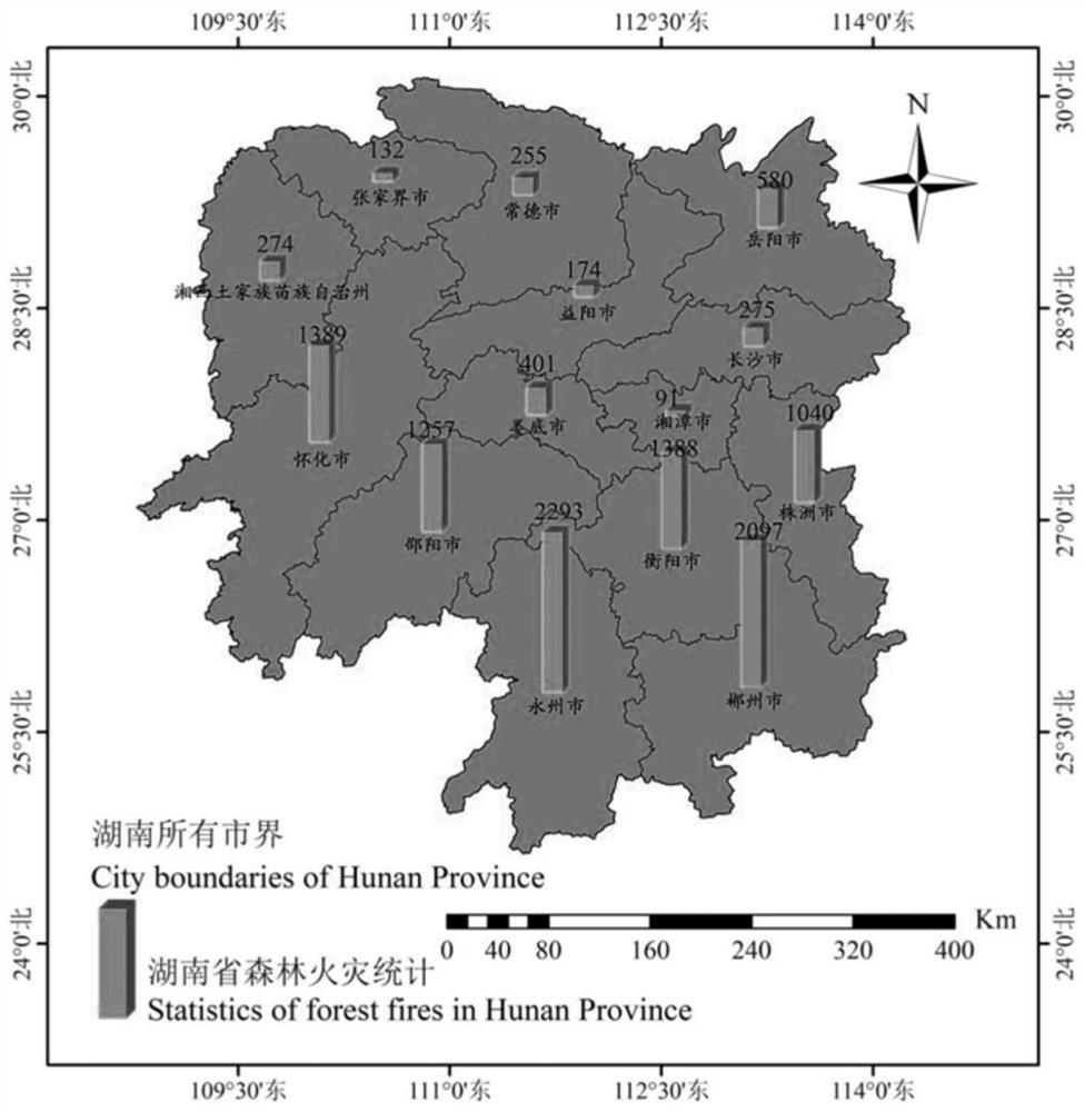
[0041] Using the above method to assess the forest fire risk in several counties and cities in Hunan Province:
[0042] 1. Materials and methods
[0043] 1.1 Overview of the object area
[0044] Hunan Province is located in the central part of China, between 2...
PUM
 Abstract
Description
Claims
Application Information
 - R&D
- Intellectual Property
- Life Sciences
- Materials
- Tech Scout
- Unparalleled Data Quality
- Higher Quality Content
- 60% Fewer Hallucinations
Browse by: Latest US Patents, China's latest patents, Technical Efficacy Thesaurus, Application Domain, Technology Topic, Popular Technical Reports.
© 2025 PatSnap. All rights reserved.Legal|Privacy policy|Modern Slavery Act Transparency Statement|Sitemap|About US| Contact US: help@patsnap.com


