Massive remote sensing data organization and management method and system based on distributed hbase storage
A mass remote sensing data, organization and management technology, applied in the field of data management, can solve problems such as low query efficiency, insufficient scalability, single node failure, etc., and achieve the effect of fast retrieval and query
- Summary
- Abstract
- Description
- Claims
- Application Information
AI Technical Summary
Problems solved by technology
Method used
Image

Examples
Embodiment 1
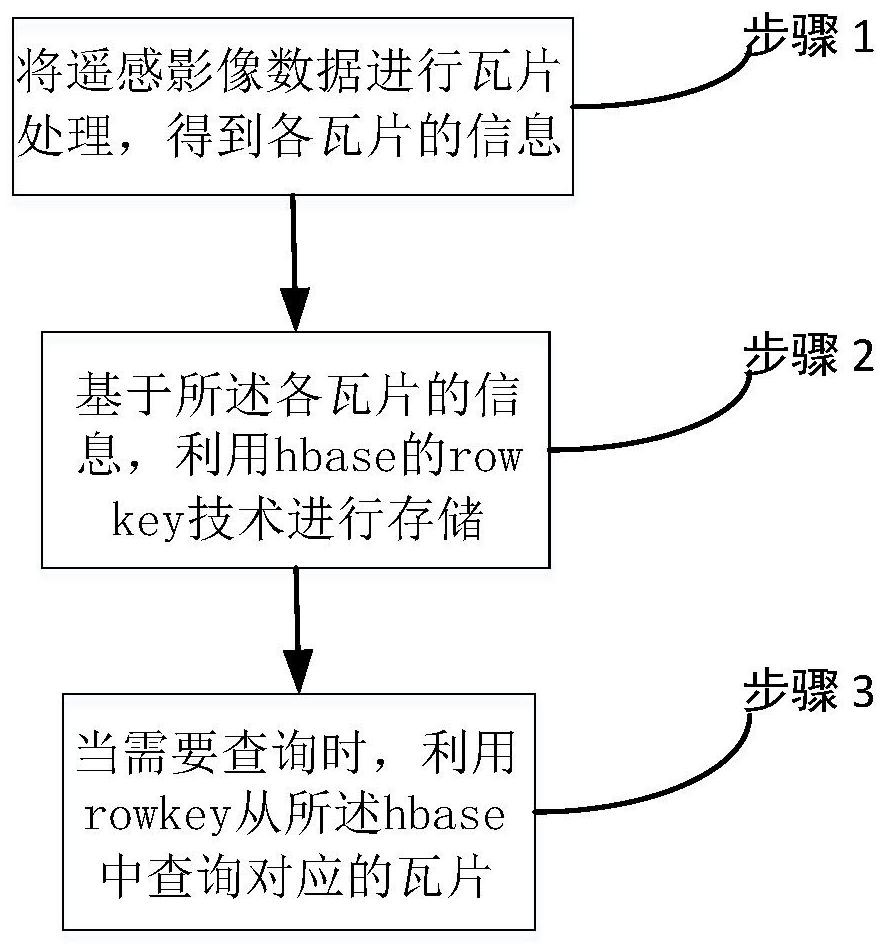
[0067] Massive remote sensing data organization and management method based on distributed hbase storage, such as figure 1 Shown:
[0068] Step 1: Perform tile processing on the remote sensing image data to obtain the information of each tile;
[0069] Step 2: based on the information of each tile, use the rowkey technology of hbase to store;
[0070] Step 3: When a query is required, use the rowkey to query the corresponding tile from the hbase;
[0071] Wherein, the tile information includes: the layer information it belongs to, time phase information, tile data type and latitude and longitude range.
[0072] Step 1: Perform tile processing on the remote sensing image data to obtain the information of each tile:
[0073] The technical solution provided by the present invention is as follows: firstly, specify the original image data path of tif and tiff format, read the image data, and divide the original image into tiles of specified size, and calculate its The informati...
Embodiment 2
[0104] The present invention based on the same inventive concept also provides a massive remote sensing data organization and management system based on distributed hbase storage, including:
[0105] Data processing module: used to perform tile processing on remote sensing image data to obtain the information of each tile;
[0106] A storage module, configured to store information based on the tiles by using the rowkey technology of hbase;
[0107] The query module is used to query the corresponding tiles from the hbase using rowkey when a query is required;
[0108] Wherein, the tile information includes: the layer information it belongs to, time phase information, tile data type and latitude and longitude range.
[0109] The data processing module includes:
[0110] The calculation sub-module is used to obtain the resolution and latitude and longitude information of the remote sensing image data, and calculate the level where the remote sensing image contains the tile and ...
PUM
 Abstract
Description
Claims
Application Information
 - R&D
- Intellectual Property
- Life Sciences
- Materials
- Tech Scout
- Unparalleled Data Quality
- Higher Quality Content
- 60% Fewer Hallucinations
Browse by: Latest US Patents, China's latest patents, Technical Efficacy Thesaurus, Application Domain, Technology Topic, Popular Technical Reports.
© 2025 PatSnap. All rights reserved.Legal|Privacy policy|Modern Slavery Act Transparency Statement|Sitemap|About US| Contact US: help@patsnap.com