Method for converting BIM model into GIS model

A conversion method and model technology, applied in special data processing applications, structured data retrieval, geometric CAD, etc., can solve the problems of uncontrollable GIS platform model reading and rendering efficiency, loss of BIM model attributes, and inability to meet applications, etc. Achieve the effect of efficient browsing, efficient complete attribute retention, and model simplification

Active Publication Date: 2020-01-17
长江航道规划设计研究院 +1
View PDF9 Cites 11 Cited by
  • Summary
  • Abstract
  • Description
  • Claims
  • Application Information

AI Technical Summary

Problems solved by technology

In the first step, because the modeler needs to manually delete the redundant faces of the BIM model, there is no uniform standard, so the operation effect mainly depends on the level and experience of the modeler, and each GIS platform has different requirements for the number of model faces. Not the same, so it is impossible to control the efficiency of model reading and rendering that is finally imported into the GIS platform
In the attribute entry stage, due to the need for manual or semi-automatic one-to-one correspondence with the model objects in the first step, problems such as loss of BIM model attributes and errors are prone to occur
[0005] CN105931294B "A Method for Converting BIM Entity Models into Multi-detail Level GIS Standardized Models" obtains an IFC simplified model based on the same Cartesian coordinate system based on the relative positional relationship between object entities in the IFC geometric information; and then according to The IFC geometric information of each object entity in the IFC simplified model is subjected to geometric conversion to obtain the CityGML geometric information corresponding to the LOD level; this method performs geometric conversion based on the IFC geometric information, which cannot satisfy the application based on the Skyline platform

Method used


Image

  • Method for converting BIM model into GIS model
  • Method for converting BIM model into GIS model
  • Method for converting BIM model into GIS model

Examples


Embodiment Construction

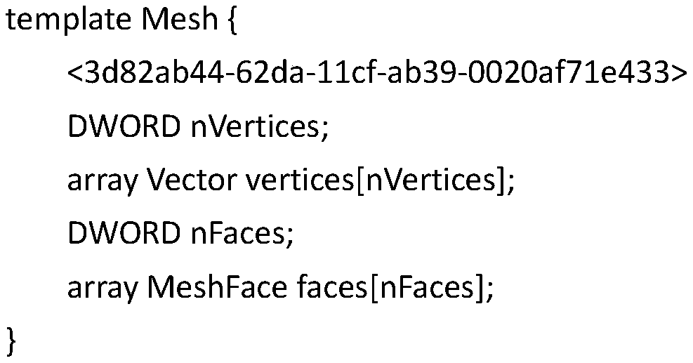
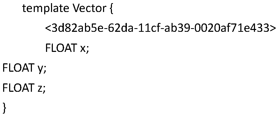
[0032] Such as figure 1 As shown, S101. format conversion: take the BIM model layer project directory structure, after classifying each object structure, obtain the layer triangle dynamic list according to the object properties, and perform the standard model format according to the DircetX format definition* .X output; grab texture; organize and store according to the data specification structure that can be recognized by .X;

[0033] The specific existing BIM model is obtained through the programming language (C#) traversal to obtain the layer project directory structure, and each object structure is classified into objects. Through the secondary development of civil3d, according to the maximum point in the model space boundary (Bounds), The smallest point, calculate a spatial distance; define a civil3d subdivision model standard (MeshFaceterData) according to parameters such as spatial distance, normal vector, scale, etc.; call civil3d, the spatial refinement interface (SubDMe...


PUM


Abstract

The invention discloses a method for converting a BIM model into a GIS model. According to the method, directly carrying out format conversion in BIM native software; extracting attribute informationas an Excel file, associating the attribute information with a geometric structure through a unique ID, establishing a central point position file of each model part, and finally outputting a GIS model with correct geometric structure, attribute and relative relationship of the BIM model. Meanwhile, after the model is subjected to double optimization, the GIS platform is entered, and efficient browsing and complete attribute reservation of the BIM model in the GIS platform are achieved. According to the method, BIM standard entity model data can be automatically converted into a GIS model; the method guarantees the integrity of the geometric information of the BIM model, guarantees the correctness of the geometric topological relation and the correct mapping of the attribute information,can provide a good data guarantee for the integrated application of the BIM and the GIS, and provides a basis for the application of the BIM model in a smart city.

Description

Technical field [0001] The invention belongs to engineering data processing technology, and specifically relates to a conversion and adaptation technology between different data models in the engineering design process, especially a conversion method from a BIM model to a GIS model when BIM and GIS are used for engineering applications. Background technique [0002] One of the basic signs of upgrading from a digital city to a smart city is the refinement of urban management. Therefore, unprecedented requirements are put forward for the integrated expression of indoor, outdoor, ground, and underground urban spaces. Due to the complexity of the urban three-dimensional environment, current surveying and mapping methods, including oblique photogrammetry, laser scanning, and traditional surveying and mapping, are difficult to accurately and effectively obtain the three-dimensional structure inside a building. Therefore, for the Three Dimensional Geographic Information System (3DGIS), ...

Claims


Application Information

Patent Timeline
Patent Type & Authority Applications(China)
IPC IPC(8): G06F30/13G06F16/29
CPCG06F16/29
Inventor 郭涛宋成果余青容杨建东王鹏顾粲刘俊伟黄栋须琼辉
Owner 长江航道规划设计研究院
Why Eureka
Try Eureka