Scene dependence-based illegal tourism path dynamic prediction method
A technology of dynamic forecasting and routing, applied in forecasting, structured data retrieval, instruments, etc., can solve the problem of insufficient understanding of the temporal and spatial evolution of the main body of illegal parade events, the inability to accurately predict the full-cycle evolution of illegal parade events, and the inability to access Provide correct decision-making basis and other issues
- Summary
- Abstract
- Description
- Claims
- Application Information
AI Technical Summary
Problems solved by technology
Method used
Image
Examples
Embodiment 1
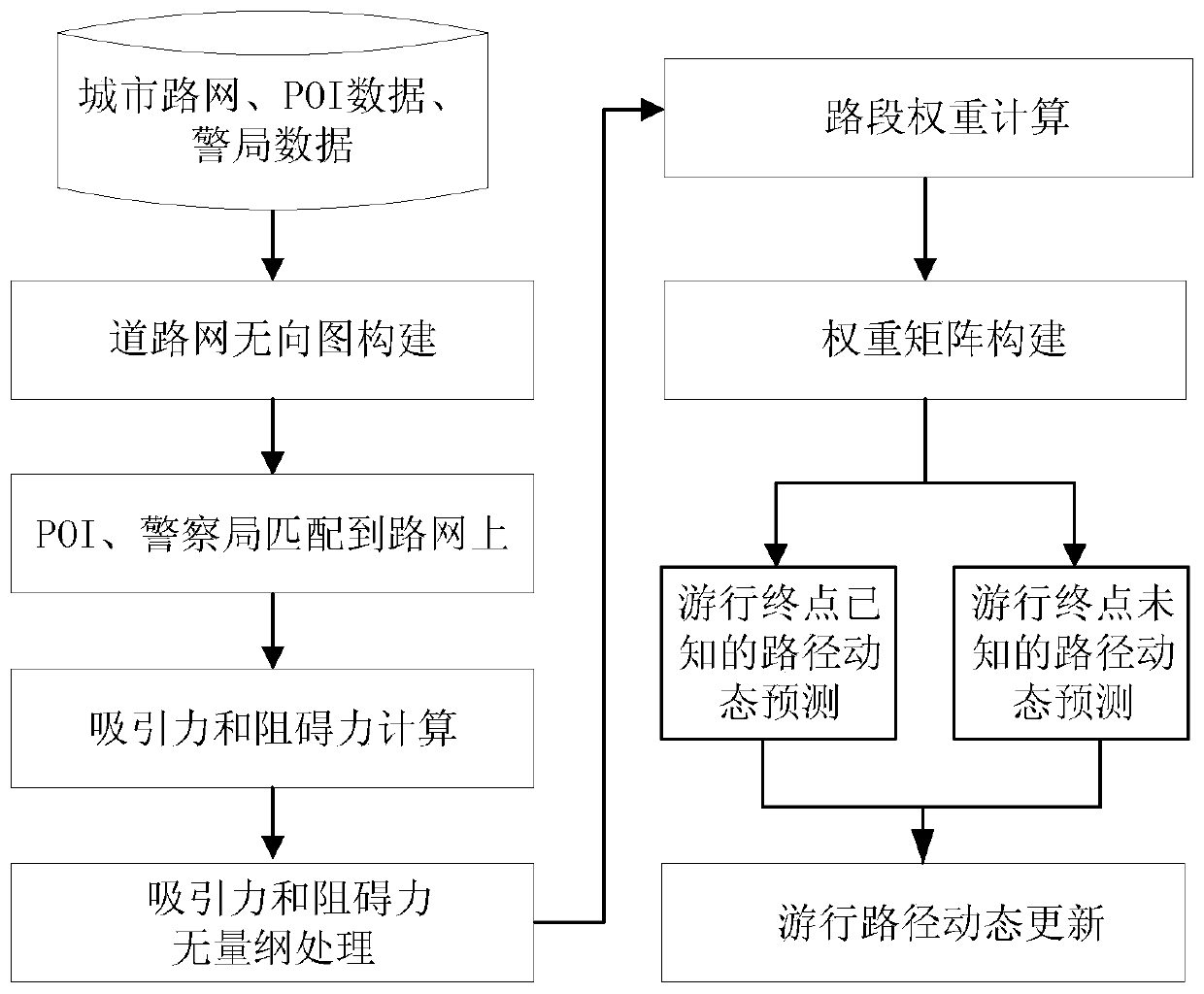
[0077] Such as figure 1 A method for dynamic prediction of illegal parade paths based on scene dependence is shown, including the following steps:
[0078] Step 101: Obtain urban road network data, POI data and police station data, and perform preprocessing operations on the data;
[0079] Step 102: constructing an undirected road network graph according to the urban road network data;
[0080] Step 103: Constrain POIs (excluding police stations) and police stations to the road network;
[0081] Step 104: Calculate the influence of different types of POIs (excluding police stations), road sections and police stations on illegal parades;
[0082] Step 105: Using the mean value method to perform dimensionless processing on each index data;
[0083] Step 106: Carry out the section weight calculation for different sections, and construct the arc section weight matrix of the road network undirected graph G according to the calculated section weights;
[0084] Step 107: Dynamica...
Embodiment 2
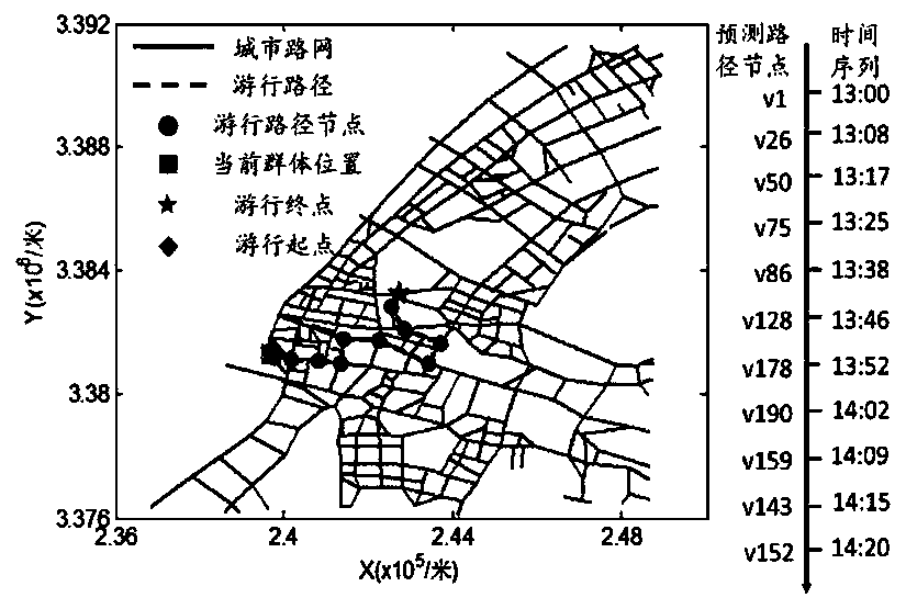
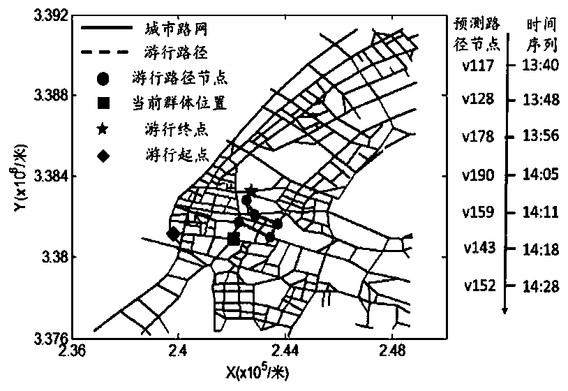
[0138] This embodiment uses the road network, POI and police station distribution data of Wuchang District, Wuhan City, my country to illustrate the specific implementation of the present invention. The specific implementation steps of the present invention to assist in solving public safety-related issues will be described in detail below in conjunction with examples:
[0139] 1) Data preprocessing. For the road network data in the study area, check whether there are topology errors in the road network data, and if so, perform topology repair.
[0140] 2) Construct the road network undirected graph. The road network of cities in the study area is abstracted into an undirected graph structure G=(E, V), where E represents the arc set of roads, and V represents the node set of roads.
[0141] 3) Match POI points (excluding police station points) and police station points to the road network.
[0142] 4) The position of the parade group is initialized. At t=13:00, the initial ...
PUM
 Abstract
Description
Claims
Application Information
 - Generate Ideas
- Intellectual Property
- Life Sciences
- Materials
- Tech Scout
- Unparalleled Data Quality
- Higher Quality Content
- 60% Fewer Hallucinations
Browse by: Latest US Patents, China's latest patents, Technical Efficacy Thesaurus, Application Domain, Technology Topic, Popular Technical Reports.
© 2025 PatSnap. All rights reserved.Legal|Privacy policy|Modern Slavery Act Transparency Statement|Sitemap|About US| Contact US: help@patsnap.com


