Hyperspectral vegetation index monitoring method for wetland vegetation rhizosphere soil microorganisms
A rhizosphere soil and wetland vegetation technology, applied in the field of remote sensing technology, can solve the problems of limited research on microbial interactions
- Summary
- Abstract
- Description
- Claims
- Application Information
AI Technical Summary
Problems solved by technology
Method used
Image
Examples
Embodiment 1
[0059] The method of the present invention is applied to the monitoring area of Panjin Wetland in Liaoning Province, China. The geographical coordinates of Panjin Wetland are between 121°30′~122°00′ east longitude and 40°45′~41°10′ north latitude. Panjin Wetland belongs to the type of coastal wetland. It is a natural wetland dominated by reed swamps and intertidal tidal flats. It is the largest coastal reed wetland in China's high latitudes. According to the steps described in the specific embodiment of the present invention, the spatial distribution map of the number of microorganisms in the rhizosphere soil of the wetland vegetation in the monitoring area was obtained.
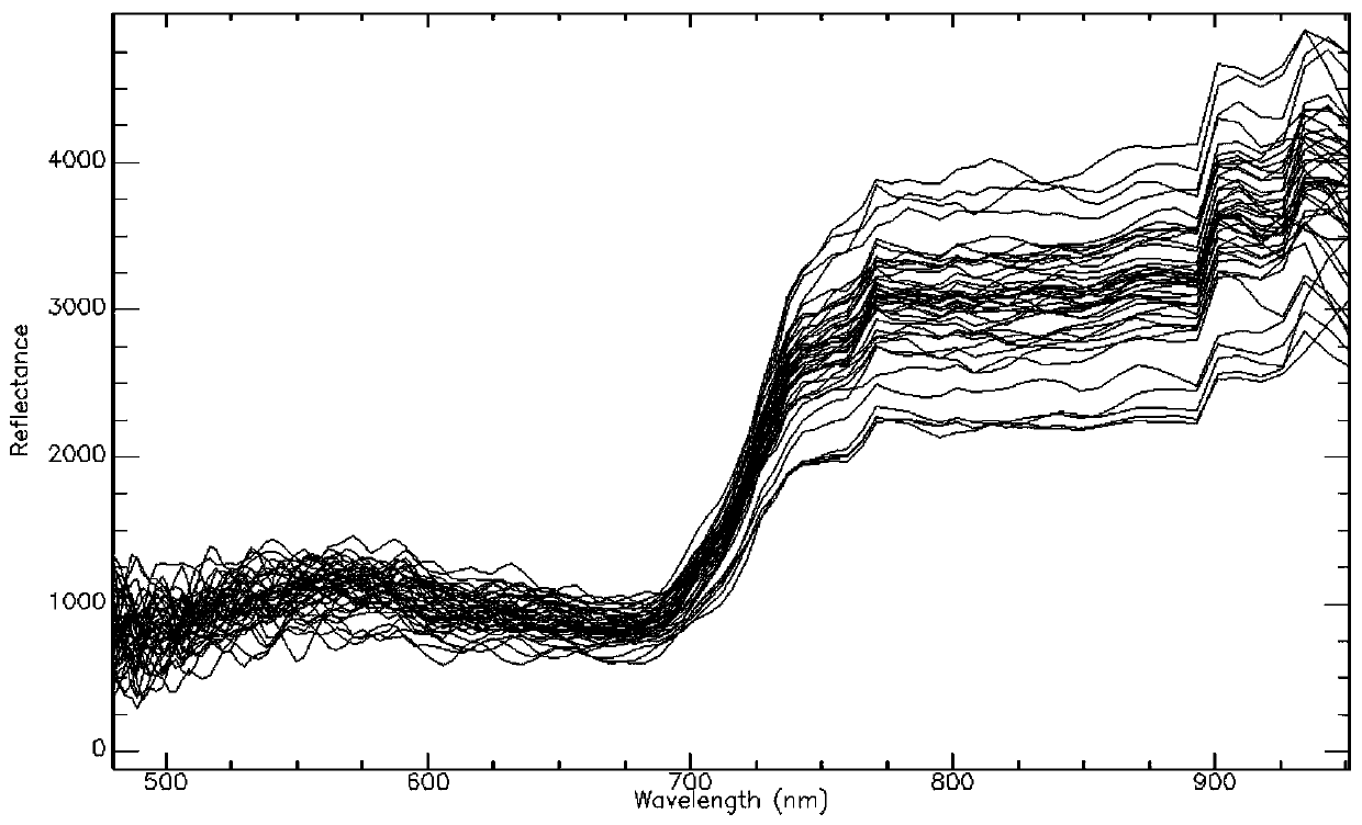
[0060] figure 1 It is the reflection spectrum curve of 42 sampling areas extracted from the hyperspectral remote sensing image HSI (Hyperspectral Imager) (note: the ordinate is the reflectance value enlarged by 10000 times).
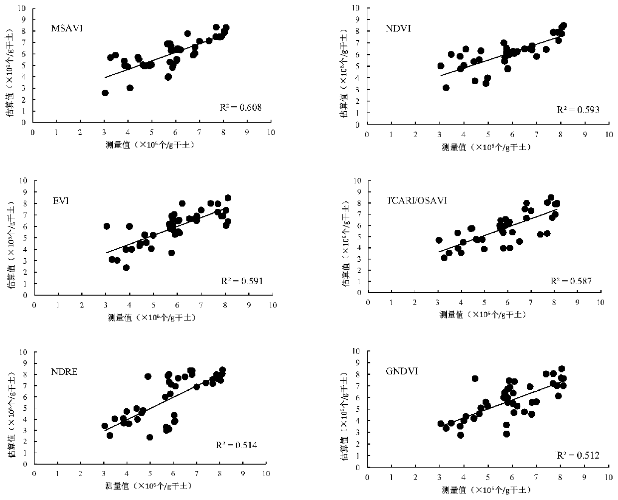
[0061] Table 2 is a comparison of the evaluation indicators for estimating the...
PUM
 Abstract
Description
Claims
Application Information
 - R&D
- Intellectual Property
- Life Sciences
- Materials
- Tech Scout
- Unparalleled Data Quality
- Higher Quality Content
- 60% Fewer Hallucinations
Browse by: Latest US Patents, China's latest patents, Technical Efficacy Thesaurus, Application Domain, Technology Topic, Popular Technical Reports.
© 2025 PatSnap. All rights reserved.Legal|Privacy policy|Modern Slavery Act Transparency Statement|Sitemap|About US| Contact US: help@patsnap.com


