A terrestrial plant ecological environment monitoring method based on multi-source remote sensing data fusion
A technology of environmental monitoring and remote sensing data, applied in image data processing, 3D image processing, instruments, etc. In order to achieve the effects of strong operability, non-contact measurement in the range, and changing the display effect and method
- Summary
- Abstract
- Description
- Claims
- Application Information
AI Technical Summary
Problems solved by technology
Method used
Image
Examples
Embodiment
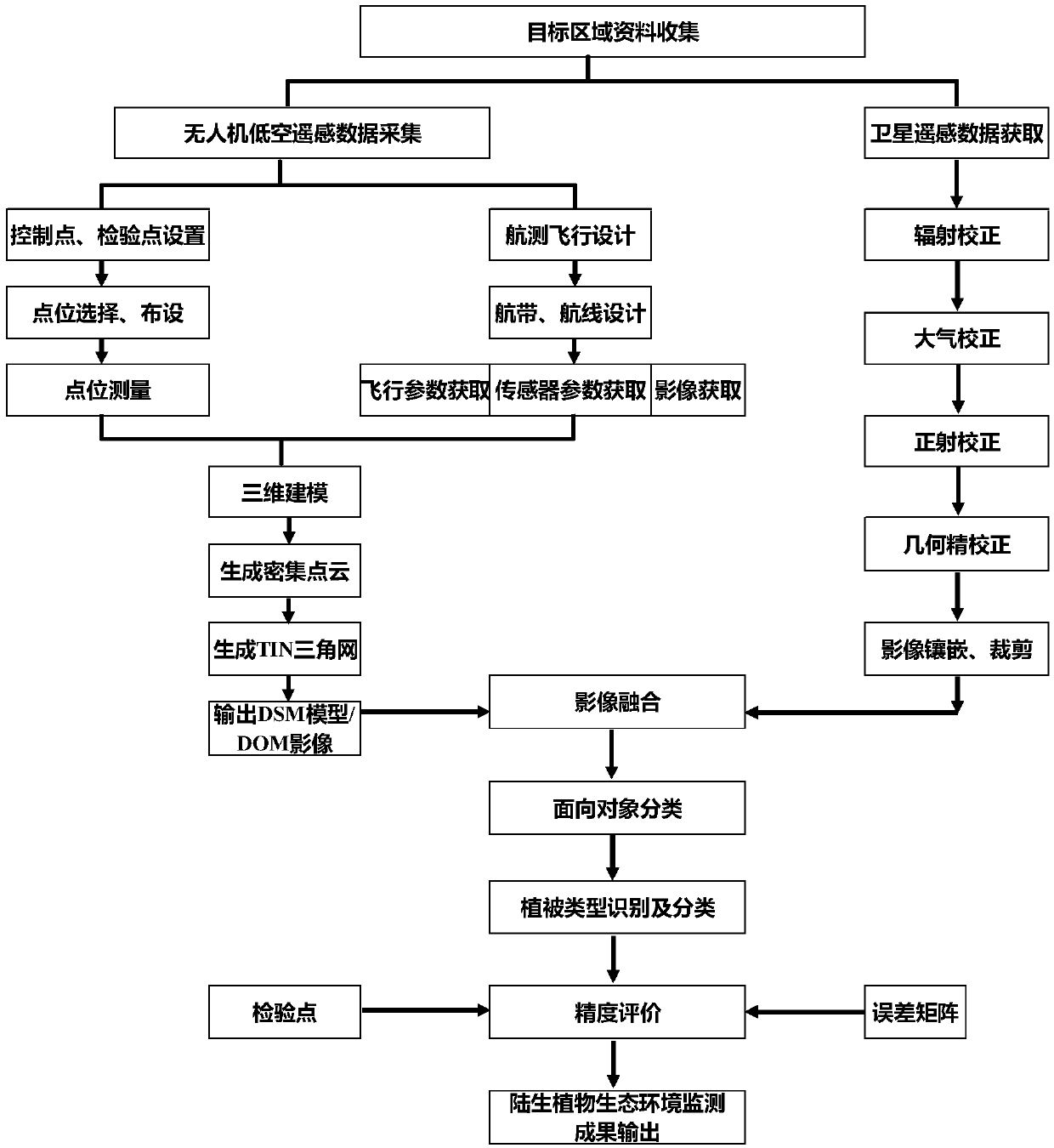
[0045] The technical solutions of the present invention will be further described below in conjunction with the drawings and examples. The examples are only to help readers better understand the technical solutions of the present invention, and are not intended to limit the protection scope of the claims of the present invention.
[0046] The technology based on multi-source remote sensing data fusion and object-oriented classification provided by the present invention greatly improves the ability of accurate, efficient and quantitative acquisition, analysis, calculation and processing of different vegetation monitoring index data in the monitoring of terrestrial plant ecological environment. It has revolutionized the display effect and method of monitoring results. It fills the technical gap in the ecological environment monitoring work without conventional monitoring methods and means for the quantitative monitoring of vegetation, and greatly improves the automation of field ...
PUM
 Abstract
Description
Claims
Application Information
 - R&D
- Intellectual Property
- Life Sciences
- Materials
- Tech Scout
- Unparalleled Data Quality
- Higher Quality Content
- 60% Fewer Hallucinations
Browse by: Latest US Patents, China's latest patents, Technical Efficacy Thesaurus, Application Domain, Technology Topic, Popular Technical Reports.
© 2025 PatSnap. All rights reserved.Legal|Privacy policy|Modern Slavery Act Transparency Statement|Sitemap|About US| Contact US: help@patsnap.com


