Space-based radar clutter simulation method and device in consideration of terrain height
A space-based radar, terrain height technology, used in radio wave measurement systems, instruments, etc.
- Summary
- Abstract
- Description
- Claims
- Application Information
AI Technical Summary
Problems solved by technology
Method used
Image
Examples
Embodiment
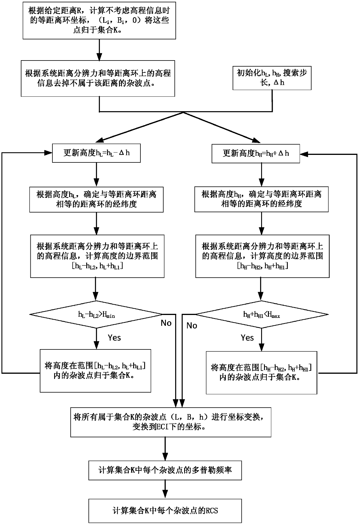
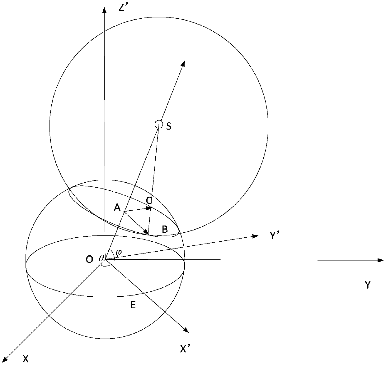
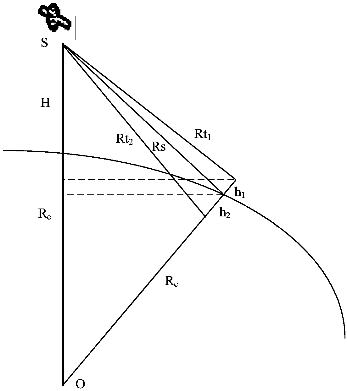
[0073] In the embodiment of the present invention, under the condition of obtaining the elevation information of the clutter area, the clutter distance R to be simulated is given, and the longitude and latitude of the clutter points whose distance from the radar is a given distance R at different heights are calculated respectively, and the clutter Compared with the actual elevation of the point, it is judged whether the distance from the clutter point to the radar is within the distance unit of distance R. After obtaining the latitude and longitude of all clutter points whose distance from the radar is R, the Doppler frequency of the clutter points on the clutter ring can be calculated; the coordinates of the clutter points in the antenna coordinate system are obtained by coordinate transformation, Thus, the antenna gain of the clutter point is calculated; finally, considering the influence of the radar equation, the calculation method of the clutter echo is obtained, such as ...
PUM
 Abstract
Description
Claims
Application Information
 - Generate Ideas
- Intellectual Property
- Life Sciences
- Materials
- Tech Scout
- Unparalleled Data Quality
- Higher Quality Content
- 60% Fewer Hallucinations
Browse by: Latest US Patents, China's latest patents, Technical Efficacy Thesaurus, Application Domain, Technology Topic, Popular Technical Reports.
© 2025 PatSnap. All rights reserved.Legal|Privacy policy|Modern Slavery Act Transparency Statement|Sitemap|About US| Contact US: help@patsnap.com


