A method and device for positioning and partitioning geographic information based on deep learning
A geographic information and deep learning technology, which is applied in the field of geographic information positioning and partitioning methods and devices, and can solve the problem of low positioning and partitioning accuracy.
- Summary
- Abstract
- Description
- Claims
- Application Information
AI Technical Summary
Problems solved by technology
Method used
Image
Examples
Embodiment 1
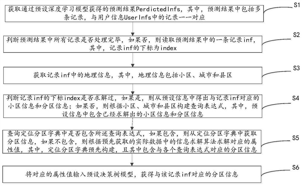
[0056] This embodiment provides a positioning partition method based on deep learning geographic information, please refer to figure 1 , the method includes:
[0057] First, step S1 is performed: obtaining the prediction result PerdictedInfs obtained through the preset deep learning model, wherein the prediction result includes multiple records corresponding to the records in the user information UserInfs.
[0058] Specifically, the preset deep learning model can be a known BiLSTM+CRF deep neural network model or an improved model. According to this model, the original user information can be predicted and identified, and the prediction result can be obtained. The records in the prediction result are pieces of information, and these records correspond to the user information one by one.
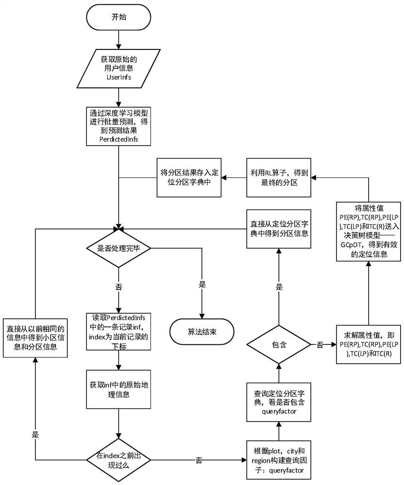
[0059] Through a lot of practice, the applicant of the present invention found that after obtaining the prediction result (that is, the user's cell information and location information), it ...
Embodiment 2
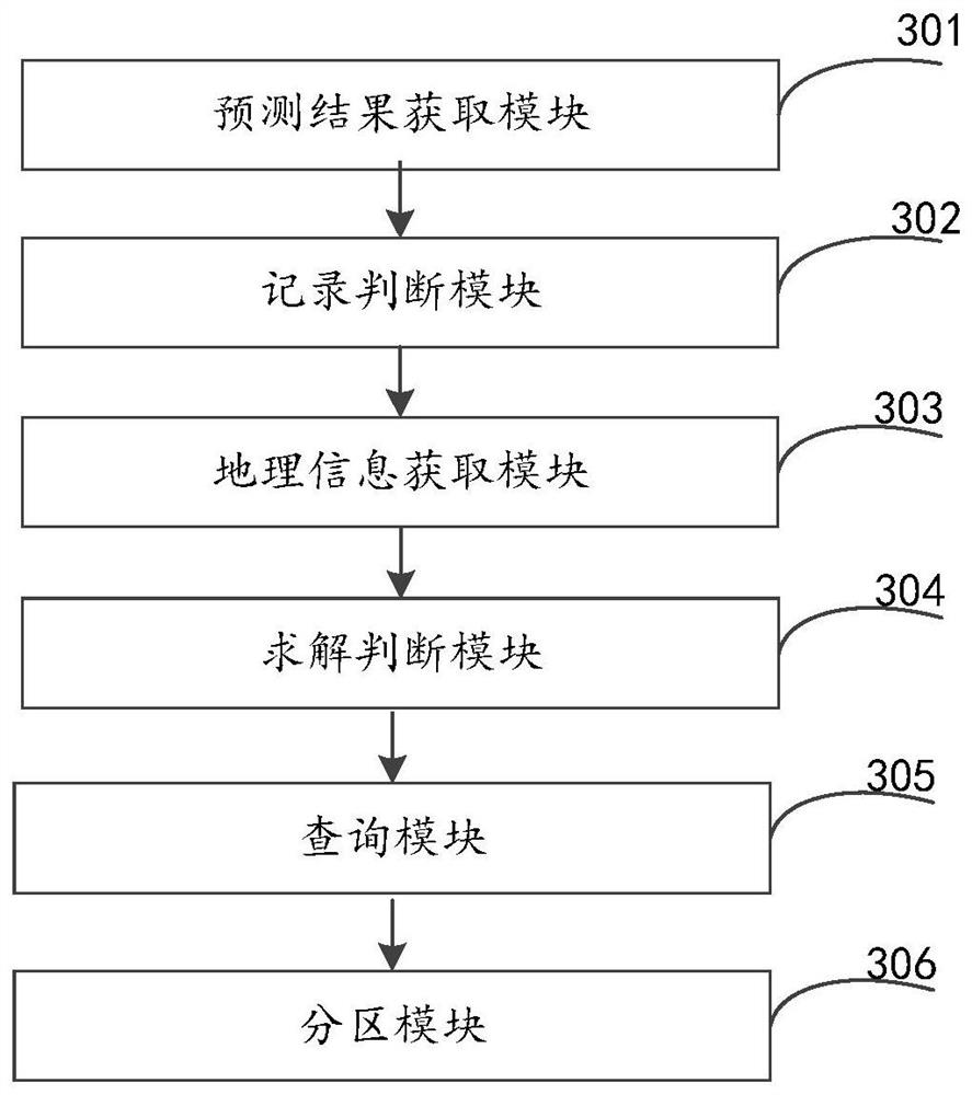
[0165] This embodiment provides a device for positioning and partitioning based on deep learning geographic information, please refer to image 3 , the device consists of:
[0166] The prediction result acquisition module 301 is used to obtain the prediction result PerdictedInfs obtained through the preset deep learning model, wherein the prediction result includes multiple records corresponding to the records in the user information UserInfs;
[0167] The record judging module 302 is used to judge whether all records in the prediction result have been processed, if not, then read a record inf in the prediction result, wherein the subscript of the record inf is index;
[0168] Geographic information acquisition module 303, configured to acquire geographic information in the record inf, wherein the geographic information includes districts, cities and counties;
[0169] Solve the judgment module 304, be used for judging whether the subscript index of record inf has been solved...
Embodiment 3
[0196] Based on the same inventive concept, the present application also provides a computer-readable storage medium 400, please refer to Figure 4 , on which a computer program 411 is stored, and the method in Embodiment 1 is implemented when the program is executed.
PUM
 Abstract
Description
Claims
Application Information
 - R&D
- Intellectual Property
- Life Sciences
- Materials
- Tech Scout
- Unparalleled Data Quality
- Higher Quality Content
- 60% Fewer Hallucinations
Browse by: Latest US Patents, China's latest patents, Technical Efficacy Thesaurus, Application Domain, Technology Topic, Popular Technical Reports.
© 2025 PatSnap. All rights reserved.Legal|Privacy policy|Modern Slavery Act Transparency Statement|Sitemap|About US| Contact US: help@patsnap.com


