Risk division and prediction method of mountain torrent disaster based on gis-neural network integration
A technology of neural network and prediction method, which is applied in the field of mountain torrent disaster risk zoning and prediction based on GIS-neural network integration, and can solve problems such as spatial scale uncertainty of mountain torrent disaster assessment.
- Summary
- Abstract
- Description
- Claims
- Application Information
AI Technical Summary
Problems solved by technology
Method used
Image
Examples
Embodiment Construction
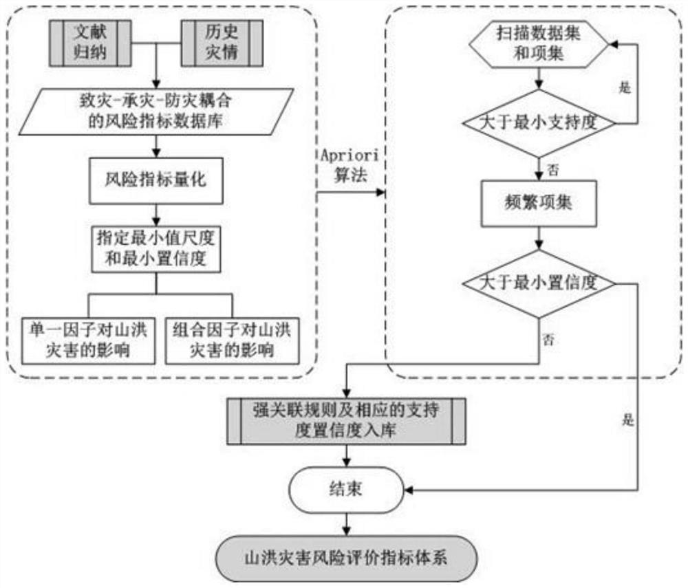
[0093] like Figure 1 to Figure 3 As shown, a method for zoning and forecasting of mountain torrent disaster risk based on GIS-neural network integration, which includes the following steps:
[0094] Step 1: The present invention selects Guangdong Province as the experimental area. Guangdong Province is located in the southern part of mainland China, with complex and diverse landform types, and is dominated by mountains and hills. Mountains above 500m above sea level account for 31.7%, and hills account for 28.5%. In addition, it is located in the subtropical monsoon region, with frequent rainstorms, affected by various natural and human factors such as special natural geographical environment, increasingly extreme disastrous weather, and human economic and social activities in mountainous areas, resulting in frequent mountain torrent disasters in Guangdong Province. Therefore, in order to further improve the defense work of mountain torrent disasters, the present invention p...
PUM
 Abstract
Description
Claims
Application Information
 - R&D
- Intellectual Property
- Life Sciences
- Materials
- Tech Scout
- Unparalleled Data Quality
- Higher Quality Content
- 60% Fewer Hallucinations
Browse by: Latest US Patents, China's latest patents, Technical Efficacy Thesaurus, Application Domain, Technology Topic, Popular Technical Reports.
© 2025 PatSnap. All rights reserved.Legal|Privacy policy|Modern Slavery Act Transparency Statement|Sitemap|About US| Contact US: help@patsnap.com


