Rapid caching method for large-scale remote sensing image
A remote sensing image and remote sensing image technology, applied in image acquisition, image data processing, image data processing, etc., can solve the problems of large workload of intermediate format files, system stuck user experience, etc., to improve reading efficiency and reduce disk drive. The effect of reading frequency and improving system performance
- Summary
- Abstract
- Description
- Claims
- Application Information
AI Technical Summary
Problems solved by technology
Method used
Image
Examples
Embodiment 1
[0052] The technical solution will be described in detail in conjunction with the accompanying drawings and specific embodiments.
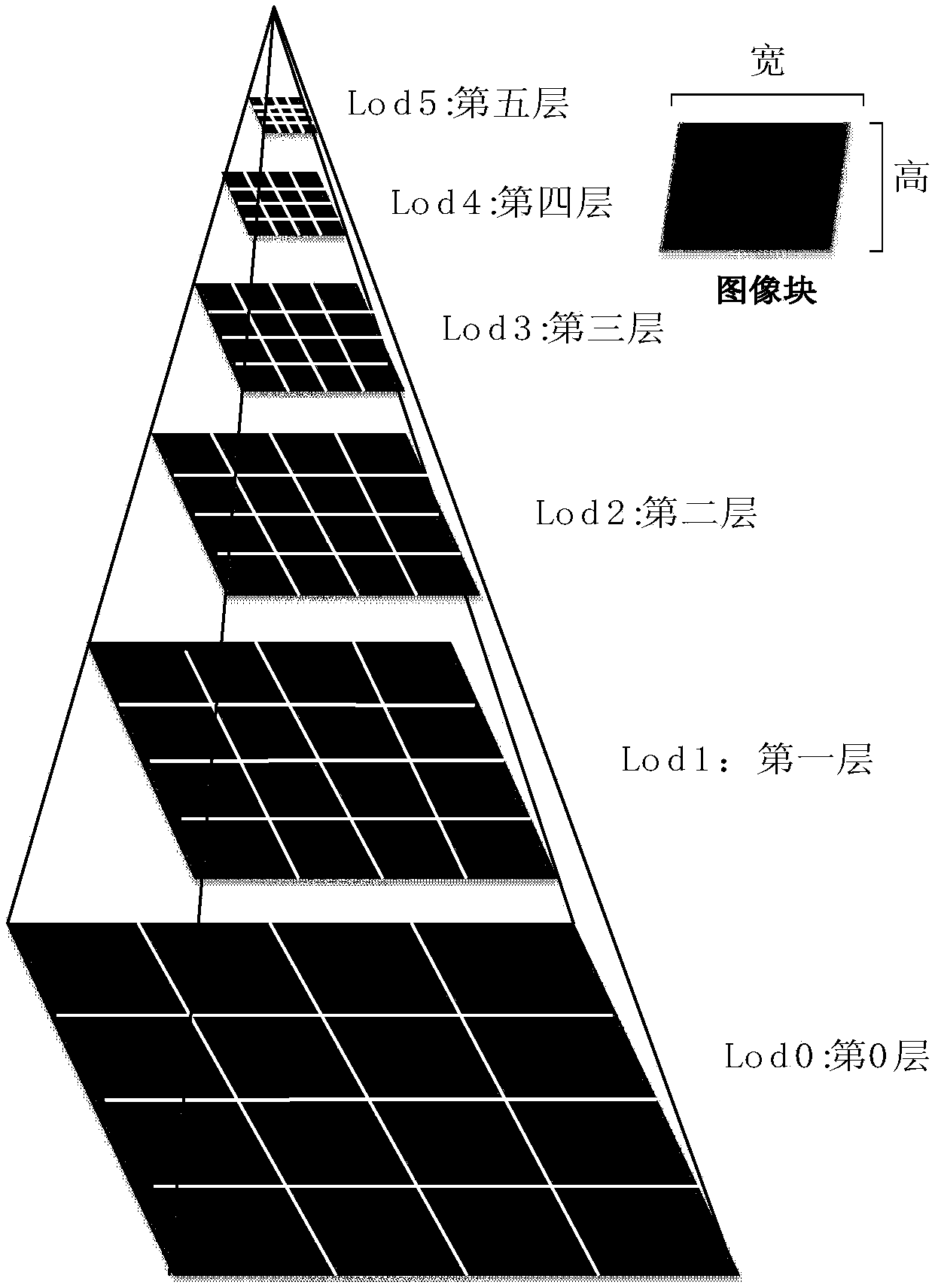
[0053] figure 1 It is the main frame diagram of this method. The whole is divided into four levels. The first layer is based on GDAL-driven data reading, which obtains the original data of remote sensing images from the disk; the second layer is the fast cache layer, which divides the read data into blocks and divides these data blocks into bands, layers, rows, and columns. The third layer is the scheduling layer, which obtains the data blocks of the corresponding image according to the current window resolution to organize and schedule (replace or add); the fourth layer is the rendering layer, which converts the data blocks in the current window resolution The data in the cache area is rendered and visualized.
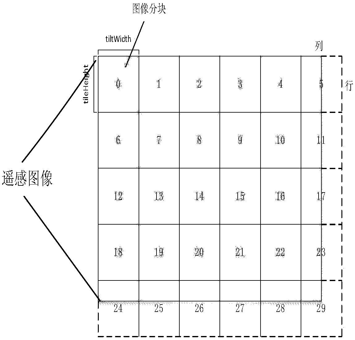
[0054] figure 2 Blocking strategy map for remote sensing images. Since the visible area is usually smaller than the entire range o...
Embodiment 2
[0059] The technical solution of the present invention and the scientific principles on which it is based are described in detail below.
[0060] 1. The principle of layered and block remote sensing images is as follows:
[0061] (1) It is assumed that the division sequence of the image blocks starts from the upper left corner, goes from left to right, and goes from top to bottom.
[0062] (2) Suppose the width and height of the source image are W s and H s , the target display image width and height are W d and H d , and the size of each image block is W tile *H tile (W tile and H tile Generally take 256 pixels or 512 pixels), W tile and H tile As the level Lod increases, it decreases in multiples of 2, thereby forming images at different resolutions. Such as figure 2 As shown, the block number of any point (x, y) on the image is:
[0063]
[0064] Then the level of the target image is:
[0065]
[0066] Among them, r xSize is the pixel width of the sourc...
Embodiment 3
[0081] The specific implementation steps of a large-scale remote sensing image fast caching method are as follows:
[0082] (1) Assume that the total number of layers of the remote sensing image pyramid is N, and the roaming operation is performed on the image on the nth layer.
[0083] (2) Determine whether there is a corresponding image block in the [n-1, 0] layer below the cache area, if there is a corresponding image block, find the image block closest to the nth layer, and store it in the memory Perform upsampling processing to obtain the data of the block, display the image of the block, and add the image of the block to the memory cache. If the upper limit of the set memory is exceeded, execute the LRU (Least Recently Used) cache elimination algorithm to remove some infrequently used Or the image block at the end of the cache queue, until there is enough space to accommodate the newly added image block data, the block reading ends; if there is no corresponding block, th...
PUM
 Abstract
Description
Claims
Application Information
 - R&D Engineer
- R&D Manager
- IP Professional
- Industry Leading Data Capabilities
- Powerful AI technology
- Patent DNA Extraction
Browse by: Latest US Patents, China's latest patents, Technical Efficacy Thesaurus, Application Domain, Technology Topic, Popular Technical Reports.
© 2024 PatSnap. All rights reserved.Legal|Privacy policy|Modern Slavery Act Transparency Statement|Sitemap|About US| Contact US: help@patsnap.com


