
Method and device for determining geologic horizons

A technology of geological horizons and formations, applied in the field of geophysical data interpretation, can solve problems such as time-consuming and laborious, and difficult to guarantee the accuracy of geological horizon tracking

Active Publication Date: 2018-03-06
BC P INC CHINA NAT PETROLEUM CORP +1
View PDF8 Cites 1 Cited by
  • Summary
  • Abstract
  • Description
  • Claims
  • Application Information

AI Technical Summary

Problems solved by technology

This method is not only time-consuming and laborious, but also relies on human knowledge and experience to make at least part of subjective judgments, so the tracking of geological horizons may be affected by human prior knowledge, and the accuracy of geological horizon tracking is difficult to guarantee

Method used


Image

  • Method and device for determining geologic horizons
  • Method and device for determining geologic horizons
  • Method and device for determining geologic horizons

Examples


Embodiment Construction

[0037] Embodiments of the present application provide a method and device for determining a geological horizon.

[0038] In order to enable those skilled in the art to better understand the technical solutions in the present application, the technical solutions in the embodiments of the present application will be clearly and completely described below in conjunction with the drawings in the embodiments of the present application. Obviously, the described The embodiments are only some of the embodiments of the present application, but not all of them. Based on the embodiments in this application, all other embodiments obtained by persons of ordinary skill in the art without creative efforts shall fall within the scope of protection of this application.

[0039] A method for determining geological horizons provided in the embodiments of the present application. The method for determining the geological horizon provides the resistivity inversion profile data of the target inter...


PUM


Abstract

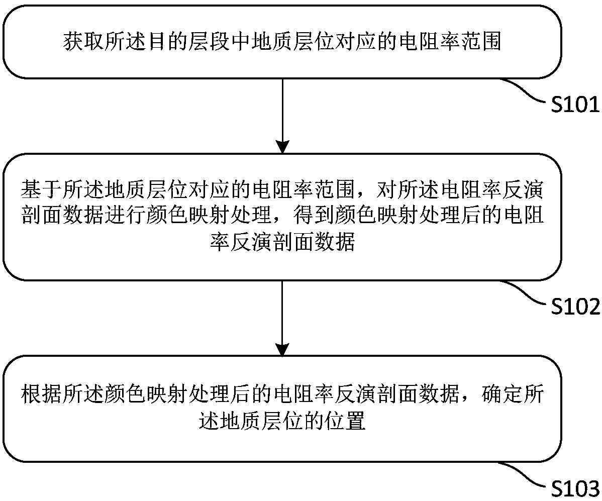
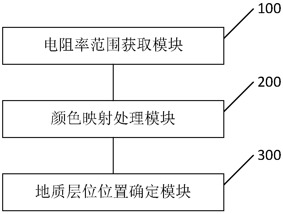
The invention discloses a method and device for determining geologic horizons. The method provides electrical resistivity inversion section data of a target interval, wherein the target interval includes at least two geologic horizons. The method includes acquiring an electrical resistivity range corresponding to the geologic horizons in the target interval; based on the electrical resistivity range corresponding to the geologic horizons, performing color mapping treatment on the electrical resistivity inversion section data and obtaining the electrical resistivity inversion section data subjected to color mapping treatment; determining the positions of the geologic horizons according to the electrical resistivity inversion section data subjected to color mapping treatment. By adopting thetechnical scheme provided by the invention, accuracy of determining the geologic horizons on an electrical method inversion section can be improved.

Description

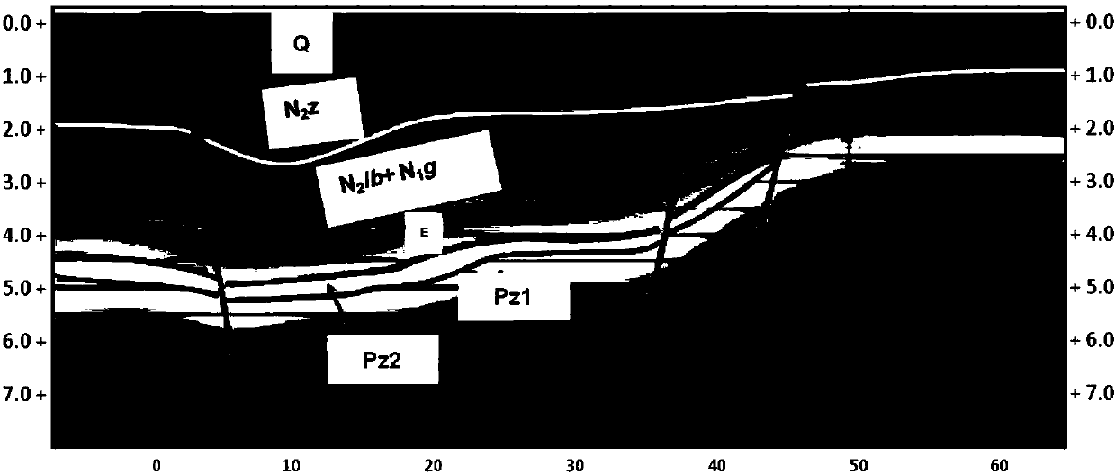
technical field [0001] This application relates to the technical field of geophysical data interpretation, in particular to a method and device for determining geological horizons. Background technique [0002] Geophysical data interpretation is an important stage of geophysical exploration engineering. This stage can be used for oil and gas exploration to find out the characteristics of underground structures and indicate favorable reservoirs. [0003] In the interpretation of geophysical data, the identification and tracking of geological horizons are very important tasks. At the same time, because the actual geological horizons often have a corresponding range of resistivity changes, it is very important to track geological horizons based on electrical inversion profiles. possible. Geological horizon tracking is one of the key technologies in electrical data interpretation. A good geological horizon tracking method can greatly improve the efficiency and accuracy of elec...

Claims


Application Information

Patent Timeline
IPC IPC(8): G01V3/38
CPCG01V3/38
Inventor 石艳玲何展翔魏强李德春刘雪军胡祖志
Owner BC P INC CHINA NAT PETROLEUM CORP
Learn More